
| Memorials | : | 2 |
| Location | : | Luthersburg, Clearfield County, USA |
| Coordinate | : | 41.0496710, -78.7205960 |
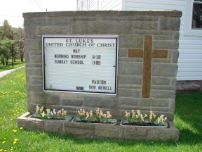
| Description | : | Saint Lukes United Church of Christ Cemetery is also known as the Luthersburg Reformed Cemetery, Brady Township, Clearfield County, PA Located near Church to the right off at Junction of Routes 410-219-322 at Golden Yoke |
frequently asked questions (FAQ):
-
Where is Saint Lukes United Church of Christ Cemetery?
Saint Lukes United Church of Christ Cemetery is located at Golden Yolk Road Luthersburg, Clearfield County ,Pennsylvania , 16848USA.
-
Saint Lukes United Church of Christ Cemetery cemetery's updated grave count on graveviews.com?
2 memorials
-
Where are the coordinates of the Saint Lukes United Church of Christ Cemetery?
Latitude: 41.0496710
Longitude: -78.7205960
Nearby Cemetories:
1. Luthersburg Union Cemetery
Luthersburg, Clearfield County, USA
Coordinate: 41.0547485, -78.7234497
2. Salem Methodist Cemetery
DuBois, Clearfield County, USA
Coordinate: 41.0747000, -78.7459000
3. West Liberty Cemetery
DuBois, Clearfield County, USA
Coordinate: 41.0802400, -78.7836300
4. Old West Liberty Cemetery
DuBois, Clearfield County, USA
Coordinate: 41.0775100, -78.7871900
5. Rockton Cemetery
Rockton, Clearfield County, USA
Coordinate: 41.0776000, -78.6493000
6. Chestnut Grove Cemetery
Chestnut Grove, Clearfield County, USA
Coordinate: 41.0215000, -78.6473000
7. Oklahoma Cemetery
Clearfield County, USA
Coordinate: 41.1142000, -78.7318000
8. Sykesville Memorial Cemetery
Sykesville, Jefferson County, USA
Coordinate: 41.0449982, -78.8191986
9. Delarme Cemetery
Winslow, Jefferson County, USA
Coordinate: 41.0818000, -78.8107000
10. Morningside Cemetery
DuBois, Clearfield County, USA
Coordinate: 41.1255989, -78.7208023
11. Rumbarger Cemetery
DuBois, Clearfield County, USA
Coordinate: 41.1157990, -78.7742004
12. Wayne Cemetery
Sandy Township, Clearfield County, USA
Coordinate: 41.1068860, -78.7934230
13. Holy Trinity Byzantine Catholic Cemetery
Sykesville, Jefferson County, USA
Coordinate: 41.0536003, -78.8268967
14. John DuBois Monument
DuBois, Clearfield County, USA
Coordinate: 41.1288240, -78.7515390
15. Saint Catherine Cemetery
DuBois, Clearfield County, USA
Coordinate: 41.1218987, -78.7782974
16. Sons of Israel Cemetery
DuBois, Clearfield County, USA
Coordinate: 41.1228250, -78.7792960
17. Saint Josephs Cemetery
DuBois, Clearfield County, USA
Coordinate: 41.1227989, -78.7822037
18. Assumption Cemetery
Sykesville, Jefferson County, USA
Coordinate: 41.0550000, -78.8354000
19. Saint Michaels Cemetery
DuBois, Clearfield County, USA
Coordinate: 41.1227989, -78.7855988
20. Dressler Cemetery
Home Camp, Clearfield County, USA
Coordinate: 41.1231003, -78.6560974
21. Prospect Cemetery
Reynoldsville, Jefferson County, USA
Coordinate: 41.0839005, -78.8377991
22. Rock Springs Cemetery
Clearfield County, USA
Coordinate: 40.9552994, -78.7375031
23. Greenville Cemetery
Clearfield, Clearfield County, USA
Coordinate: 41.0108986, -78.6042480
24. Slimmer Family Cemetery
Henderson Township, Jefferson County, USA
Coordinate: 40.9894450, -78.8283280