
| Memorials | : | 0 |
| Location | : | Hopton-on-Sea, Great Yarmouth Borough, England |
| Coordinate | : | 52.5387720, 1.7296733 |
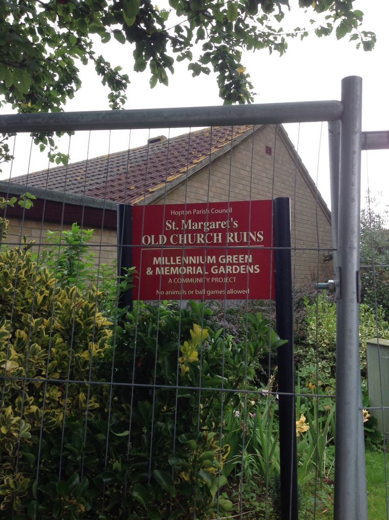
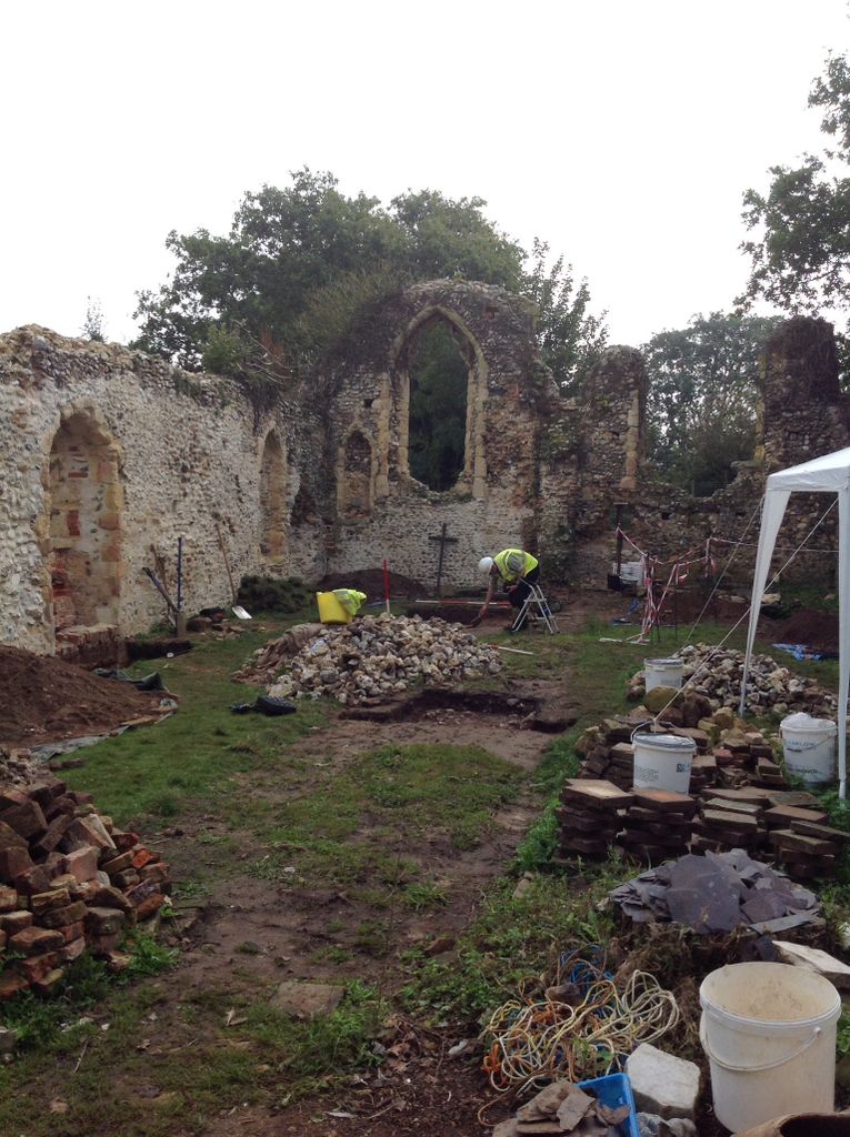
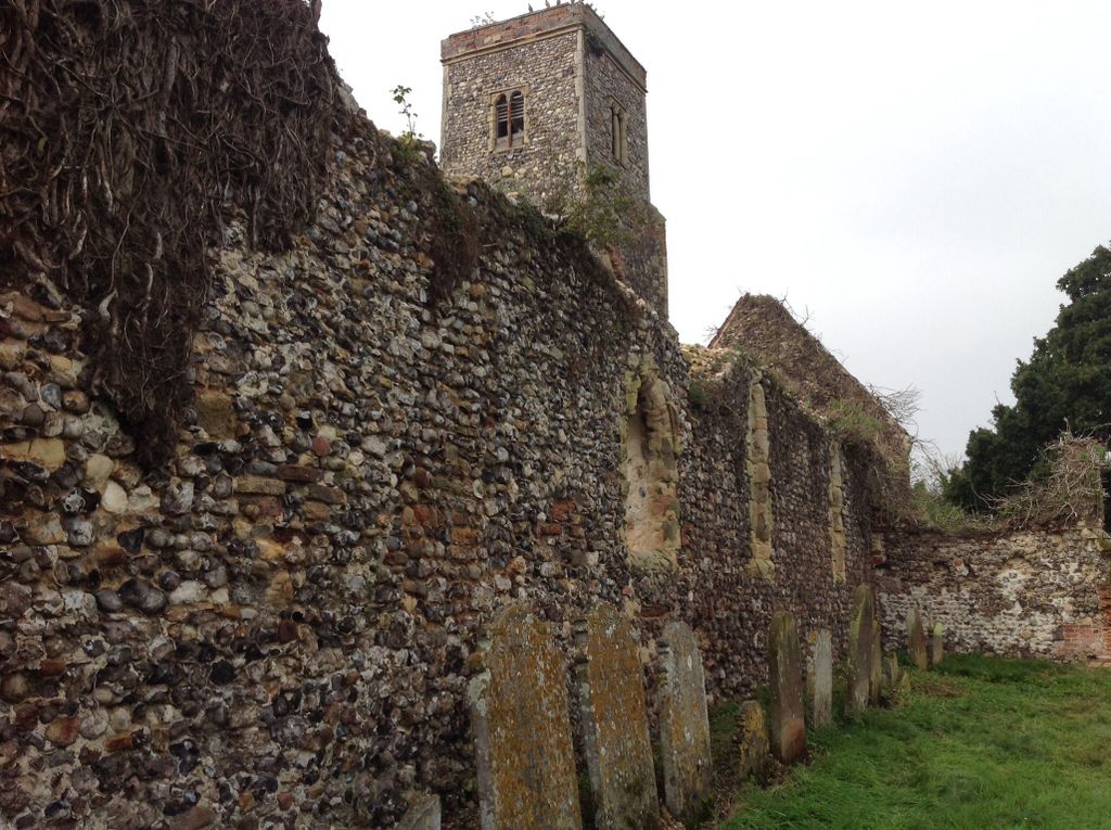
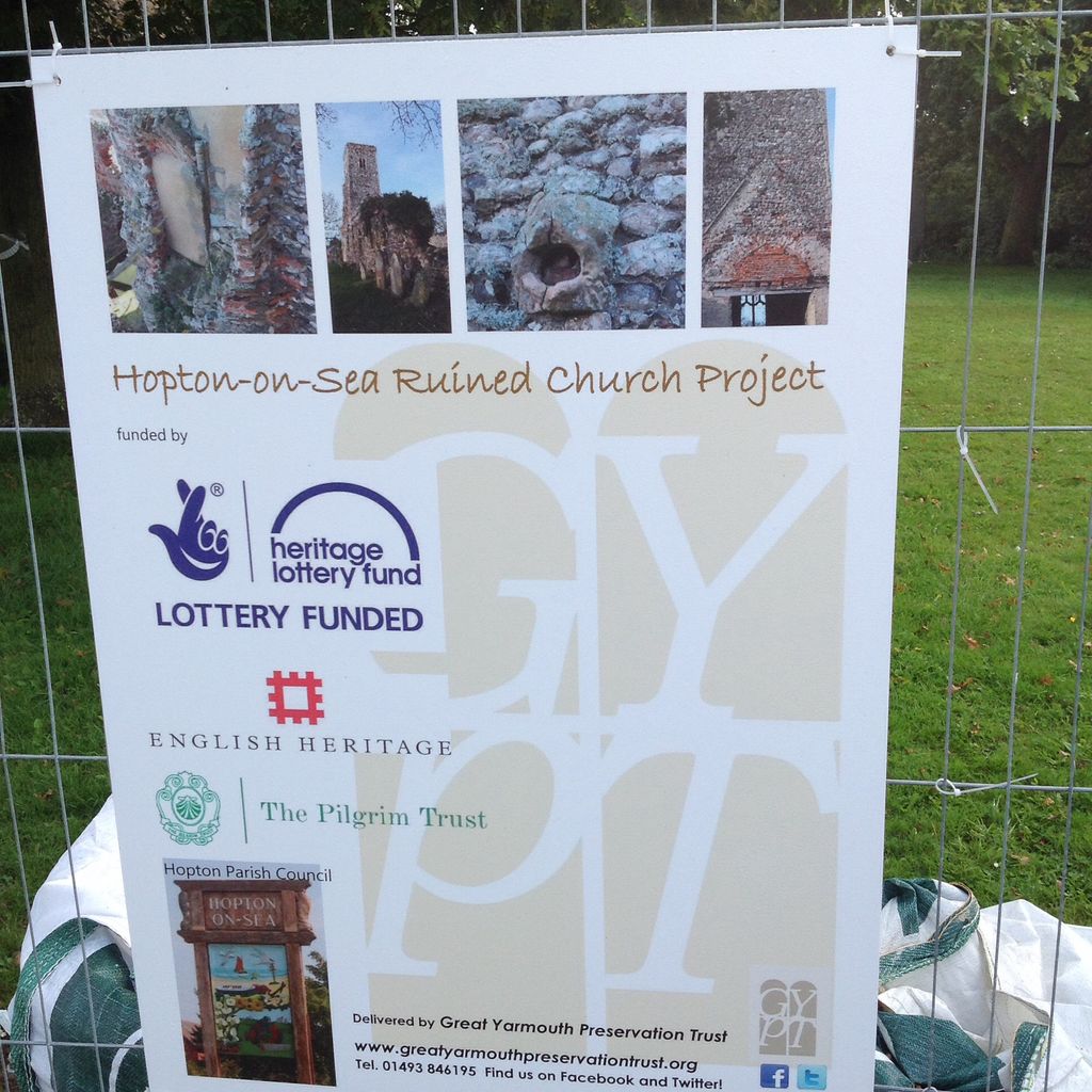
| Description | : | St Margaret’s Church in Coast Road (also known as Hopton Ruined Church) burned down in 1865 and was replaced by the existing church of the same name, on Lowestoft Road. A fire broke out in the church on Sunday 8 January 1865 when the stove became overheated and the building was all but demolished. There are a few gravestones around what is left of the church along with lots of broken up stones. The Parish Council is now working in partnership with Great Yarmouth Preservation Trust with the aim of stabilising the walls, getting the Grade II*... Read More |
frequently asked questions (FAQ):
-
Where is Saint Margaret Old Churchyard?
Saint Margaret Old Churchyard is located at Coast Road Hopton-on-Sea, Great Yarmouth Borough ,Norfolk ,England.
-
Saint Margaret Old Churchyard cemetery's updated grave count on graveviews.com?
0 memorials
-
Where are the coordinates of the Saint Margaret Old Churchyard?
Latitude: 52.5387720
Longitude: 1.7296733
Nearby Cemetories:
1. St Margaret Churchyard
Hopton-on-Sea, Great Yarmouth Borough, England
Coordinate: 52.5395717, 1.7211316
2. St Bartholomew Churchyard
Corton, Waveney District, England
Coordinate: 52.5213100, 1.7404800
3. St John the Baptist Churchyard
Lound, Waveney District, England
Coordinate: 52.5310680, 1.6937750
4. Corton War Memorial
Corton, Waveney District, England
Coordinate: 52.5148430, 1.7471340
5. St Mary The Virgin Churchyard
Blundeston, Waveney District, England
Coordinate: 52.5151100, 1.7029600
6. Magdalen Lawn Cemetery
Great Yarmouth, Great Yarmouth Borough, England
Coordinate: 52.5719600, 1.7073100
7. Gorleston Crematorium
Gorleston-on-Sea, Great Yarmouth Borough, England
Coordinate: 52.5718100, 1.7044000
8. St Mary's Parish Churchyard
Ashby, Waveney District, England
Coordinate: 52.5322480, 1.6693690
9. Gunton Woodland Burial Park
Lowestoft, Waveney District, England
Coordinate: 52.5010260, 1.7461380
10. St. Peter's Churchyard
Gunton, Waveney District, England
Coordinate: 52.5003000, 1.7444000
11. Saint Andrew Churchyard
Gorleston-on-Sea, Great Yarmouth Borough, England
Coordinate: 52.5788550, 1.7249070
12. Gorleston Cemetery
Gorleston-on-Sea, Great Yarmouth Borough, England
Coordinate: 52.5786850, 1.7171760
13. St Mary Churchyard
Somerleyton, Waveney District, England
Coordinate: 52.5157800, 1.6730900
14. St Nicholas Churchyard
Bradwell, Great Yarmouth Borough, England
Coordinate: 52.5748650, 1.6928610
15. All Saints Churchyard
Belton, Great Yarmouth Borough, England
Coordinate: 52.5674970, 1.6662540
16. St Edmund's Churchyard
Fritton, Great Yarmouth Borough, England
Coordinate: 52.5430920, 1.6460460
17. RNPS Belle Vue Park Cemetery
Lowestoft, Waveney District, England
Coordinate: 52.4901740, 1.7559862
18. St Margaret's Churchyard
Herringfleet, Waveney District, England
Coordinate: 52.5218820, 1.6493630
19. Lowestoft Naval Memorial
Lowestoft, Waveney District, England
Coordinate: 52.4883730, 1.7554520
20. St Margaret Churchyard
Lowestoft, Waveney District, England
Coordinate: 52.4860970, 1.7402750
21. Lowestoft Cemetery
Lowestoft, Waveney District, England
Coordinate: 52.4814390, 1.7404560
22. St. Michael's Churchyard
Oulton, Waveney District, England
Coordinate: 52.4823570, 1.6952900
23. Black Friars Priory
Great Yarmouth, Great Yarmouth Borough, England
Coordinate: 52.6003760, 1.7285340
24. Colby Gate Jewish Burial Ground
Great Yarmouth, Great Yarmouth Borough, England
Coordinate: 52.6014625, 1.7310622