
| Memorials | : | 0 |
| Location | : | Lowestoft, Waveney District, England |
| Coordinate | : | 52.4901740, 1.7559862 |
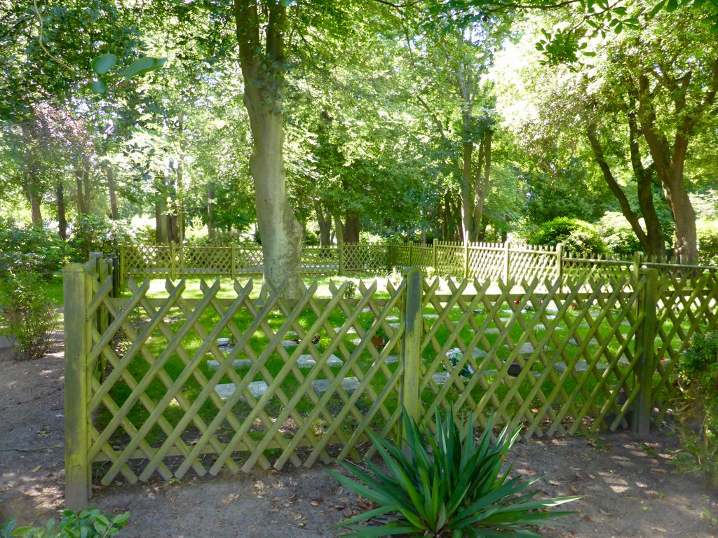
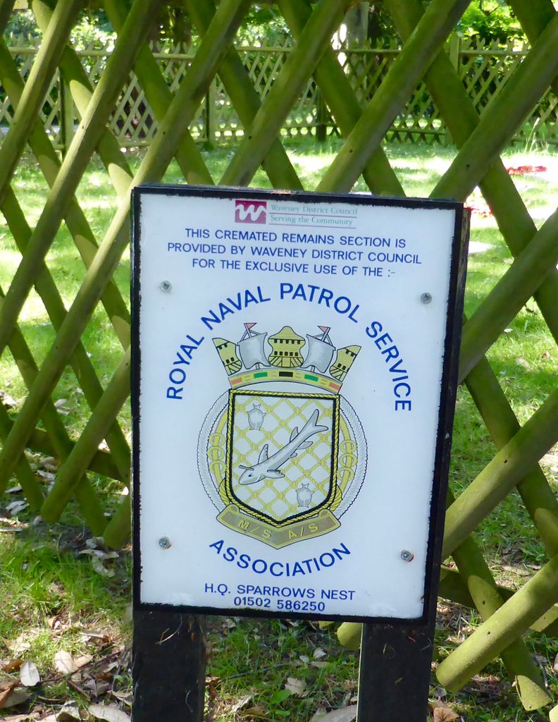
| Description | : | This cemetery is is used exclusively for veterans of the Royal Naval Patrol Services and their spouses. It is situated in Belle Vue Park in the north end of Lowestoft and only yards from the Lowestoft Naval Memorial which commemorates the men from the RNPS who died and have no known grave. |
frequently asked questions (FAQ):
-
Where is RNPS Belle Vue Park Cemetery?
RNPS Belle Vue Park Cemetery is located at Lowestoft, Waveney District ,Suffolk ,England.
-
RNPS Belle Vue Park Cemetery cemetery's updated grave count on graveviews.com?
0 memorials
-
Where are the coordinates of the RNPS Belle Vue Park Cemetery?
Latitude: 52.4901740
Longitude: 1.7559862
Nearby Cemetories:
1. Lowestoft Naval Memorial
Lowestoft, Waveney District, England
Coordinate: 52.4883730, 1.7554520
2. St Margaret Churchyard
Lowestoft, Waveney District, England
Coordinate: 52.4860970, 1.7402750
3. St. Peter's Churchyard
Gunton, Waveney District, England
Coordinate: 52.5003000, 1.7444000
4. Gunton Woodland Burial Park
Lowestoft, Waveney District, England
Coordinate: 52.5010260, 1.7461380
5. Lowestoft Cemetery
Lowestoft, Waveney District, England
Coordinate: 52.4814390, 1.7404560
6. Corton War Memorial
Corton, Waveney District, England
Coordinate: 52.5148430, 1.7471340
7. St. Peter and St. John Churchyard
Kirkley, Waveney District, England
Coordinate: 52.4628290, 1.7384010
8. St Bartholomew Churchyard
Corton, Waveney District, England
Coordinate: 52.5213100, 1.7404800
9. Kirkley Cemetery
Lowestoft, Waveney District, England
Coordinate: 52.4583260, 1.7353110
10. St. Michael's Churchyard
Oulton, Waveney District, England
Coordinate: 52.4823570, 1.6952900
11. All Saints & St Margaret Churchyard
Pakefield, Waveney District, England
Coordinate: 52.4533520, 1.7344150
12. St Mary The Virgin Churchyard
Blundeston, Waveney District, England
Coordinate: 52.5151100, 1.7029600
13. Saint Margaret Old Churchyard
Hopton-on-Sea, Great Yarmouth Borough, England
Coordinate: 52.5387720, 1.7296733
14. St Mary's Churchyard
Burgh St Peter, South Norfolk District, England
Coordinate: 52.4840860, 1.6710830
15. St Peter's New Churchyard
Carlton Colville, Waveney District, England
Coordinate: 52.4528500, 1.6953250
16. St Margaret Churchyard
Hopton-on-Sea, Great Yarmouth Borough, England
Coordinate: 52.5395717, 1.7211316
17. St Peter's Churchyard
Carlton Colville, Waveney District, England
Coordinate: 52.4514530, 1.6929030
18. St John the Baptist Churchyard
Lound, Waveney District, England
Coordinate: 52.5310680, 1.6937750
19. St Mary Churchyard
Somerleyton, Waveney District, England
Coordinate: 52.5157800, 1.6730900
20. Holy Trinity Churchyard
Gisleham, Waveney District, England
Coordinate: 52.4372320, 1.6975344
21. St Mary's Parish Churchyard
Ashby, Waveney District, England
Coordinate: 52.5322480, 1.6693690
22. St Margaret's Churchyard
Herringfleet, Waveney District, England
Coordinate: 52.5218820, 1.6493630
23. Saint John the Baptist Churchyard
Barnby, Waveney District, England
Coordinate: 52.4510410, 1.6494740
24. St. Michael's Churchyard
Rushmere, Waveney District, England
Coordinate: 52.4332200, 1.6688300