
| Memorials | : | 3 |
| Location | : | Manhattan, New York County (Manhattan), USA |
| Coordinate | : | 40.7302800, -73.9871300 |
frequently asked questions (FAQ):
-
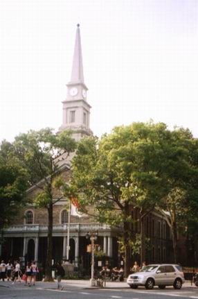
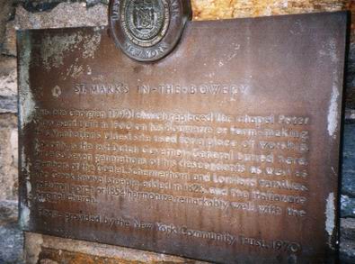
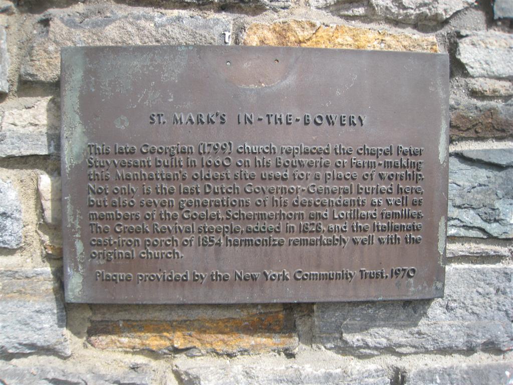
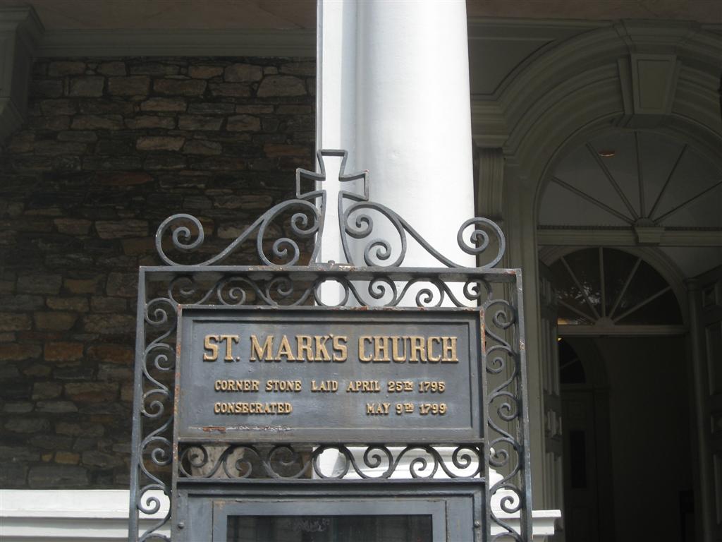
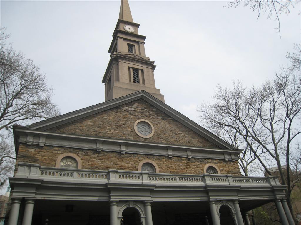
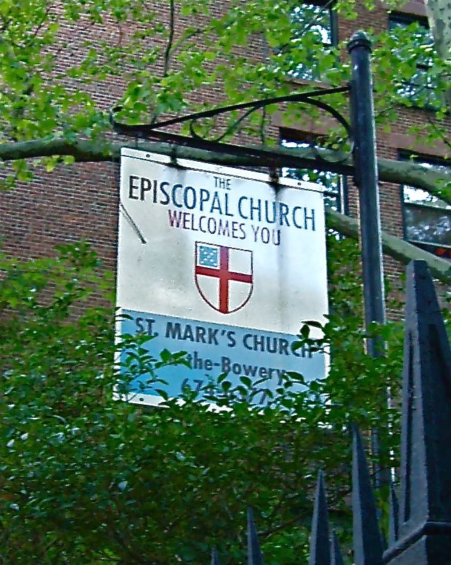
Where is Saint Marks Church-In-The-Bowery Churchyard?
Saint Marks Church-In-The-Bowery Churchyard is located at 10th Street and Second Avenue Manhattan, New York County (Manhattan) ,New York ,USA.
-
Saint Marks Church-In-The-Bowery Churchyard cemetery's updated grave count on graveviews.com?
3 memorials
-
Where are the coordinates of the Saint Marks Church-In-The-Bowery Churchyard?
Latitude: 40.7302800
Longitude: -73.9871300
Nearby Cemetories:
1. Catholic Cemetery
Manhattan, New York County (Manhattan), USA
Coordinate: 40.7291990, -73.9830860
2. Grace Church
Manhattan, New York County (Manhattan), USA
Coordinate: 40.7320100, -73.9909520
3. New York Marble Cemetery
Manhattan, New York County (Manhattan), USA
Coordinate: 40.7252570, -73.9903050
4. University Place Cemetery
Manhattan, New York County (Manhattan), USA
Coordinate: 40.7343250, -73.9928300
5. New York City Marble Cemetery
Manhattan, New York County (Manhattan), USA
Coordinate: 40.7245190, -73.9891060
6. First Baptist Cemetery (Defunct)
Manhattan, New York County (Manhattan), USA
Coordinate: 40.7235040, -73.9897220
7. Most Holy Redeemer Church Vault
Manhattan, New York County (Manhattan), USA
Coordinate: 40.7234690, -73.9844930
8. Bleecker Street Presbyterian Church
New York, New York County (Manhattan), USA
Coordinate: 40.7263090, -73.9950690
9. First Presbyterian Church
Manhattan, New York County (Manhattan), USA
Coordinate: 40.7344300, -73.9949700
10. Church of the Ascension Episcopal Columbarium
Greenwich Village, New York County (Manhattan), USA
Coordinate: 40.7337830, -73.9957900
11. Houston Street Cemetery
New York, New York County (Manhattan), USA
Coordinate: 40.7234200, -73.9919210
12. Potter’s Field Washington Square Park
Manhattan, New York County (Manhattan), USA
Coordinate: 40.7308070, -73.9974780
13. Presbyterian Cemetery
Manhattan, New York County (Manhattan), USA
Coordinate: 40.7228400, -73.9910700
14. Dutch Reformed Church Cemetery
Manhattan, New York County (Manhattan), USA
Coordinate: 40.7225500, -73.9908800
15. Saint Patrick's Old Cathedral Churchyard
Manhattan, New York County (Manhattan), USA
Coordinate: 40.7239800, -73.9949100
16. Calvary Episcopal Church Columbarium
New York, New York County (Manhattan), USA
Coordinate: 40.7389140, -73.9867200
17. Washington Square Park
Manhattan, New York County (Manhattan), USA
Coordinate: 40.7308700, -73.9988000
18. Second Cemetery of Congregation Shearith Israel
New York County (Manhattan), USA
Coordinate: 40.7351608, -73.9977417
19. Allen Street Methodist Burial Ground
Manhattan, New York County (Manhattan), USA
Coordinate: 40.7197850, -73.9897370
20. Bethel Baptist Churchyard and Burial Vaults
Manhattan, New York County (Manhattan), USA
Coordinate: 40.7202630, -73.9923950
21. Macedonia Baptist Church Cemetery #1
Odenville, St. Clair County, USA
Coordinate: 40.7418950, -73.9893080
22. Potter's Field Madison Square Park
Manhattan, New York County (Manhattan), USA
Coordinate: 40.7421300, -73.9880400
23. Methodist Protestant Attorney Street Vaults
New York County (Manhattan), USA
Coordinate: 40.7182010, -73.9848410
24. Eternal Light Monument
Manhattan, New York County (Manhattan), USA
Coordinate: 40.7425000, -73.9886100