| Memorials | : | 0 |
| Location | : | New York, New York County (Manhattan), USA |
| Coordinate | : | 40.7234200, -73.9919210 |
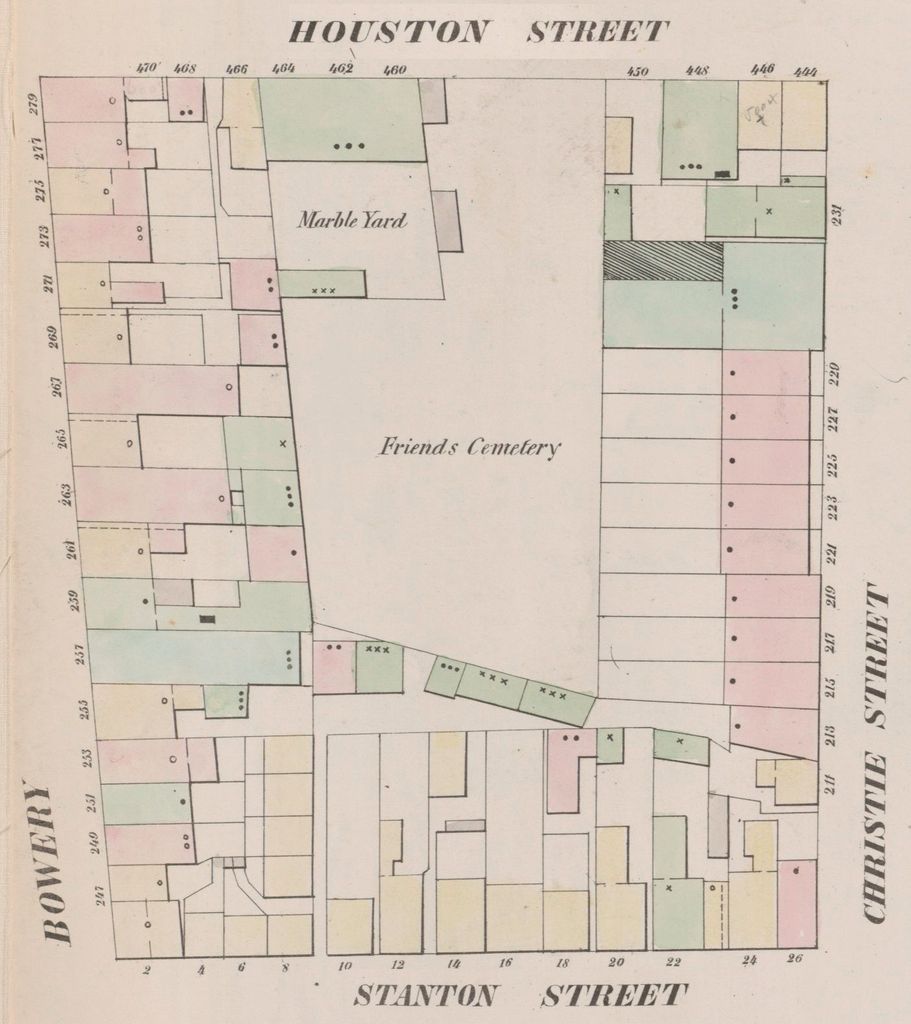
| Description | : | In 1825, the Society of Friends (Quakers) purchased land at the southeast corner of North (Houston) and the Bowery to serve as their new burial ground outside of town. Quaker burials continued here until 1849, after which the cemetery was removed. So many bodies were buried one on top of another—the Friends did not use grave markers for these early burials—that it became hard to distinguish burials when the remains were disinterred and reburied at the Westbury Meeting House at Jericho, Long Island.87 Some fragments of human bone were unearthed during recent (2003) archaeological investigations. These bones and other artifacts... Read More |
frequently asked questions (FAQ):
-
Where is Houston Street Cemetery?
Houston Street Cemetery is located at The Bowery Historic District New York, New York County (Manhattan) ,New York ,USA.
-
Houston Street Cemetery cemetery's updated grave count on graveviews.com?
0 memorials
-
Where are the coordinates of the Houston Street Cemetery?
Latitude: 40.7234200
Longitude: -73.9919210
Nearby Cemetories:
1. Presbyterian Cemetery
Manhattan, New York County (Manhattan), USA
Coordinate: 40.7228400, -73.9910700
2. Dutch Reformed Church Cemetery
Manhattan, New York County (Manhattan), USA
Coordinate: 40.7225500, -73.9908800
3. First Baptist Cemetery (Defunct)
Manhattan, New York County (Manhattan), USA
Coordinate: 40.7235040, -73.9897220
4. New York Marble Cemetery
Manhattan, New York County (Manhattan), USA
Coordinate: 40.7252570, -73.9903050
5. Saint Patrick's Old Cathedral Churchyard
Manhattan, New York County (Manhattan), USA
Coordinate: 40.7239800, -73.9949100
6. New York City Marble Cemetery
Manhattan, New York County (Manhattan), USA
Coordinate: 40.7245190, -73.9891060
7. Bethel Baptist Churchyard and Burial Vaults
Manhattan, New York County (Manhattan), USA
Coordinate: 40.7202630, -73.9923950
8. Bleecker Street Presbyterian Church
New York, New York County (Manhattan), USA
Coordinate: 40.7263090, -73.9950690
9. Allen Street Methodist Burial Ground
Manhattan, New York County (Manhattan), USA
Coordinate: 40.7197850, -73.9897370
10. Saint Stephen's Episcopal Churchyard and Vaults
Manhattan, New York County (Manhattan), USA
Coordinate: 40.7187830, -73.9933450
11. Most Holy Redeemer Church Vault
Manhattan, New York County (Manhattan), USA
Coordinate: 40.7234690, -73.9844930
12. Methodist Society Cemetery
New York, New York County (Manhattan), USA
Coordinate: 40.7164260, -73.9945290
13. Methodist Protestant Attorney Street Vaults
New York County (Manhattan), USA
Coordinate: 40.7182010, -73.9848410
14. Second Presbyterian Cemetery
Manhattan, New York County (Manhattan), USA
Coordinate: 40.7212450, -74.0015860
15. Saint Marks Church-In-The-Bowery Churchyard
Manhattan, New York County (Manhattan), USA
Coordinate: 40.7302800, -73.9871300
16. German Reformed Cemetery
Manhattan, New York County (Manhattan), USA
Coordinate: 40.7152800, -73.9947050
17. Potter’s Field Washington Square Park
Manhattan, New York County (Manhattan), USA
Coordinate: 40.7308070, -73.9974780
18. Grace Church
Manhattan, New York County (Manhattan), USA
Coordinate: 40.7320100, -73.9909520
19. Forsyth Street Methodist Episcopal Churchyard
New York County (Manhattan), USA
Coordinate: 40.7148070, -73.9942650
20. Catholic Cemetery
Manhattan, New York County (Manhattan), USA
Coordinate: 40.7291990, -73.9830860
21. Washington Square Park
Manhattan, New York County (Manhattan), USA
Coordinate: 40.7308700, -73.9988000
22. First Moravian Church Fresh Water Burial Ground
Manhattan, New York County (Manhattan), USA
Coordinate: 40.7151210, -73.9985380
23. Church of the Ascension Episcopal Columbarium
Greenwich Village, New York County (Manhattan), USA
Coordinate: 40.7337830, -73.9957900
24. University Place Cemetery
Manhattan, New York County (Manhattan), USA
Coordinate: 40.7343250, -73.9928300

