
| Memorials | : | 0 |
| Location | : | Manhattan, New York County (Manhattan), USA |
| Coordinate | : | 40.7202630, -73.9923950 |
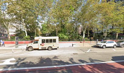
| Description | : | Located in Manhattan's Lower East Side on Delancey Street between Chrystie Street and the Bowery, buildings have continued to be erected over the site since 1856. Years of use: circa 1818 - circa 1842. The cemetery is identified as the Bethel Baptist Churchyard and Burial Vaults on page 18 of The Graveyard Shift: A Family Historian’s Guide to New York City Cemeteries, Carolee Inskeep, Ancestry Publishing (Orem, Utah) © 2000. |
frequently asked questions (FAQ):
-
Where is Bethel Baptist Churchyard and Burial Vaults?
Bethel Baptist Churchyard and Burial Vaults is located at Delancey Street Manhattan, New York County (Manhattan) ,New York , 10002USA.
-
Bethel Baptist Churchyard and Burial Vaults cemetery's updated grave count on graveviews.com?
0 memorials
-
Where are the coordinates of the Bethel Baptist Churchyard and Burial Vaults?
Latitude: 40.7202630
Longitude: -73.9923950
Nearby Cemetories:
1. Saint Stephen's Episcopal Churchyard and Vaults
Manhattan, New York County (Manhattan), USA
Coordinate: 40.7187830, -73.9933450
2. Allen Street Methodist Burial Ground
Manhattan, New York County (Manhattan), USA
Coordinate: 40.7197850, -73.9897370
3. Dutch Reformed Church Cemetery
Manhattan, New York County (Manhattan), USA
Coordinate: 40.7225500, -73.9908800
4. Presbyterian Cemetery
Manhattan, New York County (Manhattan), USA
Coordinate: 40.7228400, -73.9910700
5. Houston Street Cemetery
New York, New York County (Manhattan), USA
Coordinate: 40.7234200, -73.9919210
6. First Baptist Cemetery (Defunct)
Manhattan, New York County (Manhattan), USA
Coordinate: 40.7235040, -73.9897220
7. Methodist Society Cemetery
New York, New York County (Manhattan), USA
Coordinate: 40.7164260, -73.9945290
8. Saint Patrick's Old Cathedral Churchyard
Manhattan, New York County (Manhattan), USA
Coordinate: 40.7239800, -73.9949100
9. New York City Marble Cemetery
Manhattan, New York County (Manhattan), USA
Coordinate: 40.7245190, -73.9891060
10. New York Marble Cemetery
Manhattan, New York County (Manhattan), USA
Coordinate: 40.7252570, -73.9903050
11. German Reformed Cemetery
Manhattan, New York County (Manhattan), USA
Coordinate: 40.7152800, -73.9947050
12. Forsyth Street Methodist Episcopal Churchyard
New York County (Manhattan), USA
Coordinate: 40.7148070, -73.9942650
13. Methodist Protestant Attorney Street Vaults
New York County (Manhattan), USA
Coordinate: 40.7182010, -73.9848410
14. Bleecker Street Presbyterian Church
New York, New York County (Manhattan), USA
Coordinate: 40.7263090, -73.9950690
15. Most Holy Redeemer Church Vault
Manhattan, New York County (Manhattan), USA
Coordinate: 40.7234690, -73.9844930
16. First Moravian Church Fresh Water Burial Ground
Manhattan, New York County (Manhattan), USA
Coordinate: 40.7151210, -73.9985380
17. Second Presbyterian Cemetery
Manhattan, New York County (Manhattan), USA
Coordinate: 40.7212450, -74.0015860
18. Oliver Street Baptist Churchyard
Manhattan, New York County (Manhattan), USA
Coordinate: 40.7128470, -73.9977730
19. First Cemetery of Congregation Shearith Israel
Chinatown, New York County (Manhattan), USA
Coordinate: 40.7129211, -73.9985352
20. Saint Marks Church-In-The-Bowery Churchyard
Manhattan, New York County (Manhattan), USA
Coordinate: 40.7302800, -73.9871300
21. Second African Burial Ground
Manhattan, New York County (Manhattan), USA
Coordinate: 40.7144400, -74.0047200
22. African Burial Ground National Monument
New York, New York County (Manhattan), USA
Coordinate: 40.7144400, -74.0047200
23. Potter’s Field Washington Square Park
Manhattan, New York County (Manhattan), USA
Coordinate: 40.7308070, -73.9974780
24. Catholic Cemetery
Manhattan, New York County (Manhattan), USA
Coordinate: 40.7291990, -73.9830860