
| Memorials | : | 0 |
| Location | : | Denton, Darlington Unitary Authority, England |
| Coordinate | : | 54.5647600, -1.6626300 |
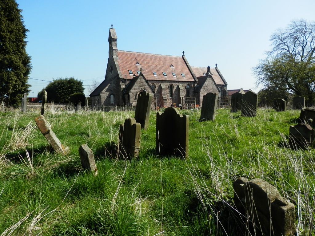
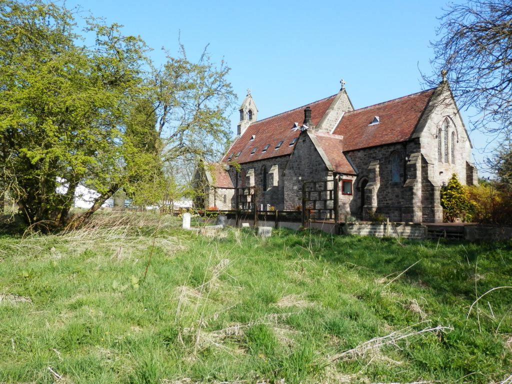
| Description | : | The small church was built in 1891, replacing an earlier one built in 1836. The church is built of sandstone and has a small porch and side chapel to the south. A stone coffin is used as a drinking trough for animals in the churchyard, and the remains of some medieval gravestones can be seen in the porch. The church is now deconsecrated and a private dwelling. The main churchyard is to the South of the church; the small new section is to its West. Although most of the headstones, many from the 18th century, are legible, the main churchyard is overgrown... Read More |
frequently asked questions (FAQ):
-
Where is Saint Mary's Churchyard?
Saint Mary's Churchyard is located at Denton, Darlington Unitary Authority ,County Durham ,England.
-
Saint Mary's Churchyard cemetery's updated grave count on graveviews.com?
0 memorials
-
Where are the coordinates of the Saint Mary's Churchyard?
Latitude: 54.5647600
Longitude: -1.6626300
Nearby Cemetories:
1. St. Mary's Churchyard
Piercebridge, Darlington Unitary Authority, England
Coordinate: 54.5366780, -1.6766370
2. St Edwin New Churchyard
High Coniscliffe, Darlington Unitary Authority, England
Coordinate: 54.5338700, -1.6554100
3. St. Edwin Churchyard
High Coniscliffe, Darlington Unitary Authority, England
Coordinate: 54.5322290, -1.6525190
4. St Michael Churchyard
Heighington, Darlington Unitary Authority, England
Coordinate: 54.5956630, -1.6162350
5. St John the Evangelist Churchyard
Ingleton, Durham Unitary Authority, England
Coordinate: 54.5795310, -1.7326110
6. St Osmund's Roman Catholic Churchyard
Gainford, Durham Unitary Authority, England
Coordinate: 54.5476300, -1.7359500
7. Saint Mary's Churchyard
Gainford, Durham Unitary Authority, England
Coordinate: 54.5453800, -1.7389100
8. All Saints Churchyard
Manfield, Richmondshire District, England
Coordinate: 54.5154080, -1.6573120
9. Gainford Cemetery
Gainford, Durham Unitary Authority, England
Coordinate: 54.5441400, -1.7417800
10. St Peter Churchyard
Cleasby, Richmondshire District, England
Coordinate: 54.5123200, -1.6166600
11. All Saints Churchyard
Shildon, Durham Unitary Authority, England
Coordinate: 54.6224700, -1.6412900
12. West Cemetery
Newton Aycliffe, Durham Unitary Authority, England
Coordinate: 54.6095500, -1.5945500
13. Carmel House Convent
Darlington, Darlington Unitary Authority, England
Coordinate: 54.5274820, -1.5819650
14. Saint Clare's Abbey
Darlington, Darlington Unitary Authority, England
Coordinate: 54.5250393, -1.5810069
15. St Andrew Churchyard
Aycliffe Village, Durham Unitary Authority, England
Coordinate: 54.5938560, -1.5634360
16. Darlington Crematorium
Darlington, Darlington Unitary Authority, England
Coordinate: 54.5206300, -1.5783830
17. Darlington West Cemetery
Darlington, Darlington Unitary Authority, England
Coordinate: 54.5206200, -1.5781200
18. Shildon Cemetery
Shildon, Durham Unitary Authority, England
Coordinate: 54.6312700, -1.6628600
19. Holy Trinity Churchyard
Darlington, Darlington Unitary Authority, England
Coordinate: 54.5278310, -1.5639640
20. St John's Churchyard
Shildon, Durham Unitary Authority, England
Coordinate: 54.6325180, -1.6471260
21. St John the Baptist Churchyard
Stanwick St John, Richmondshire District, England
Coordinate: 54.5028550, -1.7155730
22. Darlington North Cemetery
Darlington, Darlington Unitary Authority, England
Coordinate: 54.5445100, -1.5484600
23. St. Hilda's Churchyard
Caldwell, Richmondshire District, England
Coordinate: 54.5156390, -1.7508220
24. St Cuthbert Churchyard
Forcett, Richmondshire District, England
Coordinate: 54.5051660, -1.7304510