
| Memorials | : | 4 |
| Location | : | Fort Stewart, Liberty County, USA |
| Coordinate | : | 31.9356003, -81.6481018 |
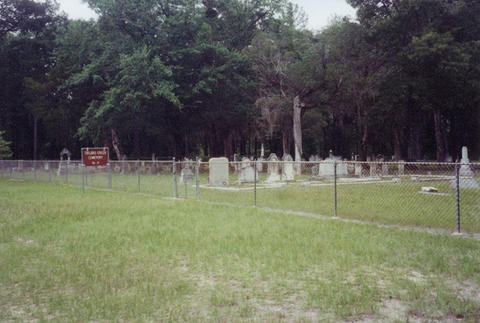
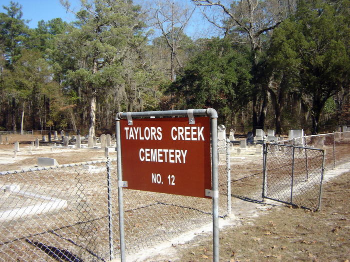
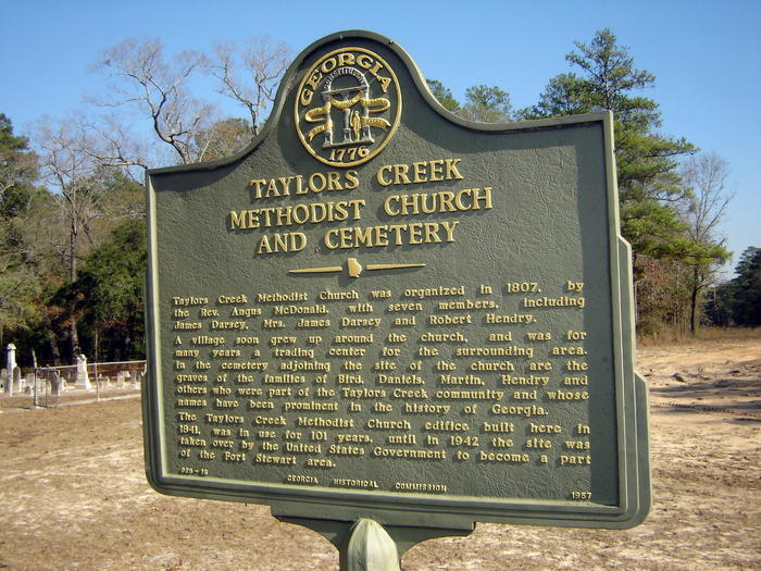
| Description | : | Taylors Creek Cemetery is located in Liberty County at Fort Stewart Military Reservation. The cemetery is located in Fort Stewart Training Area B8, north of Fort Stewart Road #144. |
frequently asked questions (FAQ):
-
Where is Taylors Creek Cemetery?
Taylors Creek Cemetery is located at Fort Stewart, Liberty County ,Georgia ,USA.
-
Taylors Creek Cemetery cemetery's updated grave count on graveviews.com?
4 memorials
-
Where are the coordinates of the Taylors Creek Cemetery?
Latitude: 31.9356003
Longitude: -81.6481018
Nearby Cemetories:
1. Thomas Hill Cemetery
Fort Stewart, Liberty County, USA
Coordinate: 31.9950008, -81.6117020
2. Strum Bay Cemetery
Fort Stewart, Liberty County, USA
Coordinate: 32.0078011, -81.6564026
3. Todd-Ray Cemetery
Fort Stewart, Liberty County, USA
Coordinate: 31.9978008, -81.7138977
4. New Home Society Cemetery
Hinesville, Liberty County, USA
Coordinate: 31.8735400, -81.5755400
5. Porter Cemetery
Liberty County, USA
Coordinate: 32.0191550, -81.6802200
6. Flemington Presbyterian Church Cemetery
Flemington, Liberty County, USA
Coordinate: 31.8695100, -81.5711100
7. Trinity Cemetery
Fort Stewart, Liberty County, USA
Coordinate: 31.9307995, -81.5382996
8. Saint Philip's Episcopal Church Memorial Garden
Hinesville, Liberty County, USA
Coordinate: 31.8558420, -81.5905660
9. Wells Cemetery
Gum Branch, Liberty County, USA
Coordinate: 31.8431000, -81.6786000
10. Liberty Baptist Church Cemetery
Hinesville, Liberty County, USA
Coordinate: 31.8598540, -81.7238940
11. Elarbee Cemetery
Liberty County, USA
Coordinate: 32.0447006, -81.6706009
12. Warnell Cemetery
Fort Stewart, Liberty County, USA
Coordinate: 32.0450380, -81.6709420
13. Bethel Church Cemetery
Fort Stewart, Liberty County, USA
Coordinate: 31.9799995, -81.7727966
14. Poppell Cemetery
Hinesville, Liberty County, USA
Coordinate: 31.8143997, -81.6492004
15. Faith Memorial Garden
Hinesville, Liberty County, USA
Coordinate: 31.8117000, -81.6495000
16. Saint Luke Missionary Baptist Church Cemetery
Hinesville, Liberty County, USA
Coordinate: 31.8085390, -81.6598060
17. Oglethorpe Memorial Park
Hinesville, Liberty County, USA
Coordinate: 31.8115450, -81.6071000
18. Corinth Cemetery
Fort Stewart, Bryan County, USA
Coordinate: 32.0106010, -81.5224991
19. Hinesville Cemetery
Hinesville, Liberty County, USA
Coordinate: 31.8043995, -81.6085968
20. Little Creek Cemetery
Fort Stewart, Bryan County, USA
Coordinate: 32.0483017, -81.5550003
21. Wilderness Baptist Church Cemetery
Hinesville, Liberty County, USA
Coordinate: 31.8358702, -81.5352460
22. New Poplar Head Church Cemetery
Donald, Long County, USA
Coordinate: 31.8668700, -81.7909500
23. Poplar Head Cemetery
Fort Stewart, Long County, USA
Coordinate: 31.9081000, -81.8139000
24. First Calvary Missionary Baptist Church Cemetery
Hinesville, Liberty County, USA
Coordinate: 31.7956000, -81.6067000