
| Memorials | : | 181 |
| Location | : | Upton, Metropolitan Borough of Wirral, England |
| Coordinate | : | 53.3824050, -3.0919920 |
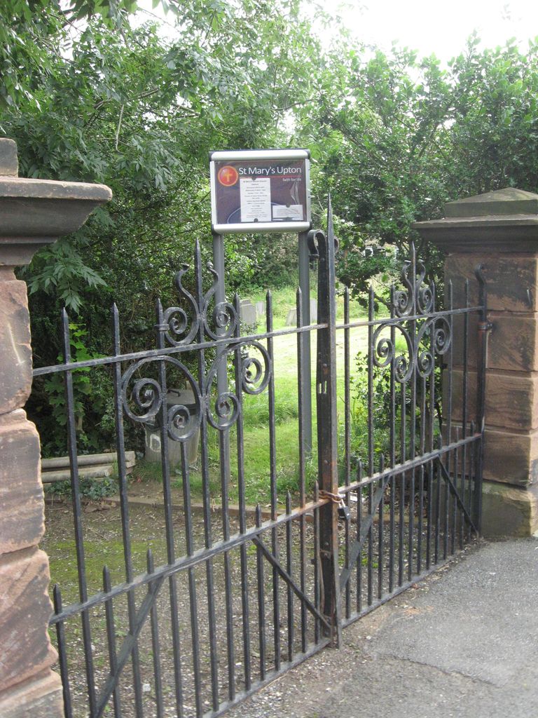
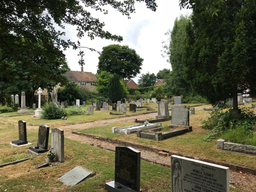
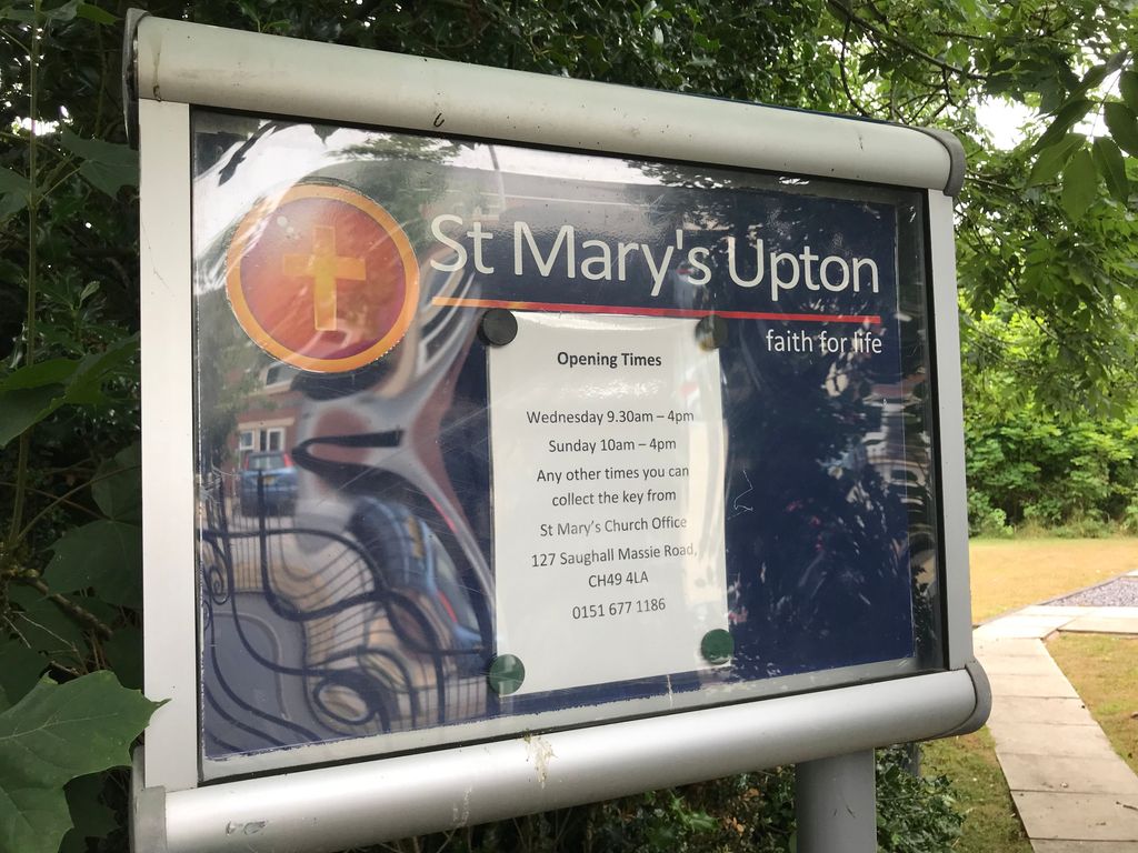
| Description | : | Also known as Upton Cemetery, or formerly Houghton Road Cemetery. This small cemetery is managed by St. Mary's C of E Parish Church which operates a restricted access policy to protect the site. Open access is available Wednesday 9.30am-4pm and Sunday 11am-5pm. Access at other times is permitted by collecting the gate key from the church office at 8 Church Road, Upton (open monday 9am-1pm, tuesday-friday 9am-3.15pm excluding school holidays which are monday - friday 9am -12.30pm). The cemetery occupies a site southeast of the village centre . The original address of the cemetery had been Houghton Road which has been truncated... Read More |
frequently asked questions (FAQ):
-
Where is Salacre Lane Cemetery?
Salacre Lane Cemetery is located at Salacre Lane Upton, Metropolitan Borough of Wirral ,Merseyside , CH49 9ASEngland.
-
Salacre Lane Cemetery cemetery's updated grave count on graveviews.com?
181 memorials
-
Where are the coordinates of the Salacre Lane Cemetery?
Latitude: 53.3824050
Longitude: -3.0919920
Nearby Cemetories:
1. Saint Mary's Churchyard
Upton, Metropolitan Borough of Wirral, England
Coordinate: 53.3847010, -3.0961600
2. Holy Cross Churchyard
Woodchurch, Metropolitan Borough of Wirral, England
Coordinate: 53.3731900, -3.0899400
3. Landican Cemetery and Crematorium
Woodchurch, Metropolitan Borough of Wirral, England
Coordinate: 53.3654000, -3.0887510
4. Christ Church Churchyard
Moreton, Metropolitan Borough of Wirral, England
Coordinate: 53.3999580, -3.1112310
5. Flaybrick Memorial Gardens
Birkenhead, Metropolitan Borough of Wirral, England
Coordinate: 53.3968130, -3.0633240
6. St Oswald's Churchyard
Bidston, Metropolitan Borough of Wirral, England
Coordinate: 53.4043400, -3.0791000
7. St. John the Divine
Frankby, Metropolitan Borough of Wirral, England
Coordinate: 53.3744200, -3.1330200
8. Frankby Cemetery
Frankby, Metropolitan Borough of Wirral, England
Coordinate: 53.3715920, -3.1399600
9. St Bartholomew's Churchyard
Thurstaston, Metropolitan Borough of Wirral, England
Coordinate: 53.3485750, -3.1320070
10. Barnston Cemetery
Barnston, Metropolitan Borough of Wirral, England
Coordinate: 53.3408590, -3.0820730
11. St. Werburgh & St. Laurence Catholic Churchyard
Birkenhead, Metropolitan Borough of Wirral, England
Coordinate: 53.3894910, -3.0217530
12. St Hilary Churchyard
Wallasey, Metropolitan Borough of Wirral, England
Coordinate: 53.4216480, -3.0601780
13. Heswall Cemetery
Heswall, Metropolitan Borough of Wirral, England
Coordinate: 53.3400420, -3.1102790
14. St Alban's Catholic Church
Wallasey, Metropolitan Borough of Wirral, England
Coordinate: 53.4181339, -3.0445808
15. Grange Cemetery
West Kirby, Metropolitan Borough of Wirral, England
Coordinate: 53.3751630, -3.1682120
16. Christ Church
Bebington, Metropolitan Borough of Wirral, England
Coordinate: 53.3584460, -3.0254810
17. St Paul's
Tranmere, Metropolitan Borough of Wirral, England
Coordinate: 53.3740000, -3.0154600
18. St. Mary's Churchyard
Birkenhead, Metropolitan Borough of Wirral, England
Coordinate: 53.3895930, -3.0112520
19. St. John the Evangelist Churchyard
Egremont, Metropolitan Borough of Wirral, England
Coordinate: 53.4163500, -3.0329700
20. Bebington Cemetery
Bebington, Metropolitan Borough of Wirral, England
Coordinate: 53.3588030, -3.0165370
21. Rake Lane Cemetery
Wallasey, Metropolitan Borough of Wirral, England
Coordinate: 53.4256120, -3.0437320
22. Holy Trinity Graveyard
Hoylake, Metropolitan Borough of Wirral, England
Coordinate: 53.3956000, -3.1765900
23. St Bridget Churchyard
West Kirby, Metropolitan Borough of Wirral, England
Coordinate: 53.3687130, -3.1764480
24. St. Peter's Churchyard
Bebington, Metropolitan Borough of Wirral, England
Coordinate: 53.3692500, -3.0021020