
| Memorials | : | 0 |
| Location | : | Sulphur, Murray County, USA |
| Coordinate | : | 34.6154800, -96.9663500 |
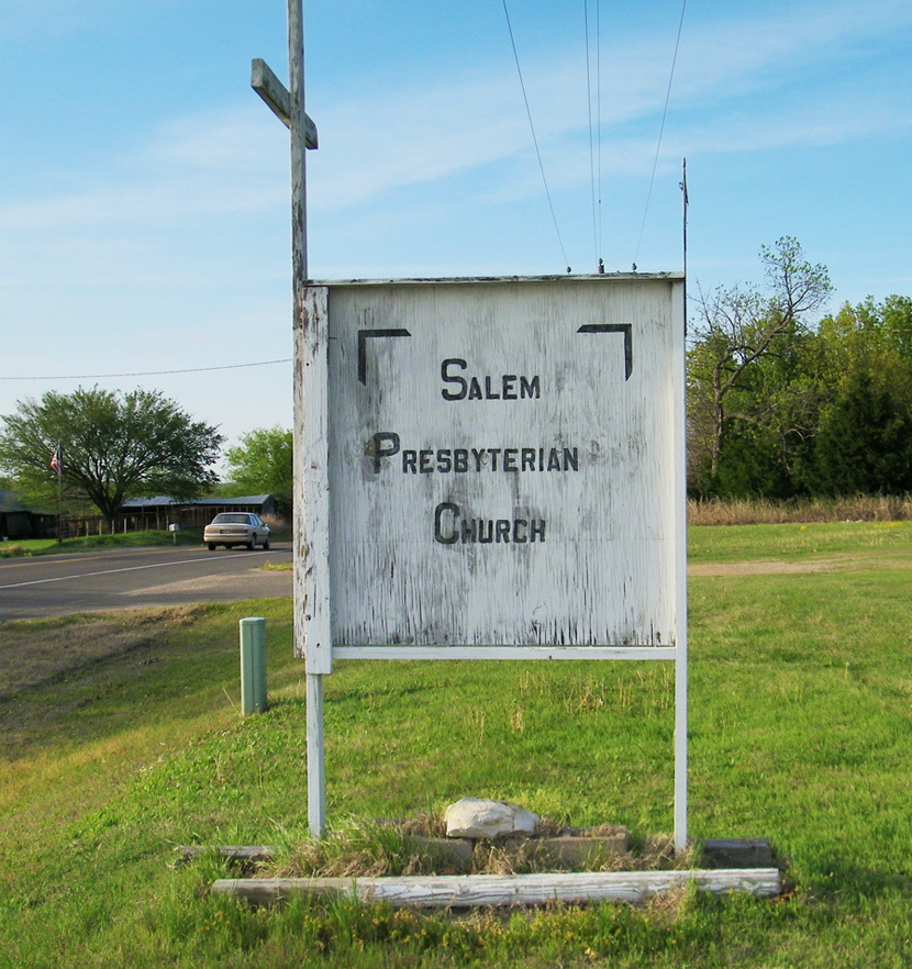
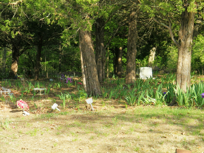
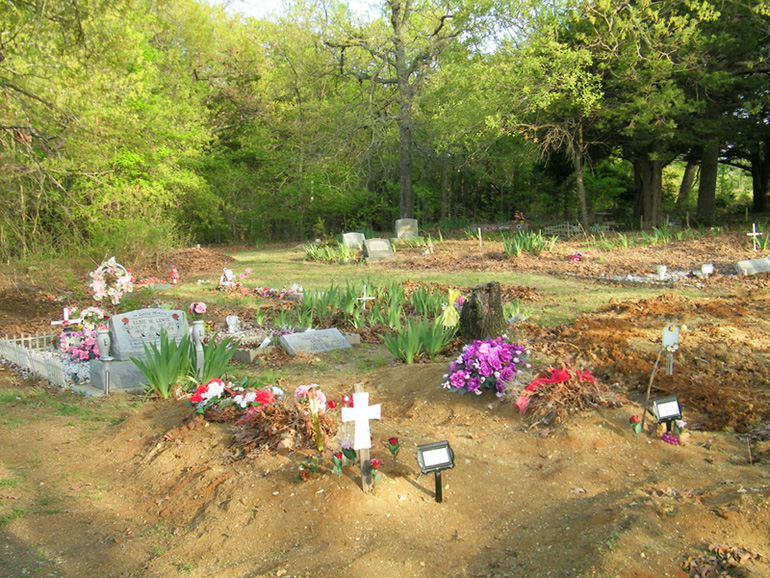
| Description | : | A Choctaw Native American cemetery located behind the Salem Presbyterian Church (southeast of church). Located 7 1/2 miles north of Sulphur, OK on US 177. |
frequently asked questions (FAQ):
-
Where is Salem Presbyterian Cemetery?
Salem Presbyterian Cemetery is located at Sulphur, Murray County ,Oklahoma ,USA.
-
Salem Presbyterian Cemetery cemetery's updated grave count on graveviews.com?
0 memorials
-
Where are the coordinates of the Salem Presbyterian Cemetery?
Latitude: 34.6154800
Longitude: -96.9663500
Nearby Cemetories:
1. Dolberg Cemetery
Roff, Pontotoc County, USA
Coordinate: 34.6224600, -96.9166100
2. Palmer Cemetery
Sulphur, Murray County, USA
Coordinate: 34.5668983, -96.9505997
3. Iona Cemetery
Murray County, USA
Coordinate: 34.6181300, -97.0296800
4. Oaklawn Cemetery
Leeper Township, Murray County, USA
Coordinate: 34.5469017, -96.9822006
5. Ramer Cemetery
Sulphur, Murray County, USA
Coordinate: 34.5438890, -96.9563890
6. Shirley Family Cemetery
Murray County, USA
Coordinate: 34.5410520, -96.9600990
7. Sandy Baptist Church Cemetery
Sulphur, Murray County, USA
Coordinate: 34.5483500, -97.0284700
8. West Hill Cemetery
Roff, Pontotoc County, USA
Coordinate: 34.6264000, -96.8613968
9. Oak Grove Cemetery
Garvin County, USA
Coordinate: 34.6643982, -97.0738983
10. Hickory Cemetery
Hickory, Murray County, USA
Coordinate: 34.5539017, -96.8683014
11. Corley Cemetery
Stratford, Garvin County, USA
Coordinate: 34.7233009, -96.9666977
12. Hart Cemetery
Roff, Pontotoc County, USA
Coordinate: 34.7125015, -96.9011002
13. East Hill Cemetery
Roff, Pontotoc County, USA
Coordinate: 34.6268997, -96.8218994
14. Scullin Cemetery
Scullin, Murray County, USA
Coordinate: 34.5209200, -96.8651200
15. Sandy Hill Cemetery
Pauls Valley, Garvin County, USA
Coordinate: 34.7397200, -97.0036100
16. Lightning Ridge Cemetery
Roff, Pontotoc County, USA
Coordinate: 34.7111015, -96.8464966
17. Fletcher Cemetery
Murray County, USA
Coordinate: 34.4886017, -96.8906021
18. Lewis Cemetery
Pauls Valley, Garvin County, USA
Coordinate: 34.7243996, -97.0792007
19. Clabber Flats Cemetery
Garvin County, USA
Coordinate: 34.7556000, -97.0374985
20. Wheeler Flats Cemetery
Murray County, USA
Coordinate: 34.5614014, -97.1399994
21. Midland Cemetery
Vanoss, Pontotoc County, USA
Coordinate: 34.7532997, -96.8846970
22. Buckhorn Cemetery
Sulphur, Murray County, USA
Coordinate: 34.4622002, -96.9511032
23. Lowrance Cemetery
Murray County, USA
Coordinate: 34.4602400, -96.9448800
24. Oaklawn Cemetery
Wynnewood, Garvin County, USA
Coordinate: 34.6347008, -97.1575012