
| Memorials | : | 0 |
| Location | : | Southern Pines, Moore County, USA |
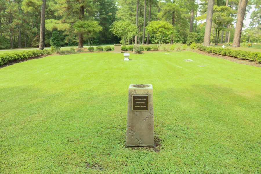
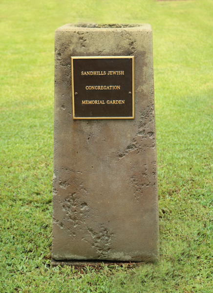
| Description | : | The Sandhills Jewish Congregation's Memorial Garden is located in Pinelawn Cemetery. Enter the main entrance and go to the right. The section is enclosed by hedges. |
frequently asked questions (FAQ):
-
Where is Sandhills Jewish Congregation Memorial Garden?
Sandhills Jewish Congregation Memorial Garden is located at No GPS information available Add GPS1105 West Morganton Road Southern Pines, Moore County ,North Carolina , 28387USA.
-
Sandhills Jewish Congregation Memorial Garden cemetery's updated grave count on graveviews.com?
0 memorials
Nearby Cemetories:
1. Dover Baptist Church Cemetery
Moore County, USA
Coordinate: 35.2083540, -79.4856550
2. Flat Rock Church Cemetery
Moore County, USA
3. Fryes Chapel Church Cemetery
Moore County, USA
Coordinate: 35.0936012, -79.4621964
4. Grimm Cemetery
Moore County, USA
5. Alston Congregational Church Cemetery
Haw Branch, Moore County, USA
Coordinate: 35.3322754, -79.5449066
6. Haw Branch Cemetery
Haw Branch, Moore County, USA
Coordinate: 35.2222290, -79.5015564
7. Kelly Grove Yard
Moore County, USA
8. Kitchen Cemetery
Moore County, USA
Coordinate: 35.2609100, -79.5817860
9. McFarland Family Cemetery
Moore County, USA
Coordinate: 35.2506660, -79.4689180
10. Morgan Family Cemetery
Moore County, USA
Coordinate: 35.2835840, -79.4743410
11. Mount Zion Wesleyan Church Cemetery
Moore County, USA
Coordinate: 35.2412120, -79.4527430
12. Noah Richardson Cemetery
Moore County, USA
Coordinate: 35.2903633, -79.4917068
13. Patterson Family Cemetery
Moore County, USA
Coordinate: 35.2083540, -79.4856550
14. Addor Community Cemetery
Pinebluff, Moore County, USA
15. Pinebluff Cemetery
Pinebluff, Moore County, USA
Coordinate: 35.0936012, -79.4621964
16. Tyson Family Cemetery
Moore County, USA
17. Barrett Family Cemetery
West End, Moore County, USA
Coordinate: 35.3322754, -79.5449066
18. Beulah Hill Baptist Church Cemetery
West End, Moore County, USA
Coordinate: 35.2222290, -79.5015564
19. Cagle Family Cemetery
West End, Moore County, USA
20. Cedar Grove Missionary Baptist Church Cemetery
West End, Moore County, USA
Coordinate: 35.2609100, -79.5817860
21. Culdee Presbyterian Church Cemetery
West End, Moore County, USA
Coordinate: 35.2506660, -79.4689180
22. Doubs Chapel United Methodist Church Cemetery
West End, Moore County, USA
Coordinate: 35.2835840, -79.4743410
23. Eastwood Community Cemetery
West End, Moore County, USA
Coordinate: 35.2412120, -79.4527430
24. Fairview Baptist Church Cemetery
West End, Moore County, USA
Coordinate: 35.2903633, -79.4917068