| Memorials | : | 0 |
| Location | : | Eagle Township, Boone County, USA |
| Coordinate | : | 39.9678000, -86.3461000 |
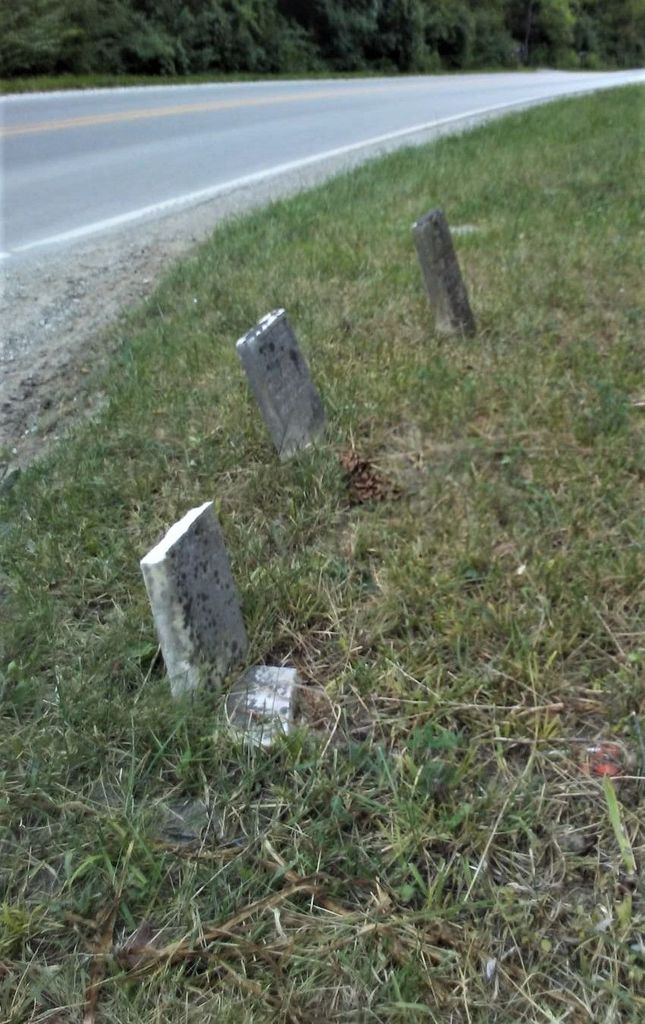
| Description | : | The cemetery is located in Eagle Township (NE quadrant of the NE quadrant of the NE quadrant of Section 31 Township 18N Range 2E) on the southwest corner of the intersection of S Main Street (County Road 650 E) and E County Road 500 S. Indiana Cemetery Locations, Volume 3, published by the Indiana Genealogical Society (April 2007), gives the primary cemetery name as Schooler Cemetery. The cemetery is listed in the Cemetery and Burial Grounds Registry of the Indiana Department of Natural Resources (DNR) and in the State Historical Architectural and Archaeological Research Database (SHAARD) with Cemetery... Read More |
frequently asked questions (FAQ):
-
Where is Schooler Cemetery?
Schooler Cemetery is located at S Main Street (County Road 650 E) and E County Road 500 S Eagle Township, Boone County ,Indiana , 46075USA.
-
Schooler Cemetery cemetery's updated grave count on graveviews.com?
0 memorials
-
Where are the coordinates of the Schooler Cemetery?
Latitude: 39.9678000
Longitude: -86.3461000
Nearby Cemetories:
1. Jones Cemetery
Boone County, USA
Coordinate: 39.9639015, -86.3458023
2. McCord Cemetery
Whitestown, Boone County, USA
Coordinate: 39.9843200, -86.3319600
3. Pitzer Cemetery
Zionsville, Boone County, USA
Coordinate: 39.9636002, -86.3206024
4. Lincoln Memory Gardens
Whitestown, Boone County, USA
Coordinate: 39.9418983, -86.3525009
5. Salem Cemetery
Zionsville, Boone County, USA
Coordinate: 39.9432487, -86.3190613
6. Howards Cemetery
Fayette, Boone County, USA
Coordinate: 39.9309860, -86.3813490
7. Smith Cemetery
Boone County, USA
Coordinate: 39.9749985, -86.4075012
8. Saint Francis of the Fields Episcopal Columbarium
Zionsville, Boone County, USA
Coordinate: 39.9643200, -86.2816300
9. Mount Tabor Cemetery
Fayette, Boone County, USA
Coordinate: 39.9378242, -86.3980713
10. Lutheran Cemetery
Whitestown, Boone County, USA
Coordinate: 40.0073433, -86.2995148
11. Hutton Memorial Cemetery
Northfield, Boone County, USA
Coordinate: 39.9986000, -86.2849503
12. Eagle Creek Regular Baptist Cemetery
Eagle Village, Boone County, USA
Coordinate: 39.9799538, -86.2736588
13. Dickerson Cemetery
Fayette, Boone County, USA
Coordinate: 39.9244003, -86.3944016
14. Sheets Cemetery
Boone County, USA
Coordinate: 39.9317017, -86.2797012
15. Lane Cemetery
Northfield, Boone County, USA
Coordinate: 40.0061798, -86.2796707
16. Smith-Shepherd Cemetery
Brownsburg, Hendricks County, USA
Coordinate: 39.9165500, -86.3978500
17. Johnson Cemetery
Brownsburg, Hendricks County, USA
Coordinate: 39.9162990, -86.3978230
18. Cox Cemetery
Zionsville, Boone County, USA
Coordinate: 39.9836006, -86.2596970
19. Macedonia Baptist Church Cemetery
Brownsburg, Hendricks County, USA
Coordinate: 39.8989334, -86.3392029
20. Mounts Runn Baptist Cemetery
Whitestown, Boone County, USA
Coordinate: 40.0368996, -86.3230972
21. Dowden Cemetery
Lebanon, Boone County, USA
Coordinate: 40.0269012, -86.3983002
22. Clarkston Cemetery
Zionsville, Boone County, USA
Coordinate: 39.9693985, -86.2508011
23. Zionsville Cemetery
Zionsville, Boone County, USA
Coordinate: 39.9402771, -86.2577744
24. Harmon Family Cemetery
Traders Point, Marion County, USA
Coordinate: 39.9167500, -86.2767500

