
| Memorials | : | 18 |
| Location | : | Sedona, Coconino County, USA |
| Coordinate | : | 34.8438310, -111.7655470 |
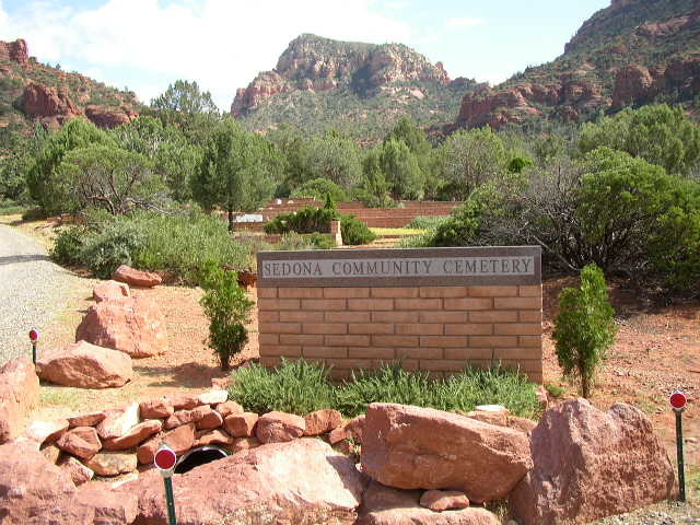
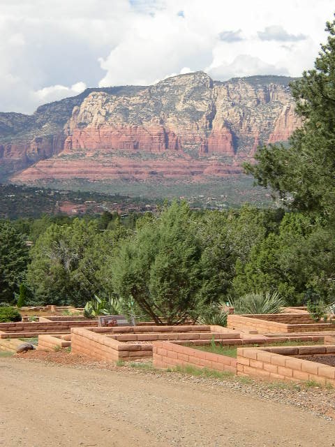
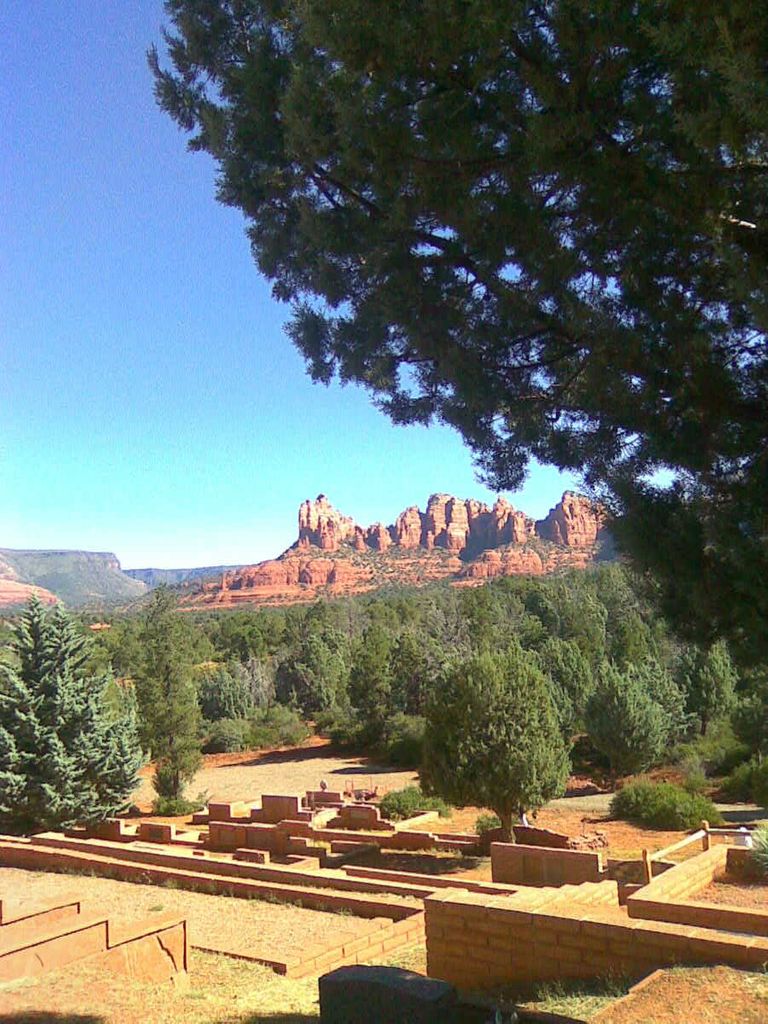
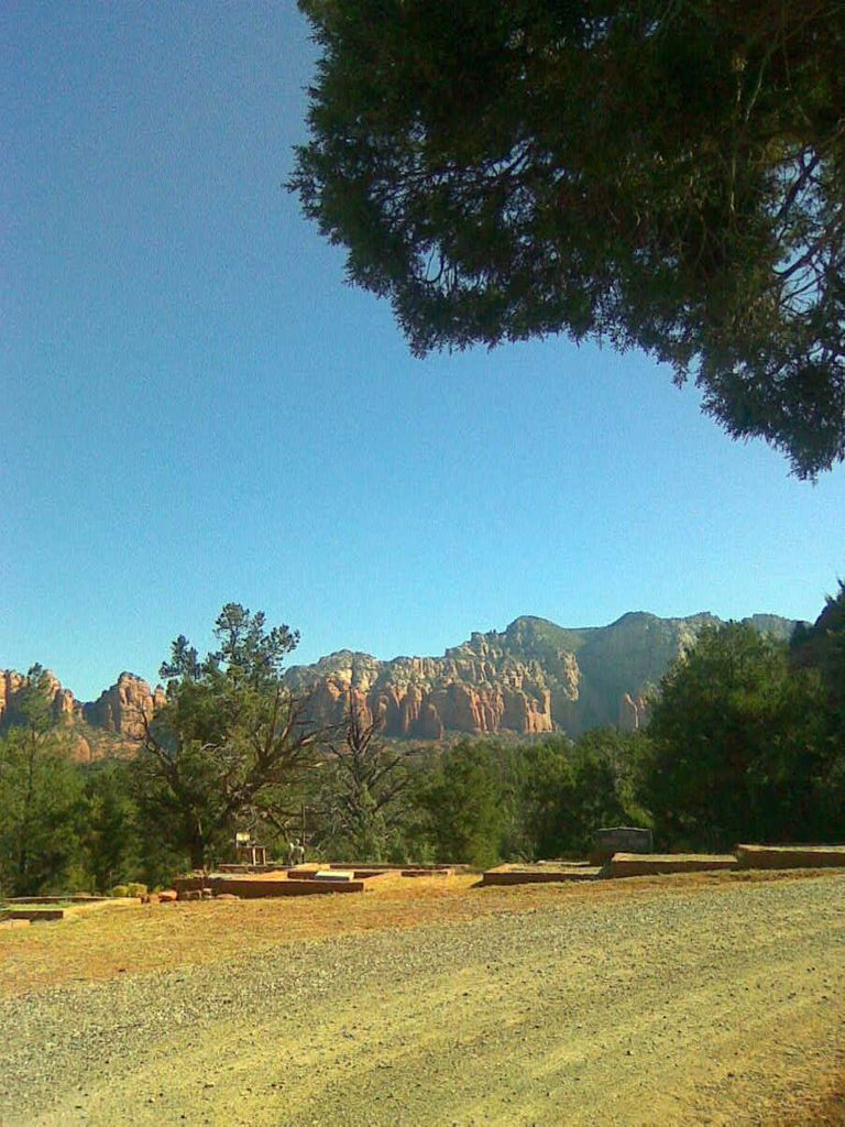
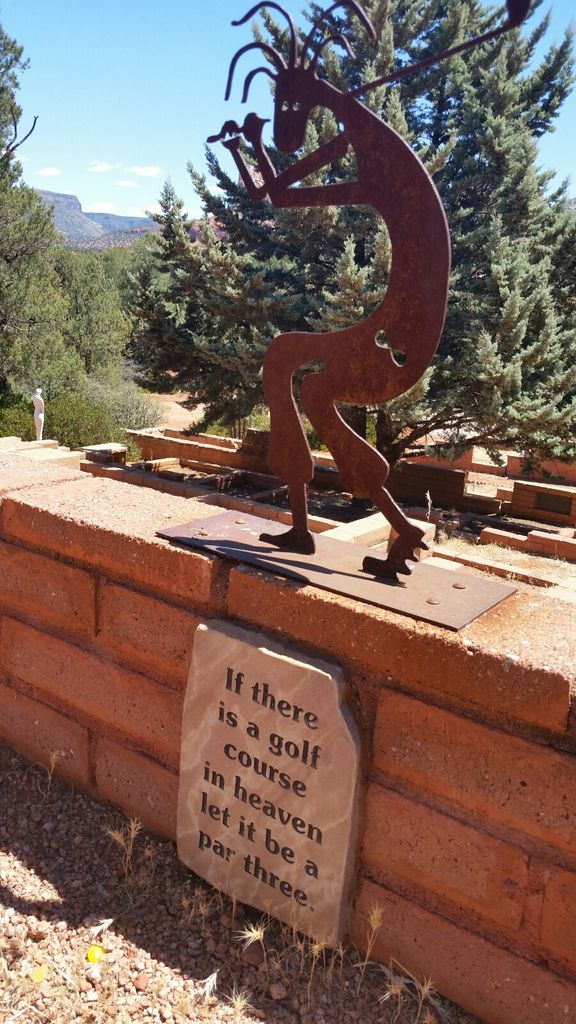
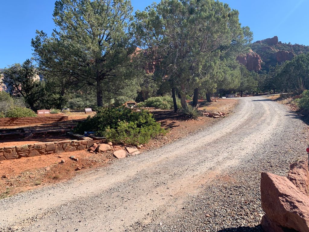
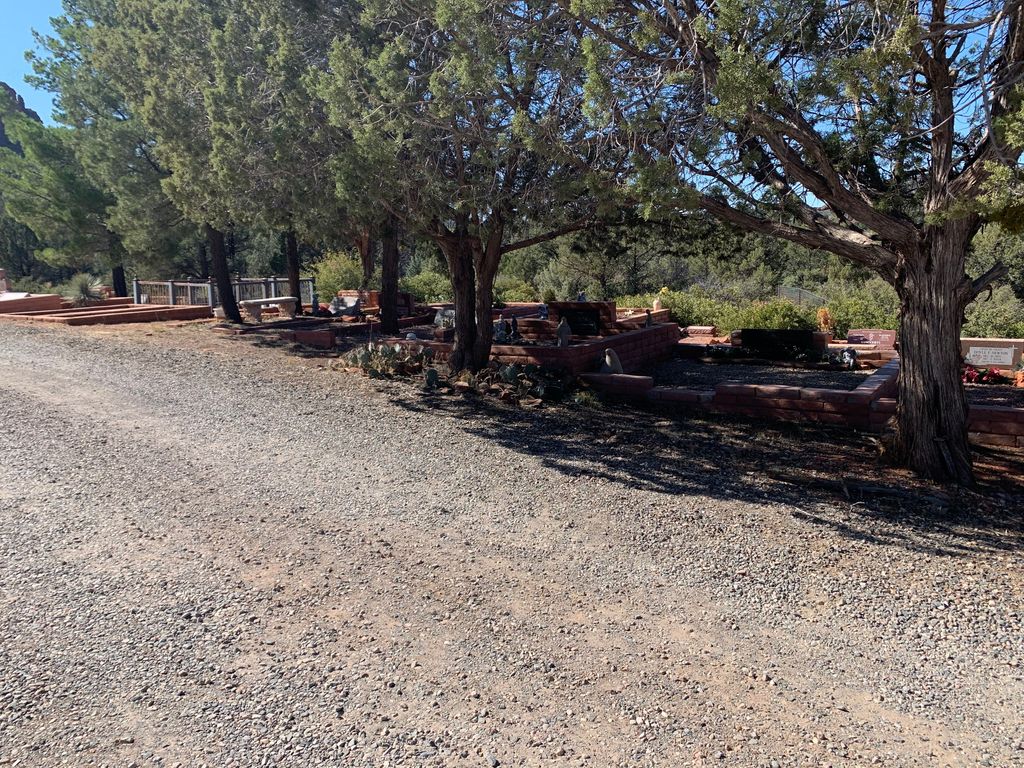
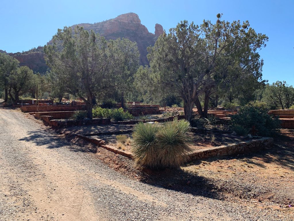
| Description | : | There are very few cemeteries in the world with such spectacular scenery. The red ochre and terra cotta-colored sandstone cliffs of the Schnebly Hill Formation can be seen in the distance overlying the mudstone layers of the Hermit Formation. The markers are surrounded by fragrant oak and juniper trees. The cemetery staff can be contacted at (928) 282-3440. The town of Sedona, Arizona is in both Yavapai and Coconino counties, and the community cemetery is to the south in Coconino County and east of Oak Creek. |
frequently asked questions (FAQ):
-
Where is Sedona Community Cemetery?
Sedona Community Cemetery is located at Pine Drive Sedona, Coconino County ,Arizona , 86336USA.
-
Sedona Community Cemetery cemetery's updated grave count on graveviews.com?
13 memorials
-
Where are the coordinates of the Sedona Community Cemetery?
Latitude: 34.8438310
Longitude: -111.7655470

Nearby Cemetories:
1. Church of the Red Rocks Columbarium
Coconino County, USA
Coordinate: 34.8499000, -111.7667000
2. Christ Lutheran Church Memorial Garden
Sedona, Coconino County, USA
Coordinate: 34.8325380, -111.7758970
3. Saint Lukes Memorial Garden
Sedona, Coconino County, USA
Coordinate: 34.8306100, -111.7779100
4. Sedona United Methodist Church Columbarium
Sedona, Coconino County, USA
Coordinate: 34.8263120, -111.7776790
5. Cooks Cedar Glade Cemetery
Sedona, Yavapai County, USA
Coordinate: 34.8610306, -111.7811432
6. Saint Andrew's Episcopal Church Columbarium
West Sedona, Yavapai County, USA
Coordinate: 34.8597400, -111.8142250
7. Schuerman Red Rock Cemetery
Sedona, Yavapai County, USA
Coordinate: 34.8271280, -111.8153020
8. Thompson Family Cemetery
Cornville, Yavapai County, USA
Coordinate: 34.7440400, -111.8885900
9. Casner Family Cemetery
Rimrock, Yavapai County, USA
Coordinate: 34.6778200, -111.6952700
10. All Souls Cemetery
Cottonwood, Yavapai County, USA
Coordinate: 34.7459000, -111.9710000
11. Beaver Creek Baptist Church Cemetery
Yavapai County, USA
Coordinate: 34.6450200, -111.7840600
12. Jerome Mine Laborers Cemetery
Cottonwood, Yavapai County, USA
Coordinate: 34.7569900, -112.0182500
13. Cottonwood Cemetery
Cottonwood, Yavapai County, USA
Coordinate: 34.7448900, -112.0130400
14. Azteca Cemetery
Cottonwood, Yavapai County, USA
Coordinate: 34.7454000, -112.0138000
15. Middle Verde Yavapai-Apache Cemetery
Camp Verde, Yavapai County, USA
Coordinate: 34.6306030, -111.8862190
16. Middle Verde Cemetery
Camp Verde, Yavapai County, USA
Coordinate: 34.6253014, -111.8886032
17. Rainbow Acres Columbarium
Camp Verde, Yavapai County, USA
Coordinate: 34.6206470, -111.8876170
18. Saint Thomas Episcopal Church Columbarium
Clarkdale, Yavapai County, USA
Coordinate: 34.7710420, -112.0568670
19. Raymond County Park
Flagstaff, Coconino County, USA
Coordinate: 35.0917430, -111.6866100
20. Valley View Cemetery
Clarkdale, Yavapai County, USA
Coordinate: 34.7566986, -112.0599976
21. Jerome Valley Cemetery
Clarkdale, Yavapai County, USA
Coordinate: 34.7488100, -112.0624800
22. Jerome Cemetery
Jerome, Yavapai County, USA
Coordinate: 34.7538500, -112.1049600
23. Clear Creek Cemetery
Camp Verde, Yavapai County, USA
Coordinate: 34.5261002, -111.8272018
24. Mescal Gulch Cemetery
Jerome, Yavapai County, USA
Coordinate: 34.7256360, -112.1338340