| Memorials | : | 0 |
| Location | : | Gilmer County, USA |
| Coordinate | : | 34.5789528, -84.6376419 |
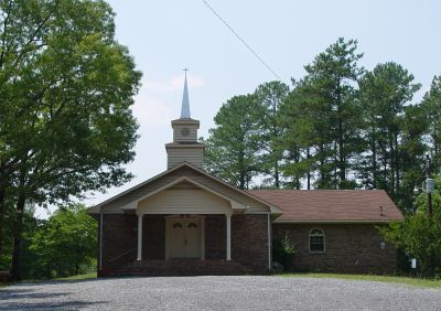
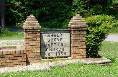
| Description | : | Shady Grove Baptist Church was established in 1864. Directions: From the square in Ellijay, Ga. take Hwy 5 South for four miles. Turn right on Hwy 382. Go approx 11.5 miles until reaching the intersection of Hwy 136. Turn right and go approx 1.5 miles. Shady Grove Baptist Church is on the left. |
frequently asked questions (FAQ):
-
Where is Shady Grove Baptist Church Cemetery?
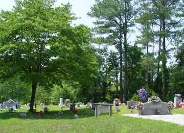
Shady Grove Baptist Church Cemetery is located at Gilmer County ,Georgia ,USA.
-
Shady Grove Baptist Church Cemetery cemetery's updated grave count on graveviews.com?
0 memorials
-
Where are the coordinates of the Shady Grove Baptist Church Cemetery?
Latitude: 34.5789528
Longitude: -84.6376419
Nearby Cemetories:
1. Berean Baptist Church Cemetery
Ellijay, Gilmer County, USA
Coordinate: 34.5883770, -84.5928700
2. Hopewell Baptist Cemetery
Oakman, Gordon County, USA
Coordinate: 34.5802950, -84.6988390
3. Missionaries For Christ Church Cemetery
Gilmer County, USA
Coordinate: 34.5935970, -84.5769310
4. Oakman Ranger United Methodist Cemetery
Oakman, Gordon County, USA
Coordinate: 34.5699040, -84.7104500
5. Fairview Church of God Cemetery
Ranger, Gordon County, USA
Coordinate: 34.5692300, -84.7194400
6. Mount Pisgah Baptist Church Cemetery
Gilmer County, USA
Coordinate: 34.5774680, -84.5518760
7. Hopper Family Cemetery
Ranger, Gordon County, USA
Coordinate: 34.5223570, -84.7085630
8. New Hope Baptist Church Cemetery
Ranger, Gordon County, USA
Coordinate: 34.5265330, -84.7135500
9. Keeter Cemetery
Whitestone, Gilmer County, USA
Coordinate: 34.5671540, -84.5378490
10. Ridgeway Baptist Church Cemetery
Ellijay, Gilmer County, USA
Coordinate: 34.6618580, -84.6435430
11. Goble Family Cemetery
Ellijay, Gilmer County, USA
Coordinate: 34.6393030, -84.5669550
12. Mount Carmel Cemetery
Red Bud, Gordon County, USA
Coordinate: 34.5521740, -84.7392400
13. Flat Creek Baptist Church Cemetery
Webb, Gilmer County, USA
Coordinate: 34.6416500, -84.5626170
14. Welcome Cemetery
Ranger, Gordon County, USA
Coordinate: 34.5796776, -84.7485352
15. Stokes Family Cemetery
Ellijay, Gilmer County, USA
Coordinate: 34.6136390, -84.5314590
16. Sunlight Baptist Church Cemetery
Gilmer County, USA
Coordinate: 34.6267060, -84.5379870
17. Coosawattee White Graves Road Baptist Church Cemet
Ranger, Gordon County, USA
Coordinate: 34.6061965, -84.7496591
18. Corinth Church of God Cemetery
Whitestone, Gilmer County, USA
Coordinate: 34.5468220, -84.5274580
19. House of Deliverance Church
Ranger, Gordon County, USA
Coordinate: 34.5400031, -84.7448070
20. East Damascus Cemetery
Fairmount, Gordon County, USA
Coordinate: 34.4806960, -84.6602130
21. Liberty Baptist Church Cemetery
Ranger, Gordon County, USA
Coordinate: 34.5089200, -84.7245000
22. Grant Cemetery
Fairmount, Gordon County, USA
Coordinate: 34.4800900, -84.6715800
23. Miracle Temple Church Cemetery
Ranger, Gordon County, USA
Coordinate: 34.5652000, -84.7626600
24. Whitestone Baptist Church Cemetery
Gilmer County, USA
Coordinate: 34.5625250, -84.5125920


