
| Memorials | : | 1 |
| Location | : | Hayesville, Clay County, USA |
| Coordinate | : | 35.0126240, -83.8646970 |
frequently asked questions (FAQ):
-
Where is Shady Grove Missionary Baptist Church Cemetery?
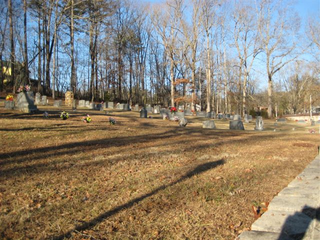
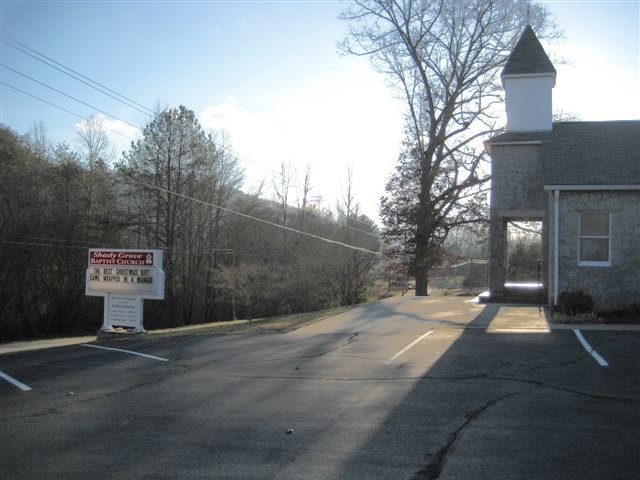
Shady Grove Missionary Baptist Church Cemetery is located at 2632 Old Highway 64 West Hayesville, Clay County ,North Carolina ,USA.
-
Shady Grove Missionary Baptist Church Cemetery cemetery's updated grave count on graveviews.com?
1 memorials
-
Where are the coordinates of the Shady Grove Missionary Baptist Church Cemetery?
Latitude: 35.0126240
Longitude: -83.8646970
Nearby Cemetories:
1. Mount Pisgah Baptist Church Cemetery
Hayesville, Clay County, USA
Coordinate: 34.9981260, -83.8813510
2. New Hope Baptist Church Cemetery
Hayesville, Clay County, USA
Coordinate: 35.0370950, -83.8766620
3. Bethel Missionary Baptist Church Cemetery
Hayesville, Clay County, USA
Coordinate: 35.0153900, -83.8997000
4. Grace Baptist Church Cemetery
Hayesville, Clay County, USA
Coordinate: 35.0368000, -83.8896000
5. Mountain Grace Baptist Church Cemetery
Hayesville, Clay County, USA
Coordinate: 34.9896120, -83.8373240
6. Pine Grove Baptist Church Cemetery
Hayesville, Clay County, USA
Coordinate: 35.0165140, -83.8214940
7. Pilgrim Baptist Church Cemetery
Hayesville, Clay County, USA
Coordinate: 34.9911600, -83.8286900
8. Sweetwater United Methodist Church Cemetery
Hayesville, Clay County, USA
Coordinate: 35.0503300, -83.8818100
9. Hayesville Baptist-Presbyterian Cemetery
Hayesville, Clay County, USA
Coordinate: 35.0377490, -83.8199330
10. First United Methodist Church Cemetery
Hayesville, Clay County, USA
Coordinate: 35.0364800, -83.8185920
11. Rogers Cemetery
Hayesville, Clay County, USA
Coordinate: 35.0393830, -83.8200920
12. Myers Chapel United Methodist Cemetery
Hayesville, Clay County, USA
Coordinate: 35.0023600, -83.8072400
13. Sweetwater Baptist Church Cemetery
Hayesville, Clay County, USA
Coordinate: 35.0557050, -83.8927820
14. Ogden Cemetery
Warne, Clay County, USA
Coordinate: 35.0105100, -83.9248960
15. McClure Cemetery
Clay County, USA
Coordinate: 35.0083008, -83.7988968
16. Good Shepherd Memorial Gardens
Hayesville, Clay County, USA
Coordinate: 35.0375320, -83.8017080
17. Herbert Hills Cemetery
Hayesville, Clay County, USA
Coordinate: 35.0352450, -83.7990660
18. Episcopal Church of the Good Shepherd
Hayesville, Clay County, USA
Coordinate: 35.0340233, -83.7982178
19. Barnard Cemetery
Hayesville, Clay County, USA
Coordinate: 35.0236015, -83.7941971
20. Fires Creek Cemetery
Hayesville, Clay County, USA
Coordinate: 35.0746994, -83.8739014
21. Oak Forest Cemetery
Hayesville, Clay County, USA
Coordinate: 35.0369500, -83.7934800
22. Hickory Stand Church Cemetery
Brasstown, Clay County, USA
Coordinate: 35.0369780, -83.9389990
23. Meadow Grove Baptist Cemetery
Hayesville, Clay County, USA
Coordinate: 35.0655760, -83.8150200
24. Shiloh Baptist Church Cemetery
Hayesville, Clay County, USA
Coordinate: 35.0664450, -83.7932750