
| Memorials | : | 0 |
| Location | : | Shap, Eden District, England |
| Coordinate | : | 54.5323200, -2.6711700 |
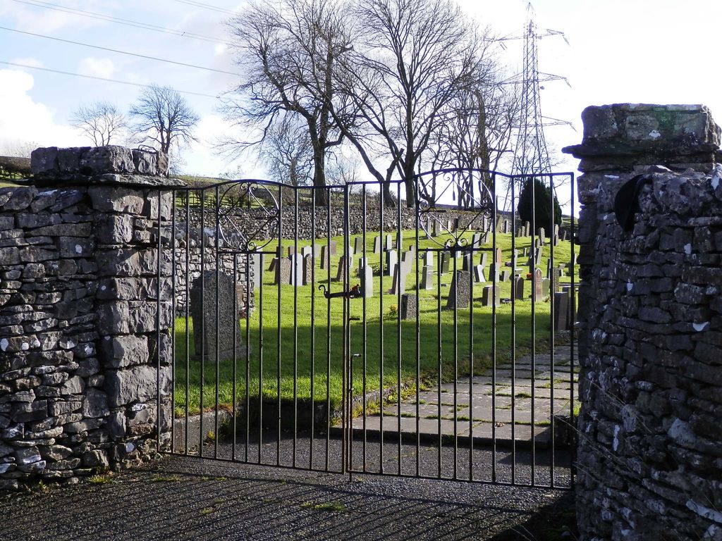
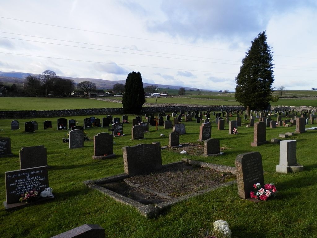
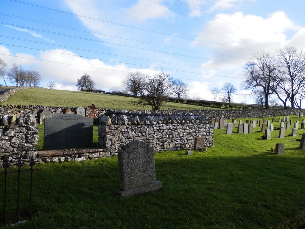
| Description | : | The cemetery is 200 metres away from Saint Michael’s Churchyard in Shap, to the east of the village. In the North East corner of the cemetery is the Mardale Burial Ground, where a number of bodies exhumed from the village of Mardale were reinterred when the structural remains of the small farming community were “drowned” in 1935 so that the level of Haweswater could be raised to provide water for Manchester. Most of the village's buildings were blown up by the Royal Engineers, who used them for demolition practice. Some 97 sets of remains were disinterred from the churchyard and transferred to... Read More |
frequently asked questions (FAQ):
-
Where is Shap Cemetery?
Shap Cemetery is located at Shap, Eden District ,Cumbria ,England.
-
Shap Cemetery cemetery's updated grave count on graveviews.com?
0 memorials
-
Where are the coordinates of the Shap Cemetery?
Latitude: 54.5323200
Longitude: -2.6711700
Nearby Cemetories:
1. St. Michael‘s Churchyard
Shap, Eden District, England
Coordinate: 54.5314090, -2.6754280
2. Shap Abbey
Shap, Eden District, England
Coordinate: 54.5301890, -2.6999250
3. St Mary Churchyard
Thrimby, Eden District, England
Coordinate: 54.5708750, -2.6782120
4. St Patrick Church Cemetery
Bampton Grange, Eden District, England
Coordinate: 54.5565000, -2.7384500
5. Bampton New Cemetery
Bampton Grange, Eden District, England
Coordinate: 54.5566033, -2.7384797
6. St Patrick Churchyard
Bampton Grange, Eden District, England
Coordinate: 54.5553000, -2.7413640
7. St Patrick's Church Roll Of Honour WW1 WW2
Bampton Grange, Eden District, England
Coordinate: 54.5553230, -2.7413750
8. St Lawrence Crosby Ravensworth
Crosby Ravensworth, Eden District, England
Coordinate: 54.5276540, -2.5859000
9. St Barnabas Cemetery
Great Strickland, Eden District, England
Coordinate: 54.6002670, -2.6794060
10. St. Lawrence Churchyard
Morland, Eden District, England
Coordinate: 54.5964730, -2.6235880
11. All Saints Churchyard
Orton, Eden District, England
Coordinate: 54.4694510, -2.5845290
12. St Cuthbert Churchyard
Cliburn, Eden District, England
Coordinate: 54.6138700, -2.6399030
13. Saint Peter's Churchyard
Askham, Eden District, England
Coordinate: 54.6077420, -2.7476530
14. St. Michael Churchyard
Lowther, Eden District, England
Coordinate: 54.6129190, -2.7462760
15. All Saints Churchyard
Bolton, Eden District, England
Coordinate: 54.6043250, -2.5599880
16. St Peter's Churchyard
Great Asby, Eden District, England
Coordinate: 54.5134470, -2.4946230
17. St. James Churchyard
Tebay, Eden District, England
Coordinate: 54.4338540, -2.5931330
18. Saint Cuthbert's Churchyard
Clifton, Eden District, England
Coordinate: 54.6361620, -2.7266804
19. Saint James Churchyard
Temple Sowerby, Eden District, England
Coordinate: 54.6378210, -2.6033040
20. St. Lawrence Churchyard
Appleby-in-Westmorland, Eden District, England
Coordinate: 54.5781650, -2.4915290
21. St Michael Churchyard
Kirkby Thore, Eden District, England
Coordinate: 54.6272940, -2.5621770
22. Eden Valley Crematorium
Temple Sowerby, Eden District, England
Coordinate: 54.6451850, -2.6237780
23. St Michael Churchyard
Appleby-in-Westmorland, Eden District, England
Coordinate: 54.5731360, -2.4829400
24. St. Margaret & St. James Churchyard
Long Marton, Eden District, England
Coordinate: 54.6099400, -2.5175850