| Memorials | : | 11 |
| Location | : | Skattungbyn, Orsa kommun, Sweden |
| Phone | : | +46 10 490 45 91 |
| Website | : | www.svenskakyrkan.se/orsa/skattungekyrka |
| Coordinate | : | 61.1858797, 14.8368884 |
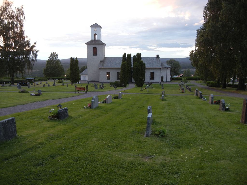
| Description | : | Skattunge church has a high and scenic location in the northern slope towards the river Ore. On the other side of the valley spreads the majestic forests that houses Orsa Finnmark, a border region to Härjedalen and Hälsingland. The present church was built in 1839 on the site of an almost dilapidated, wooden chapel which originates from the 1600s. The chapel, which was 11 m long and 8 m wide, had to serve as a scaffold inside the church during the construction period. Wooden chapel was torn down. Construction of the new church was made possible by donations and... Read More |
frequently asked questions (FAQ):
-
Where is Skattunge Kyrkagard?
Skattunge Kyrkagard is located at Skattungbyn, Orsa kommun ,Dalarnas län ,Sweden.
-
Skattunge Kyrkagard cemetery's updated grave count on graveviews.com?
11 memorials
-
Where are the coordinates of the Skattunge Kyrkagard?
Latitude: 61.1858797
Longitude: 14.8368884
Nearby Cemetories:
1. Våmhus kyrkogård
Vamhus, Mora kommun, Sweden
Coordinate: 61.1236500, 14.4719550
2. Mora Nya Kyrkogård
Mora, Mora kommun, Sweden
Coordinate: 61.0134033, 14.5714618
3. Gamla Mora kyrkogård
Mora, Sigtuna kommun, Sweden
Coordinate: 61.0074470, 14.5409980
4. Gamla Kyrkogården
Mora, Mora kommun, Sweden
Coordinate: 61.0071510, 14.5415320
5. Boda Kyrkogård
Boda, Rättviks kommun, Sweden
Coordinate: 61.0115740, 15.2084940
6. Rättviks kyrkogård
Rättviks kommun, Sweden
Coordinate: 60.8909900, 15.0963300
7. Voxna Kyrkogård
Voxna, Ovanåkers kommun, Sweden
Coordinate: 61.3653170, 15.5146930
8. Dådrans kyrkogård
Rättviks kommun, Sweden
Coordinate: 60.9410000, 15.5379200
9. Bingsjö Kyrkogård
Bingsjo, Rättviks kommun, Sweden
Coordinate: 61.0230600, 15.6493610
10. Leksands kyrkogård
Leksand, Leksands kommun, Sweden
Coordinate: 60.7318690, 14.9810310
11. Hamra Fågelsjö Kyrkogård
Hamra, Ljusdals kommun, Sweden
Coordinate: 61.6555400, 14.9959600
12. Öjung Kapell och Kyrkogård
Ovanaker, Ovanåkers kommun, Sweden
Coordinate: 61.5913170, 15.5672290
13. Ovanåker Kyrkogård
Ovanaker, Ovanåkers kommun, Sweden
Coordinate: 61.3638701, 15.9005535
14. Los Kyrkogård
Los, Ljusdals kommun, Sweden
Coordinate: 61.7256600, 15.1763200
15. Envikens Kyrkogård
Enviken, Falu kommun, Sweden
Coordinate: 60.8056910, 15.7712940
16. Gagnefs kyrkogård
Gagnef, Gagnefs kommun, Sweden
Coordinate: 60.5898820, 15.0597170
17. Alfta Kyrkogård
Alfta, Ovanåkers kommun, Sweden
Coordinate: 61.3483330, 16.0836110
18. Kristine kyrka
Falun, Falu kommun, Sweden
Coordinate: 60.6077780, 15.6311110
19. Malungs kyrkogård
Malung-Sälens kommun, Sweden
Coordinate: 60.6701656, 13.7319857
20. Sankt Lars Kyrkogård
Bollnas, Bollnäs kommun, Sweden
Coordinate: 61.3461670, 16.3636940
21. Bollnäs Kyrkogård - Nya
Bollnas, Bollnäs kommun, Sweden
Coordinate: 61.3466730, 16.3845040
22. Bollnäs Kyrkogård - Gamla
Bollnas, Bollnäs kommun, Sweden
Coordinate: 61.3464340, 16.3873390
23. Färila Kyrkogård
Farila, Ljusdals kommun, Sweden
Coordinate: 61.8010426, 15.8482274
24. Vika kyrkogard
Falun, Falu kommun, Sweden
Coordinate: 60.5133980, 15.7138820

