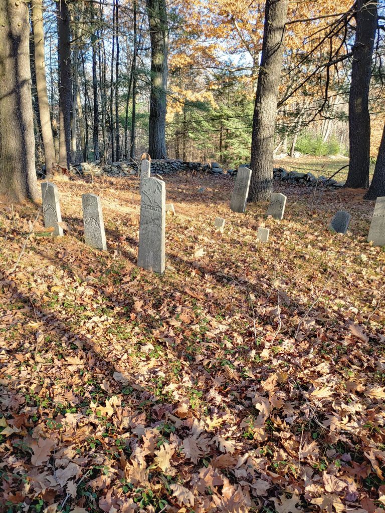
| Memorials | : | 1 |
| Location | : | Rutland, Worcester County, USA |
| Coordinate | : | 42.3946064, -71.9231169 |
| Description | : | A small family cemetery, originally part of the Smith farm, which no longer exists. The cemetery has only seven graves. It is surrounded by low stone walls and woods. Visible from the road in fall and winter. Current land ownership is undetermined. Not actively managed. |
frequently asked questions (FAQ):
-
Where is Smith Family Cemetery?
Smith Family Cemetery is located at Wachusett Street Rutland, Worcester County ,Massachusetts , 01543USA.
-
Smith Family Cemetery cemetery's updated grave count on graveviews.com?
1 memorials
-
Where are the coordinates of the Smith Family Cemetery?
Latitude: 42.3946064
Longitude: -71.9231169
Nearby Cemetories:
1. Rutland Rural Cemetery
Rutland, Worcester County, USA
Coordinate: 42.3790100, -71.9447500
2. South Burying Ground
Princeton, Worcester County, USA
Coordinate: 42.4192009, -71.8957977
3. Old Burial Ground
Rutland, Worcester County, USA
Coordinate: 42.3756000, -71.9578000
4. Goose Hill Cemetery
Rutland, Worcester County, USA
Coordinate: 42.3997400, -71.9914000
5. West Cemetery
Princeton, Worcester County, USA
Coordinate: 42.4454100, -71.9256500
6. Rutland Prison Camp Cemetery
Rutland, Worcester County, USA
Coordinate: 42.3988500, -71.9923800
7. Woodlawn Cemetery
Princeton, Worcester County, USA
Coordinate: 42.4447260, -71.8835880
8. Saint Mary Cemetery
Holden, Worcester County, USA
Coordinate: 42.3522400, -71.8684200
9. Grove Cemetery
Holden, Worcester County, USA
Coordinate: 42.3520400, -71.8672700
10. Park Avenue Cemetery
Holden, Worcester County, USA
Coordinate: 42.3514200, -71.8656900
11. Putnam Farm Cemetery
Rutland, Worcester County, USA
Coordinate: 42.3484010, -71.9771420
12. West Rutland Cemetery
Rutland, Worcester County, USA
Coordinate: 42.3561970, -71.9897170
13. Old Burying Ground
Holden, Worcester County, USA
Coordinate: 42.3505800, -71.8626000
14. Boylston Burial Ground
Princeton, Worcester County, USA
Coordinate: 42.4490700, -71.8787000
15. Saint Francis Episcopal Church Memorial Garden
Holden, Worcester County, USA
Coordinate: 42.3522800, -71.8588700
16. Mooreland Cemetery
Paxton, Worcester County, USA
Coordinate: 42.3280800, -71.9321000
17. Meetinghouse Cemetery
Princeton, Worcester County, USA
Coordinate: 42.4551600, -71.8823000
18. Worcester County Memorial Park
Paxton, Worcester County, USA
Coordinate: 42.3245697, -71.9308777
19. Route 62 Cemetery
Hubbardston, Worcester County, USA
Coordinate: 42.4426910, -72.0014980
20. Parker Cemetery
Barre, Worcester County, USA
Coordinate: 42.4250800, -72.0240400
21. Parker II Cemetery
Princeton, Worcester County, USA
Coordinate: 42.4451900, -71.8370600
22. Paxton Center Cemetery
Paxton, Worcester County, USA
Coordinate: 42.3128900, -71.9277700
23. Green Hollow Cemetery
Oakham, Worcester County, USA
Coordinate: 42.3549995, -72.0243988
24. Evergreen Cemetery
Hubbardston, Worcester County, USA
Coordinate: 42.4630750, -71.9974320

