
| Memorials | : | 21 |
| Location | : | Easley, Pickens County, USA |
| Coordinate | : | 34.7969017, -82.6466980 |
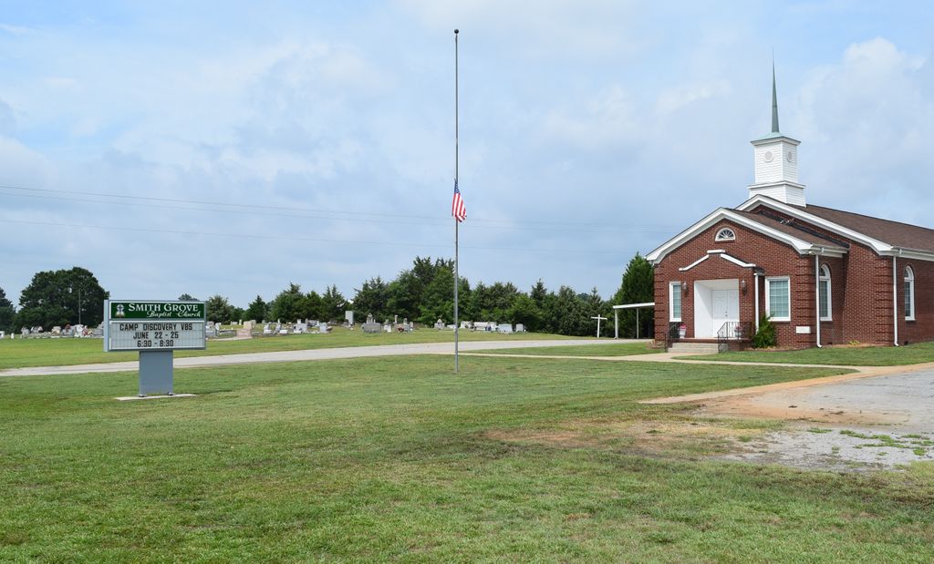
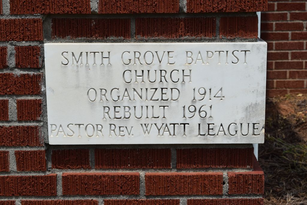
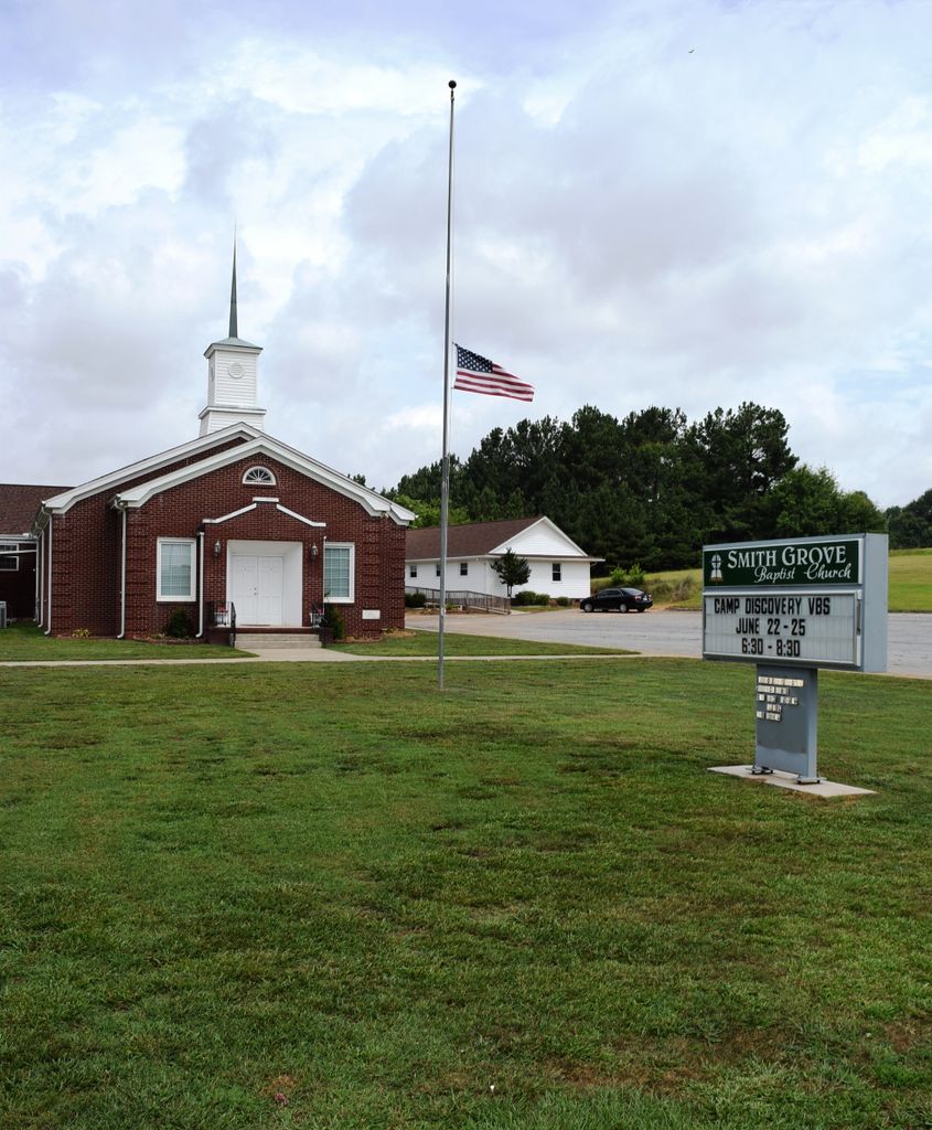
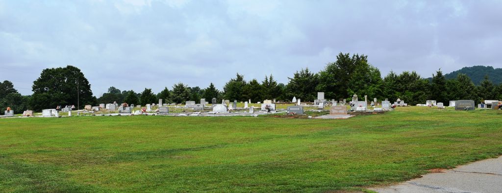
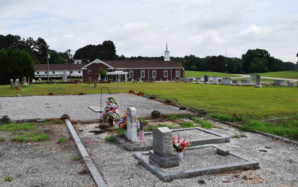
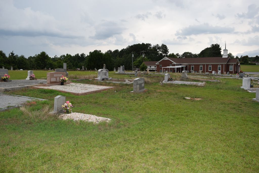
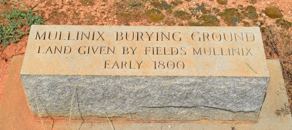
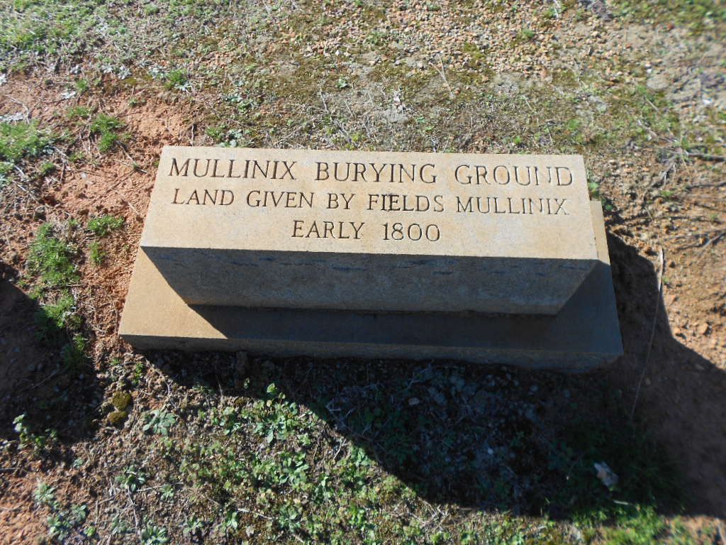
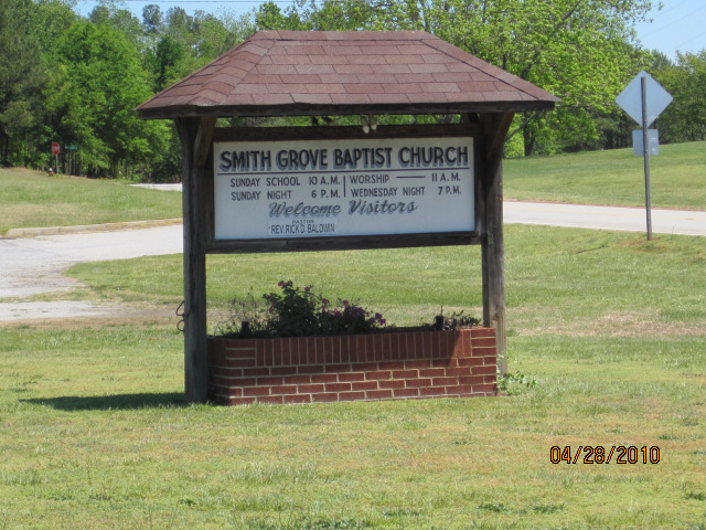
| Description | : | Smith Grove Baptist Church is between Easley and Liberty, approximately ½ mile from Reliable Sprinkler /Pickens County Industrial Park. It was organized in 1914 on land donated for the church by T. Nathan Smith, for whom it was named. The cemetery long predates the church's organization; land was donated by Fields Mullinix for burials in the early 1800's and was known as the Mullinix burying ground in many older death notices from the period. |
frequently asked questions (FAQ):
-
Where is Smith Grove Baptist Church Cemetery?
Smith Grove Baptist Church Cemetery is located at 1220 Smith Grove Road Easley, Pickens County ,South Carolina , 29640USA.
-
Smith Grove Baptist Church Cemetery cemetery's updated grave count on graveviews.com?
21 memorials
-
Where are the coordinates of the Smith Grove Baptist Church Cemetery?
Latitude: 34.7969017
Longitude: -82.6466980
Nearby Cemetories:
1. Grace Baptist Church Cemetery
Liberty, Pickens County, USA
Coordinate: 34.7846760, -82.6394180
2. Kennemore-Mauldin-O'Dell Cemetery
Easley, Pickens County, USA
Coordinate: 34.8177986, -82.6536026
3. Mount Calvary Wesleyan Church Cemetery
Easley, Pickens County, USA
Coordinate: 34.7829000, -82.6223670
4. Greenlawn Memorial Park
Easley, Pickens County, USA
Coordinate: 34.8227997, -82.6200027
5. Easley Mill Cemetery
Easley, Pickens County, USA
Coordinate: 34.8185997, -82.6108017
6. Zion United Methodist Church Cemetery Old
Easley, Pickens County, USA
Coordinate: 34.7793000, -82.6066170
7. Alice Mill Cemetery
Easley, Pickens County, USA
Coordinate: 34.8330160, -82.6247500
8. Enon Baptist Church Cemetery
Easley, Pickens County, USA
Coordinate: 34.8372002, -82.6496964
9. Hallum Family Cemetery
Liberty, Pickens County, USA
Coordinate: 34.7653999, -82.6778030
10. Carmel Presbyterian Church Cemetery
Liberty, Pickens County, USA
Coordinate: 34.7557983, -82.6417007
11. Williams Family Cemetery
Liberty, Pickens County, USA
Coordinate: 34.7737000, -82.6883500
12. Zion Methodist Church Cemetery
Easley, Pickens County, USA
Coordinate: 34.7822000, -82.5981670
13. Golden Grove Wesleyan Church Cemetery
Liberty, Pickens County, USA
Coordinate: 34.7557983, -82.6605988
14. Arial United Methodist Church Cemetery
Arial, Pickens County, USA
Coordinate: 34.8406430, -82.6392300
15. Mount Olivet Methodist Church Cemetery
Easley, Pickens County, USA
Coordinate: 34.8299900, -82.6085600
16. Ariail-Hendricks Cemetery
Pickens County, USA
Coordinate: 34.8428000, -82.6458000
17. West View Cemetery
Easley, Pickens County, USA
Coordinate: 34.8302994, -82.6082993
18. Oates Family Cemetery
Easley, Pickens County, USA
Coordinate: 34.8188438, -82.5972290
19. Flat Rock Baptist Church Cemetery
Liberty, Pickens County, USA
Coordinate: 34.7498398, -82.6614685
20. Boggs Family Cemetery
Liberty, Pickens County, USA
Coordinate: 34.7495830, -82.6602500
21. Liberty Memorial Gardens
Liberty, Pickens County, USA
Coordinate: 34.7839280, -82.7050780
22. Mauldin Cemetery
Easley, Pickens County, USA
Coordinate: 34.8366330, -82.6073440
23. West View Cemetery
Liberty, Pickens County, USA
Coordinate: 34.7822890, -82.7064940
24. Abbott Cemetery
Liberty, Pickens County, USA
Coordinate: 34.7815000, -82.7067670