
| Memorials | : | 1 |
| Location | : | Easley, Pickens County, USA |
| Coordinate | : | 34.7793000, -82.6066170 |
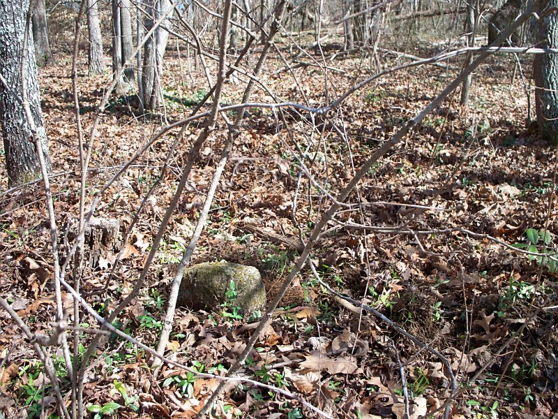
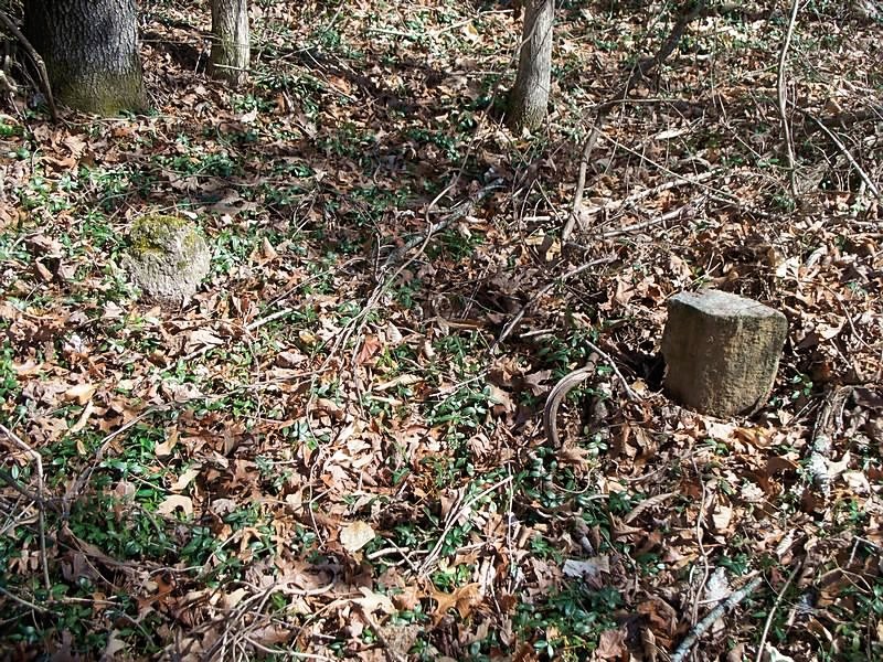
| Description | : | This old cemetery ia about 1/2 mile from present site. access from Mary Jane Drive. Cemetery is in the forest (long walk to it). This was the site of Original Zion Methodist Church. There were actually two church buildings on this site. The last building was burned in the 1880's. Some graves were moved to the site of the new church (Across the road where a building stood from 1905 to 1960. Mostly all the graves at the site in the woods are marked with plain field rocks only a few have inscriptions. A Great Great grandson said there was logging done... Read More |
frequently asked questions (FAQ):
-
Where is Zion United Methodist Church Cemetery Old?
Zion United Methodist Church Cemetery Old is located at Orchid Drive Easley, Pickens County ,South Carolina , 29642USA.
-
Zion United Methodist Church Cemetery Old cemetery's updated grave count on graveviews.com?
1 memorials
-
Where are the coordinates of the Zion United Methodist Church Cemetery Old?
Latitude: 34.7793000
Longitude: -82.6066170
Nearby Cemetories:
1. Zion Methodist Church Cemetery
Easley, Pickens County, USA
Coordinate: 34.7822000, -82.5981670
2. Mount Calvary Wesleyan Church Cemetery
Easley, Pickens County, USA
Coordinate: 34.7829000, -82.6223670
3. Corinth Baptist Church #1 Cemetery
Anderson County, USA
Coordinate: 34.7624160, -82.5922170
4. Fairview United Methodist Church Cemetery
Anderson County, USA
Coordinate: 34.7714005, -82.5824966
5. Grace Baptist Church Cemetery
Liberty, Pickens County, USA
Coordinate: 34.7846760, -82.6394180
6. Carmel Presbyterian Church Cemetery
Liberty, Pickens County, USA
Coordinate: 34.7557983, -82.6417007
7. Smith Grove Baptist Church Cemetery
Easley, Pickens County, USA
Coordinate: 34.7969017, -82.6466980
8. John Wesley United Methodist Church
Anderson County, USA
Coordinate: 34.7743660, -82.5608830
9. Easley Mill Cemetery
Easley, Pickens County, USA
Coordinate: 34.8185997, -82.6108017
10. Oates Family Cemetery
Easley, Pickens County, USA
Coordinate: 34.8188438, -82.5972290
11. Pickens Cemetery
Anderson County, USA
Coordinate: 34.7392006, -82.5911026
12. Greenlawn Memorial Park
Easley, Pickens County, USA
Coordinate: 34.8227997, -82.6200027
13. Couch Family Cemetery
Pickens, Pickens County, USA
Coordinate: 34.8049940, -82.5570310
14. Golden Grove Wesleyan Church Cemetery
Liberty, Pickens County, USA
Coordinate: 34.7557983, -82.6605988
15. Mount Olivet Methodist Church Cemetery
Easley, Pickens County, USA
Coordinate: 34.8299900, -82.6085600
16. West View Cemetery
Easley, Pickens County, USA
Coordinate: 34.8302994, -82.6082993
17. Boggs Family Cemetery
Liberty, Pickens County, USA
Coordinate: 34.7495830, -82.6602500
18. Flat Rock Baptist Church Cemetery
Liberty, Pickens County, USA
Coordinate: 34.7498398, -82.6614685
19. Kennemore-Mauldin-O'Dell Cemetery
Easley, Pickens County, USA
Coordinate: 34.8177986, -82.6536026
20. Saint Paul United Methodist Church Cemetery
Anderson County, USA
Coordinate: 34.7794991, -82.5391998
21. Alice Mill Cemetery
Easley, Pickens County, USA
Coordinate: 34.8330160, -82.6247500
22. Day Family Cemetery
Easley, Pickens County, USA
Coordinate: 34.8245125, -82.5656891
23. Saint Michaels Episcopal Church Columbarium
Easley, Pickens County, USA
Coordinate: 34.8115900, -82.5493960
24. Mauldin Cemetery
Easley, Pickens County, USA
Coordinate: 34.8366330, -82.6073440