
| Memorials | : | 31 |
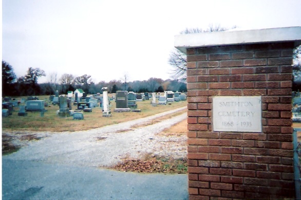
| Location | : | Smithton, Pettis County, USA |
| Coordinate | : | 38.6697006, -93.0986023 |
| Description | : | South of town on Rattlesnake Hill Road |
frequently asked questions (FAQ):
-
Where is Smithton Cemetery?
Smithton Cemetery is located at Smithton, Pettis County ,Missouri ,USA.
-
Smithton Cemetery cemetery's updated grave count on graveviews.com?
28 memorials
-
Where are the coordinates of the Smithton Cemetery?
Latitude: 38.6697006
Longitude: -93.0986023
Nearby Cemetories:
1. Flat Creek Baptist Cemetery
Sedalia, Pettis County, USA
Coordinate: 38.6303000, -93.1332800
2. Abell Cemetery
Sedalia, Pettis County, USA
Coordinate: 38.6542015, -93.1774979
3. Salem Cemetery
Smithton, Pettis County, USA
Coordinate: 38.7352982, -93.1333008
4. Highland Sacred Gardens
Sedalia, Pettis County, USA
Coordinate: 38.6831017, -93.1883011
5. Providence Baptist Church Cemetery
Smithton, Pettis County, USA
Coordinate: 38.7384900, -93.0725900
6. Pleasant Hill Cemetery
Sedalia, Pettis County, USA
Coordinate: 38.6341600, -93.1817000
7. Allcorn-Dumsday Cemetery
Sedalia, Pettis County, USA
Coordinate: 38.6772100, -93.2011800
8. Lone Star Cemetery
Pettis County, USA
Coordinate: 38.5952988, -93.1382980
9. Pleasant Grove Cemetery
Otterville, Cooper County, USA
Coordinate: 38.7090575, -93.0069203
10. Bethlehem Baptist Cemetery
Florence, Morgan County, USA
Coordinate: 38.6316500, -93.0042500
11. Wheeler Family Cemetery
Beaman, Pettis County, USA
Coordinate: 38.7533600, -93.1045000
12. IOOF Cemetery
Otterville, Cooper County, USA
Coordinate: 38.7103740, -93.0006790
13. Lee Cemetery
Beaman, Pettis County, USA
Coordinate: 38.7557983, -93.0836029
14. Wear Cemetery
Otterville, Cooper County, USA
Coordinate: 38.6885950, -92.9887350
15. Shackleford Cemetery
Otterville, Cooper County, USA
Coordinate: 38.6889000, -92.9882965
16. Lake Creek Cemetery
Pettis County, USA
Coordinate: 38.5816994, -93.0793991
17. Asbury Good-Knight Cemetery
Pettis County, USA
Coordinate: 38.6155500, -93.1986100
18. Calvary Cemetery
Sedalia, Pettis County, USA
Coordinate: 38.7170100, -93.2131300
19. Crown Hill Cemetery
Sedalia, Pettis County, USA
Coordinate: 38.7178001, -93.2149963
20. Glenwood Cemetery
Sedalia, Pettis County, USA
Coordinate: 38.7163000, -93.2171500
21. Saint John's Catholic Cemetery
Bahner, Pettis County, USA
Coordinate: 38.5686400, -93.1287400
22. Olive Hill Amish Mennonite Cemetery
Beaman, Pettis County, USA
Coordinate: 38.7705600, -93.1413200
23. Calvary Episcopal Church Columbarium
Sedalia, Pettis County, USA
Coordinate: 38.7044800, -93.2282100
24. Hebrew Cemetery
Sedalia, Pettis County, USA
Coordinate: 38.6875000, -93.2371979