
| Memorials | : | 0 |
| Location | : | Sedalia, Pettis County, USA |
| Coordinate | : | 38.6542015, -93.1774979 |
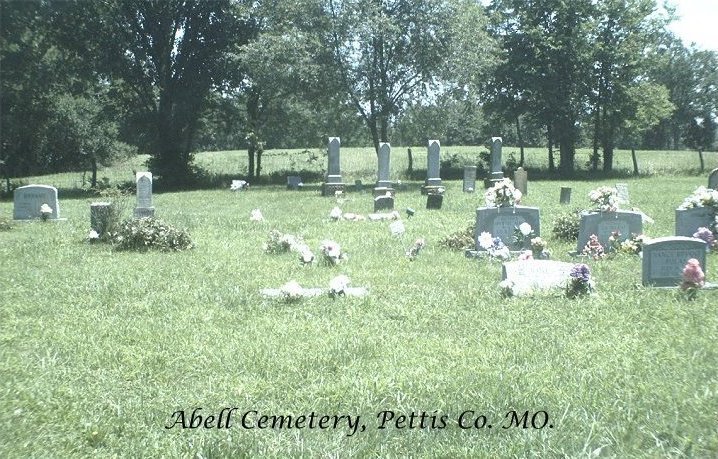
| Description | : | Location: Sedalia, Pettis County, Missouri. Flat Creek Township - Section 24 : 38.39.15N - 93.10.39W. North-east corner of Section 24. Directions: On the east side of M just north of Pleasant Hill Road. Clearly visible. History: The cemetery is a quarter-acre square and is located on land donated by Mr. Abell, who is not buried there, nor any of his family so far as anyone knows. The cemetery is locally known as the Bryant Cemetery. Benjamin Ransdell married Sally Higgins in Mercer County, Kentucky on 20 January 1820; they came to Pettis County in the early 1830s... Read More |
frequently asked questions (FAQ):
-
Where is Abell Cemetery?
Abell Cemetery is located at Sedalia, Pettis County ,Missouri ,USA.
-
Abell Cemetery cemetery's updated grave count on graveviews.com?
0 memorials
-
Where are the coordinates of the Abell Cemetery?
Latitude: 38.6542015
Longitude: -93.1774979
Nearby Cemetories:
1. Pleasant Hill Cemetery
Sedalia, Pettis County, USA
Coordinate: 38.6341600, -93.1817000
2. Allcorn-Dumsday Cemetery
Sedalia, Pettis County, USA
Coordinate: 38.6772100, -93.2011800
3. Highland Sacred Gardens
Sedalia, Pettis County, USA
Coordinate: 38.6831017, -93.1883011
4. Flat Creek Baptist Cemetery
Sedalia, Pettis County, USA
Coordinate: 38.6303000, -93.1332800
5. Asbury Good-Knight Cemetery
Pettis County, USA
Coordinate: 38.6155500, -93.1986100
6. Hebrew Cemetery
Sedalia, Pettis County, USA
Coordinate: 38.6875000, -93.2371979
7. Bethlehem Baptist Church Cemetery
Pettis County, USA
Coordinate: 38.6250000, -93.2457962
8. Smithton Cemetery
Smithton, Pettis County, USA
Coordinate: 38.6697006, -93.0986023
9. Calvary Episcopal Church Columbarium
Sedalia, Pettis County, USA
Coordinate: 38.7044800, -93.2282100
10. Memorial Park Cemetery
Sedalia, Pettis County, USA
Coordinate: 38.6824989, -93.2542038
11. Lone Star Cemetery
Pettis County, USA
Coordinate: 38.5952988, -93.1382980
12. Bourn Cemetery
Spring Fork, Pettis County, USA
Coordinate: 38.6119410, -93.2463310
13. Calvary Cemetery
Sedalia, Pettis County, USA
Coordinate: 38.7170100, -93.2131300
14. Glenwood Cemetery
Sedalia, Pettis County, USA
Coordinate: 38.7163000, -93.2171500
15. Crown Hill Cemetery
Sedalia, Pettis County, USA
Coordinate: 38.7178001, -93.2149963
16. Saint Patricks Catholic Cemetery
Spring Fork, Pettis County, USA
Coordinate: 38.5887300, -93.2137500
17. New Bethel Cemetery
Sedalia, Pettis County, USA
Coordinate: 38.6191500, -93.2669600
18. Salem Cemetery
Smithton, Pettis County, USA
Coordinate: 38.7352982, -93.1333008
19. Saint John's Catholic Cemetery
Bahner, Pettis County, USA
Coordinate: 38.5686400, -93.1287400
20. Shobe Cemetery
Sedalia, Pettis County, USA
Coordinate: 38.6996994, -93.2968979
21. Lake Creek Cemetery
Pettis County, USA
Coordinate: 38.5816994, -93.0793991
22. McKee Chapel Cemetery
Sedalia, Pettis County, USA
Coordinate: 38.6396100, -93.3144800
23. Wheeler Family Cemetery
Beaman, Pettis County, USA
Coordinate: 38.7533600, -93.1045000
24. Providence Baptist Church Cemetery
Smithton, Pettis County, USA
Coordinate: 38.7384900, -93.0725900