
| Memorials | : | 6 |
| Location | : | Santa Fe, Monroe County, USA |
| Coordinate | : | 39.3889000, -91.7903000 |
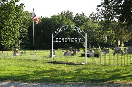
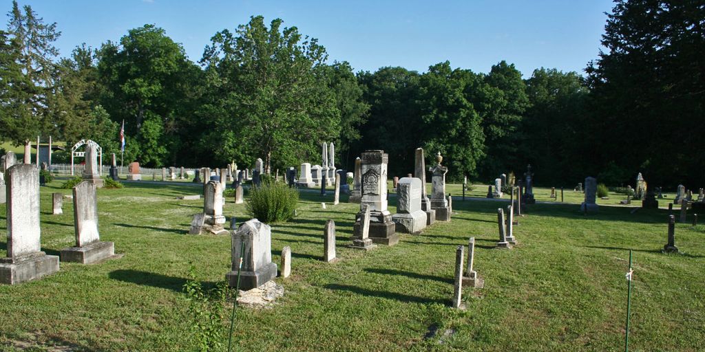
| Description | : | South Fork Cemetery appears to be very well maintained, and a bulletin board located just inside the entrance includes a map of the burials along with a list of the cemetery board members and their phone numbers. Driving directions: From Missouri Highway 154 between Perry and Paris Missouri at the junction with Hwy 107, follow route E about 5 miles south. The Cemetery will be on the right (west). |
frequently asked questions (FAQ):
-
Where is South Fork Cemetery?
South Fork Cemetery is located at Santa Fe, Monroe County ,Missouri ,USA.
-
South Fork Cemetery cemetery's updated grave count on graveviews.com?
5 memorials
-
Where are the coordinates of the South Fork Cemetery?
Latitude: 39.3889000
Longitude: -91.7903000
Nearby Cemetories:
1. Santa Fe Cemetery
Santa Fe, Monroe County, USA
Coordinate: 39.3689180, -91.8206540
2. Talley Cemetery
Salt River Township, Audrain County, USA
Coordinate: 39.3166666, -91.7839523
3. Talley Cemetery I
Prairie Township, Audrain County, USA
Coordinate: 39.3166655, -91.7837607
4. Victor Cemetery
Monroe County, USA
Coordinate: 39.4547500, -91.8340800
5. Old Mount Prairie Cemetery
Monroe County, USA
Coordinate: 39.4557991, -91.7241974
6. Mount Prairie Presbyterian Church Cemetery
Monroe County, USA
Coordinate: 39.4558590, -91.7242400
7. Unity Cemetery
Audrain County, USA
Coordinate: 39.3106003, -91.7380981
8. Mount Prairie Baptist Church Cemetery
Monroe County, USA
Coordinate: 39.4667700, -91.7355100
9. Lick Creek Cemetery
Perry, Ralls County, USA
Coordinate: 39.4185982, -91.6774979
10. Berea Cemetery
Mexico, Audrain County, USA
Coordinate: 39.3352100, -91.8888900
11. Bethel Presbyterian Cemetery
Audrain County, USA
Coordinate: 39.3012600, -91.8329900
12. New Hope Cemetery
Monroe County, USA
Coordinate: 39.4108009, -91.9105988
13. Scobee Cemetery
Ralls County, USA
Coordinate: 39.4688988, -91.7136002
14. Wolfe Cemetery
Perry, Ralls County, USA
Coordinate: 39.4392014, -91.6714020
15. Florida Cemetery
Florida, Monroe County, USA
Coordinate: 39.4947850, -91.7933250
16. Littleby Baptist Church Cemetery
Worcester, Audrain County, USA
Coordinate: 39.2798500, -91.7679700
17. Hawkins Cemetery
Monroe County, USA
Coordinate: 39.4942017, -91.8452988
18. Muldrow Cemetery
Salt River, Ralls County, USA
Coordinate: 39.3992004, -91.6408005
19. Pleasant Hill Cemetery
Paris, Monroe County, USA
Coordinate: 39.4557991, -91.9141998
20. Green Lawn Cemetery
Ralls County, USA
Coordinate: 39.4778100, -91.6861000
21. Corinth Cemetery
Ralls County, USA
Coordinate: 39.3422012, -91.6436005
22. Mount Zion Cemetery
Audrain County, USA
Coordinate: 39.2933006, -91.8933029
23. Crigler Cemetery
Florida, Monroe County, USA
Coordinate: 39.5121994, -91.7497025
24. Scobee Cemetery
Monroe County, USA
Coordinate: 39.4916992, -91.8891983