
| Memorials | : | 102 |
| Location | : | Upleatham, Redcar and Cleveland Unitary Authority, England |
| Coordinate | : | 54.5656900, -1.0164700 |
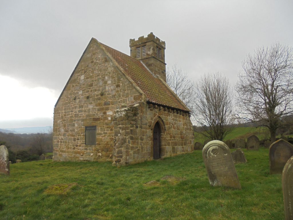
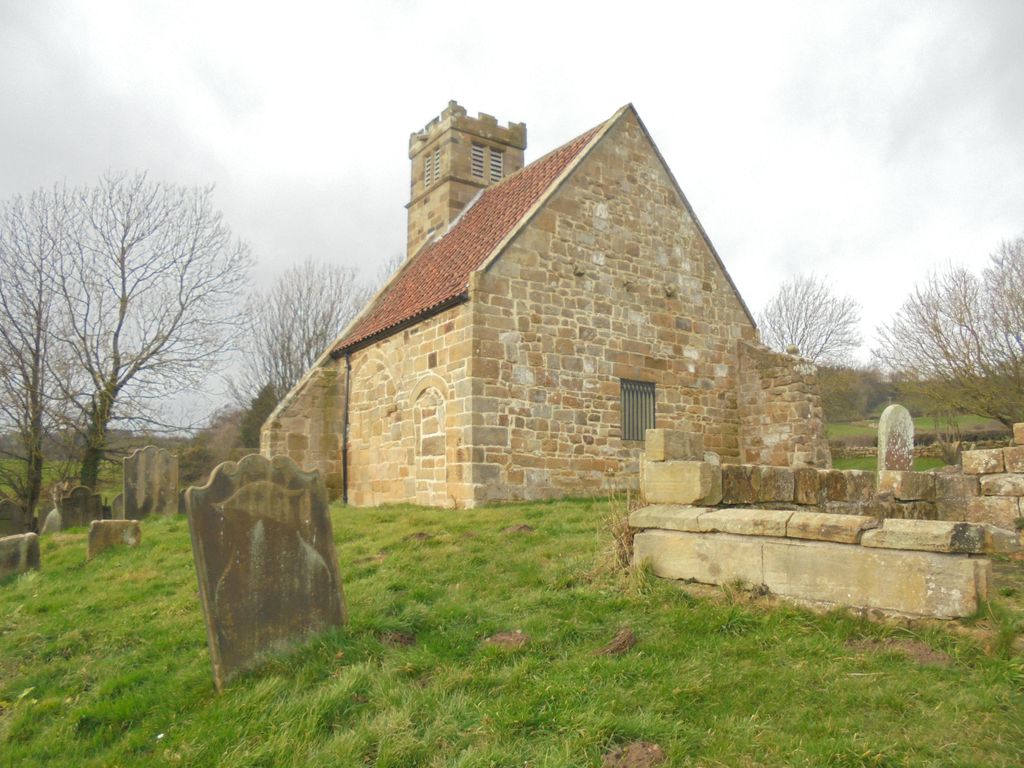
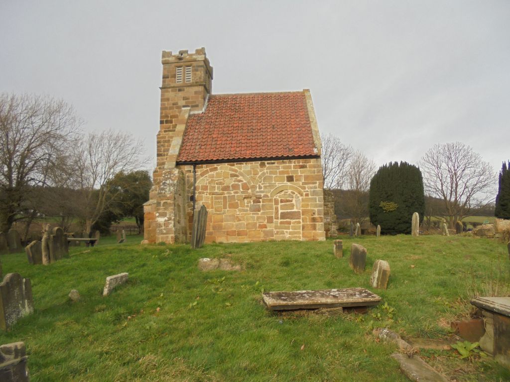
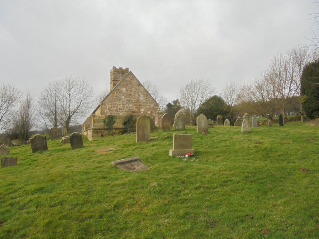
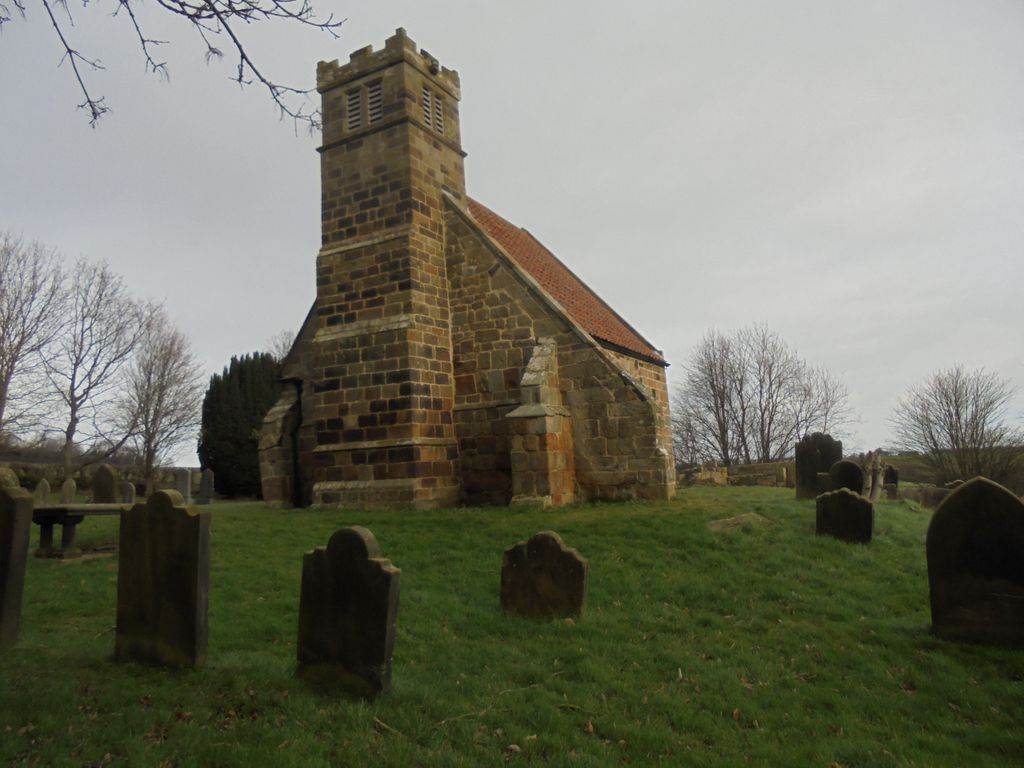
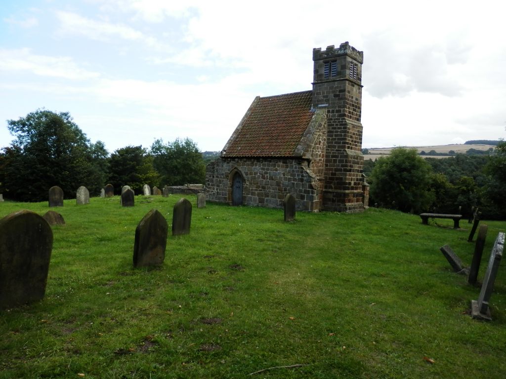
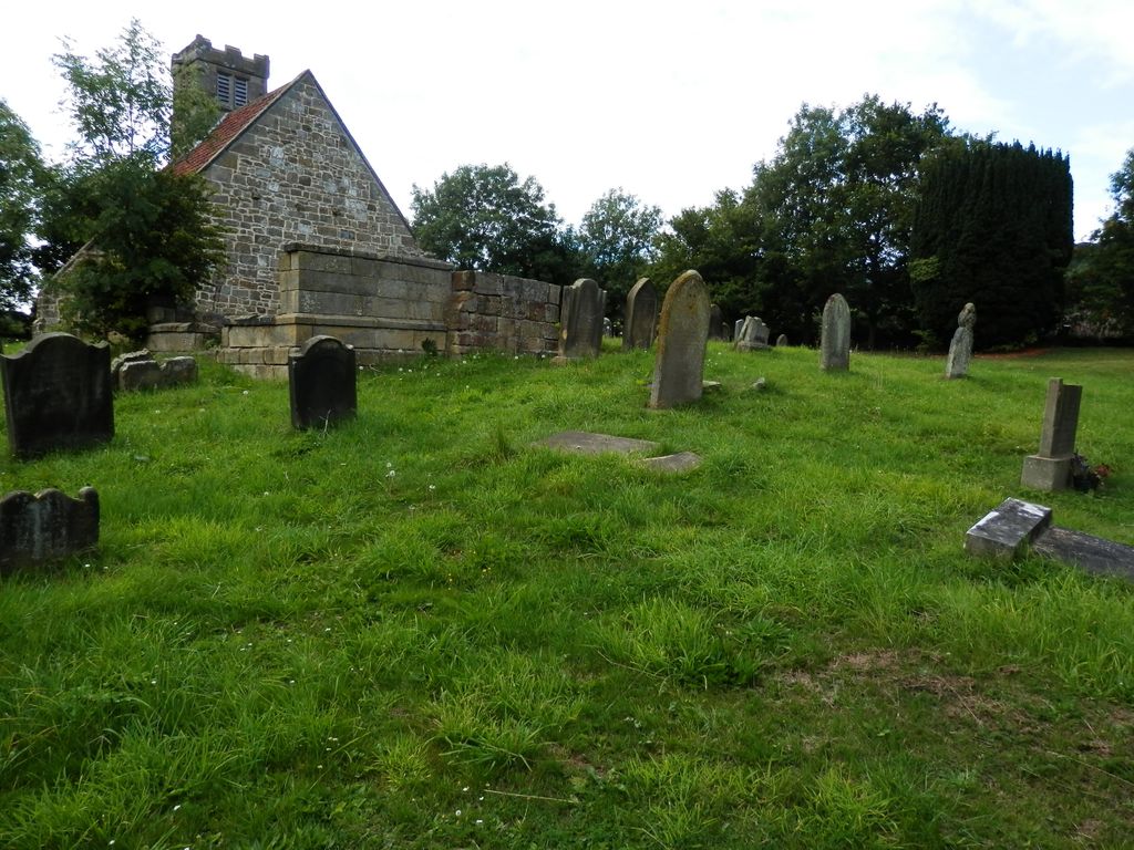
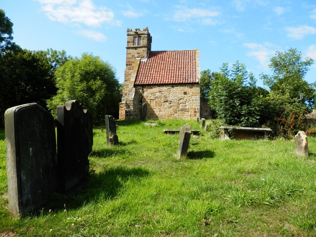
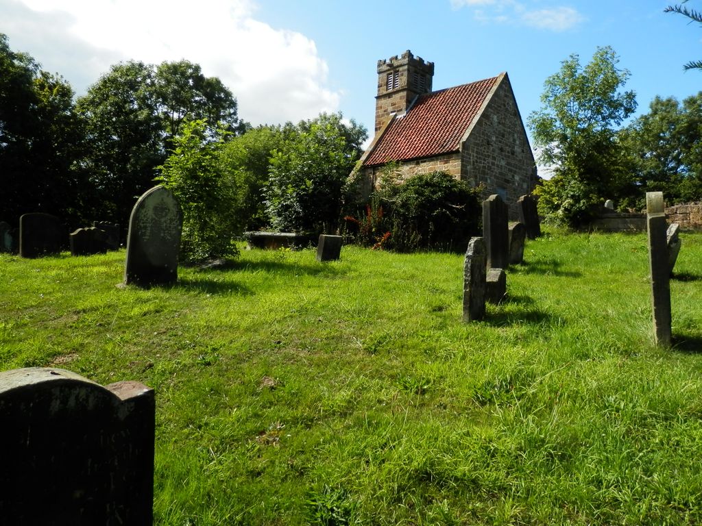
| Description | : | The churchyard is on the B1268, outside the village of Upleatham, two miles north of Skelton, and around 15 miles North West of Whitby. St Andrew’s Church at Upleatham is often claimed to be the smallest church in England, but unfortunately that honour goes to Bremilham Church in Wiltshire at 4m by 3.6m. Upleatham is about 6m by 4m. St Andrew’s Church, which is in Council ownership, has been disused for many years. Unfortunately the church is now unused as a place of worship, although the churchyard is open and you are freely able to walk around the exterior of the church... Read More |
frequently asked questions (FAQ):
-
Where is St. Andrew's Old Churchyard?
St. Andrew's Old Churchyard is located at Upleatham, Redcar and Cleveland Unitary Authority ,North Yorkshire ,England.
-
St. Andrew's Old Churchyard cemetery's updated grave count on graveviews.com?
0 memorials
-
Where are the coordinates of the St. Andrew's Old Churchyard?
Latitude: 54.5656900
Longitude: -1.0164700
Nearby Cemetories:
1. All Saints Old Churchyard
Skelton, Redcar and Cleveland Unitary Authority, England
Coordinate: 54.5623500, -0.9927600
2. Saltburn by the Sea Cemetery
Saltburn-by-the-Sea, Redcar and Cleveland Unitary Authority, England
Coordinate: 54.5808780, -0.9880640
3. Skelton Cemetery
Skelton, Redcar and Cleveland Unitary Authority, England
Coordinate: 54.5604320, -0.9736353
4. Guisborough Cemetery
Guisborough, Redcar and Cleveland Unitary Authority, England
Coordinate: 54.5448330, -1.0430940
5. St. Germain Churchyard
Marske-by-the-Sea, Redcar and Cleveland Unitary Authority, England
Coordinate: 54.5946000, -1.0115200
6. Boosbeck Cemetery
Boosbeck, Redcar and Cleveland Unitary Authority, England
Coordinate: 54.5434900, -0.9779200
7. St Aidan Churchyard
Boosbeck, Redcar and Cleveland Unitary Authority, England
Coordinate: 54.5428560, -0.9786800
8. St. Nicholas Churchyard
Guisborough, Redcar and Cleveland Unitary Authority, England
Coordinate: 54.5366500, -1.0482800
9. Guisborough Priory
Guisborough, Redcar and Cleveland Unitary Authority, England
Coordinate: 54.5361700, -1.0489500
10. Quakers Burial Ground
Guisborough, Redcar and Cleveland Unitary Authority, England
Coordinate: 54.5355100, -1.0569760
11. Kirkleatham Memorial Park and Crematorium
Yearby, Redcar and Cleveland Unitary Authority, England
Coordinate: 54.5866300, -1.0753800
12. St Cuthbert Churchyard
Kirkleatham, Redcar and Cleveland Unitary Authority, England
Coordinate: 54.5881700, -1.0825600
13. St Margaret of Antioch Churchyard
Brotton, Redcar and Cleveland Unitary Authority, England
Coordinate: 54.5691380, -0.9358330
14. St Cuthbert Churchyard
Wilton, Redcar and Cleveland Unitary Authority, England
Coordinate: 54.5694200, -1.0992400
15. St Peter Churchyard
Brotton, Redcar and Cleveland Unitary Authority, England
Coordinate: 54.5679900, -0.9316200
16. Brotton Cemetery
Brotton, Redcar and Cleveland Unitary Authority, England
Coordinate: 54.5670800, -0.9310100
17. St. Margaret of Antioch Church Cemetery
Brotton, Redcar and Cleveland Unitary Authority, England
Coordinate: 54.5662700, -0.9305900
18. Redcar Cemetery
Redcar, Redcar and Cleveland Unitary Authority, England
Coordinate: 54.6105800, -1.0609200
19. St. Peter's Churchyard
Redcar, Redcar and Cleveland Unitary Authority, England
Coordinate: 54.6163250, -1.0594380
20. Christ Church Churchyard
Coatham, Redcar and Cleveland Unitary Authority, England
Coordinate: 54.6170000, -1.0806600
21. St Mary Churchyard
Moorsholm, Redcar and Cleveland Unitary Authority, England
Coordinate: 54.5207800, -0.9375800
22. St Helen's
Carlin How, Redcar and Cleveland Unitary Authority, England
Coordinate: 54.5673410, -0.9024120
23. St. Michael Churchyard
Liverton, Redcar and Cleveland Unitary Authority, England
Coordinate: 54.5370370, -0.9025160
24. St Leonard Churchyard
Loftus, Redcar and Cleveland Unitary Authority, England
Coordinate: 54.5532560, -0.8855250