
| Memorials | : | 12 |
| Location | : | Foston, Blaby District, England |
| Coordinate | : | 52.5494850, -1.1116260 |
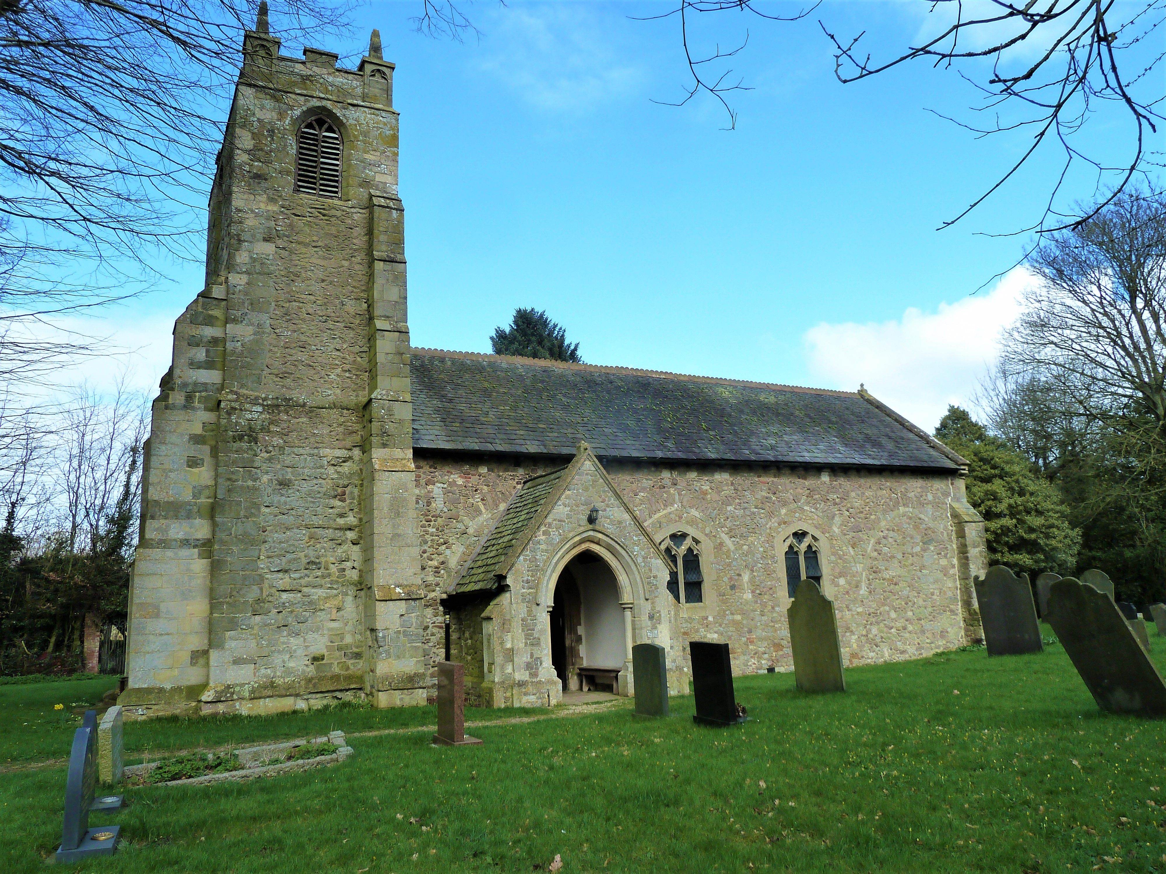
| Description | : | One of the oldest churches in Leicestershire and the Norman arcade which separates the nave from the north aisle dates from 1081, these beautiful piers and arches have some crosses cut into the stone when the Norman building was consecrated. Above one arch is a filled in window which was originally part of the Saxon building that stood before the building was adapted by the Normans. The church consists of a west tower, nave, small north aisle and chancel. The Victorians restored the church in 1874, but thankfully kept to the original fabric and made little building alterations. The western half... Read More |
frequently asked questions (FAQ):
-
Where is St. Bartholomew's Churchyard?
St. Bartholomew's Churchyard is located at Foston, Blaby District ,Leicestershire ,England.
-
St. Bartholomew's Churchyard cemetery's updated grave count on graveviews.com?
3 memorials
-
Where are the coordinates of the St. Bartholomew's Churchyard?
Latitude: 52.5494850
Longitude: -1.1116260
Nearby Cemetories:
1. St Bartholomew in Foston
Kilby, Blaby District, England
Coordinate: 52.5494780, -1.1117810
2. South Leicestershire Memorial Park and Crematorium
Countesthorpe, Blaby District, England
Coordinate: 52.5562541, -1.1289665
3. Countesthorpe Parish Cemetery
Countesthorpe, Blaby District, England
Coordinate: 52.5577540, -1.1309080
4. St Mary Magdalene
Kilby, Blaby District, England
Coordinate: 52.5554660, -1.0884320
5. St Andrew's Churchyard
Countesthorpe, Blaby District, England
Coordinate: 52.5536270, -1.1379810
6. All Saints Churchyard
Peatling Magna, Harborough District, England
Coordinate: 52.5267900, -1.1247040
7. Baptist Chapel Churchyard
Arnesby, Harborough District, England
Coordinate: 52.5264000, -1.0909600
8. Wigston Cemetery
Wigston, Oadby and Wigston Borough, England
Coordinate: 52.5752060, -1.1007170
9. St Peter Churchyard
Arnesby, Harborough District, England
Coordinate: 52.5240840, -1.0918950
10. All Saints Churchyard
Wigston, Oadby and Wigston Borough, England
Coordinate: 52.5823880, -1.1096900
11. St Mary's Churchyard
Willoughby Waterleys, Harborough District, England
Coordinate: 52.5270920, -1.1532770
12. Wigston United Reformed Church
Wigston, Oadby and Wigston Borough, England
Coordinate: 52.5840900, -1.1071200
13. Blaby Cemetery
Blaby, Blaby District, England
Coordinate: 52.5738950, -1.1541280
14. St Luke's Churchyard, Newton Harcourt
Wistow, Harborough District, England
Coordinate: 52.5646320, -1.0577376
15. St Wistans Church
Wistow, Harborough District, England
Coordinate: 52.5577010, -1.0522340
16. St Wistan's Churchyard
Wigston, Oadby and Wigston Borough, England
Coordinate: 52.5866580, -1.1024700
17. All Saints Churchyard
Blaby, Blaby District, England
Coordinate: 52.5754960, -1.1600850
18. St. Mary Magdalene Churchyard
Shearsby, Harborough District, England
Coordinate: 52.5131629, -1.0832646
19. St. Mary Magdalene
Shearsby, Harborough District, England
Coordinate: 52.5131685, -1.0831940
20. St Nicholas Churchyard
Fleckney, Harborough District, England
Coordinate: 52.5349410, -1.0470240
21. Saffron Hill Cemetery
Leicester, Leicester Unitary Authority, England
Coordinate: 52.5934120, -1.1310010
22. Whetstone Cemetery
Whetstone, Blaby District, England
Coordinate: 52.5722900, -1.1779200
23. St. Mary's Churchyard
Bruntingthorpe, Harborough District, England
Coordinate: 52.5029600, -1.1148100
24. Saint Peter's Churchyard
Whetstone, Blaby District, England
Coordinate: 52.5727910, -1.1788510