
| Memorials | : | 0 |
| Location | : | Wigston, Oadby and Wigston Borough, England |
| Coordinate | : | 52.5866580, -1.1024700 |
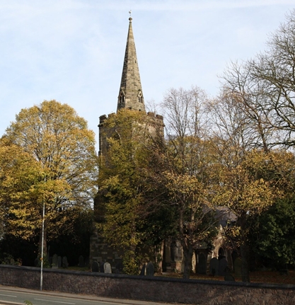
| Description | : | One of two medieval churches in Wigston Magna, the other being All Saints. The building is Grade II listed. |
frequently asked questions (FAQ):
-
Where is St Wistan's Churchyard?
St Wistan's Churchyard is located at Bullhead Street, Wigston Magna Wigston, Oadby and Wigston Borough ,Leicestershire , LE18 3RAEngland.
-
St Wistan's Churchyard cemetery's updated grave count on graveviews.com?
0 memorials
-
Where are the coordinates of the St Wistan's Churchyard?
Latitude: 52.5866580
Longitude: -1.1024700
Nearby Cemetories:
1. Wigston United Reformed Church
Wigston, Oadby and Wigston Borough, England
Coordinate: 52.5840900, -1.1071200
2. All Saints Churchyard
Wigston, Oadby and Wigston Borough, England
Coordinate: 52.5823880, -1.1096900
3. Wigston Cemetery
Wigston, Oadby and Wigston Borough, England
Coordinate: 52.5752060, -1.1007170
4. Oadby Cemetery
Oadby, Oadby and Wigston Borough, England
Coordinate: 52.5961580, -1.0826170
5. St. Peter Churchyard
Oadby, Oadby and Wigston Borough, England
Coordinate: 52.5973900, -1.0805100
6. Saffron Hill Cemetery
Leicester, Leicester Unitary Authority, England
Coordinate: 52.5934120, -1.1310010
7. Saint Mary Magdalene Churchyard
Knighton, Leicester Unitary Authority, England
Coordinate: 52.6054170, -1.1163730
8. St. john the Baptist
Leicester, Leicester Unitary Authority, England
Coordinate: 52.6181730, -1.1118790
9. St Mary Magdalene
Kilby, Blaby District, England
Coordinate: 52.5554660, -1.0884320
10. Countesthorpe Parish Cemetery
Countesthorpe, Blaby District, England
Coordinate: 52.5577540, -1.1309080
11. Blaby Cemetery
Blaby, Blaby District, England
Coordinate: 52.5738950, -1.1541280
12. South Leicestershire Memorial Park and Crematorium
Countesthorpe, Blaby District, England
Coordinate: 52.5562541, -1.1289665
13. St Luke's Churchyard, Newton Harcourt
Wistow, Harborough District, England
Coordinate: 52.5646320, -1.0577376
14. All Saints Churchyard
Blaby, Blaby District, England
Coordinate: 52.5754960, -1.1600850
15. St. Denys' Churchyard
Evington, Leicester Unitary Authority, England
Coordinate: 52.6193210, -1.0743860
16. Welford Road Cemetery
Leicester, Leicester Unitary Authority, England
Coordinate: 52.6200104, -1.1295080
17. St Andrew Churchyard
Aylestone, Leicester Unitary Authority, England
Coordinate: 52.6038420, -1.1568900
18. St. Bartholomew's Churchyard
Foston, Blaby District, England
Coordinate: 52.5494850, -1.1116260
19. St Bartholomew in Foston
Kilby, Blaby District, England
Coordinate: 52.5494780, -1.1117810
20. Church of St. Mary and All Saints
Stoughton, Harborough District, England
Coordinate: 52.6129090, -1.0552350
21. St Andrew's Churchyard
Countesthorpe, Blaby District, England
Coordinate: 52.5536270, -1.1379810
22. Saint Cuthbert Churchyard
Great Glen, Harborough District, England
Coordinate: 52.5739000, -1.0390700
23. St Wistans Church
Wistow, Harborough District, England
Coordinate: 52.5577010, -1.0522340
24. St Peter's Church (Defunct)
Leicester, Leicester Unitary Authority, England
Coordinate: 52.6300260, -1.1164980