
| Memorials | : | 42 |
| Location | : | Goodnestone, Dover District, England |
| Coordinate | : | 51.3166220, 0.9322200 |
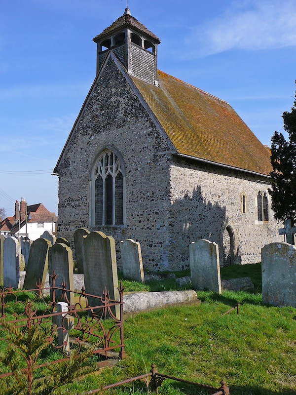
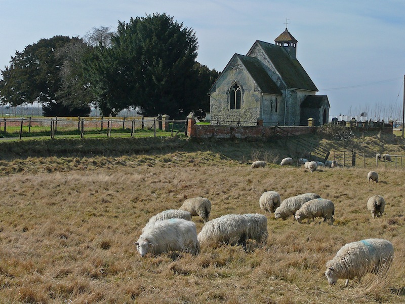
| Description | : | The tiny Norman Church of St Bartholomew, almost in a farmyard, is surprisingly visible on its low hill surrounded by marshland. It is almost in an original state, apart from the porch, rebult in the 17th century after suffering earthquake damage. The churchyard has ben partially cleared, with the markers now clustered around the porch, but at the west end are two rows of impressive headstones of the Murton family, most with original massive bodystones (one has two additional small unnamed bodystones.) An elegant altar tomb to the south of the church lies beneath one of two old yews. The... Read More |
frequently asked questions (FAQ):
-
Where is St Bartholomew Churchyard?
St Bartholomew Churchyard is located at holly cross church Goodnestone, Dover District ,Kent , CT3 1PLEngland.
-
St Bartholomew Churchyard cemetery's updated grave count on graveviews.com?
42 memorials
-
Where are the coordinates of the St Bartholomew Churchyard?
Latitude: 51.3166220
Longitude: 0.9322200
Nearby Cemetories:
1. All Saints Churchyard
Graveney, Swale Borough, England
Coordinate: 51.3261450, 0.9447880
2. Faversham Cemetery
Faversham, Swale Borough, England
Coordinate: 51.3110470, 0.9053170
3. St Michael Churchyard
Hernhill, Swale Borough, England
Coordinate: 51.3077430, 0.9612050
4. Wesleyan Chapel Burial Ground
Boughton-under-Blean, Swale Borough, England
Coordinate: 51.2968700, 0.9484080
5. Faversham Abbey (Defunct)
Faversham, Swale Borough, England
Coordinate: 51.3165680, 0.8958480
6. St Mary of Charity Churchyard
Faversham, Swale Borough, England
Coordinate: 51.3171730, 0.8948480
7. St. Catherine's Churchyard
Faversham, Swale Borough, England
Coordinate: 51.3103390, 0.8926930
8. Saint Peter and Saint Paul Churchyard
Boughton-under-Blean, Swale Borough, England
Coordinate: 51.2892810, 0.9355410
9. St Mary Magdalene and St Lawrence Churchyard
Faversham, Swale Borough, England
Coordinate: 51.3193510, 0.8845170
10. Christ Church Churchyard
Dunkirk, Swale Borough, England
Coordinate: 51.2916540, 0.9741890
11. St Peter's Churchyard
Oare, Swale Borough, England
Coordinate: 51.3335910, 0.8804350
12. St Peter and St Paul Churchyard
Ospringe, Swale Borough, England
Coordinate: 51.3070220, 0.8690570
13. St Mary the Virgin Churchyard
Selling, Swale Borough, England
Coordinate: 51.2739880, 0.9208920
14. St Thomas the Apostle Churchyard
Harty, Swale Borough, England
Coordinate: 51.3598251, 0.9045590
15. St Mary Churchyard
Luddenham, Swale Borough, England
Coordinate: 51.3324180, 0.8586720
16. St James Churchyard
Sheldwich, Swale Borough, England
Coordinate: 51.2753830, 0.8821940
17. St. Alphege's Churchyard
Seasalter, City of Canterbury, England
Coordinate: 51.3432041, 1.0041740
18. St. Leonard Churchyard
Badlesmere, Swale Borough, England
Coordinate: 51.2590000, 0.8850000
19. Deerton Natural Burial Ground
Teynham, Swale Borough, England
Coordinate: 51.3344460, 0.8297850
20. St Mary Churchyard
Norton, Swale Borough, England
Coordinate: 51.3149750, 0.8221900
21. St. Michael and All Angels Churchyard
Throwley, Swale Borough, England
Coordinate: 51.2651000, 0.8540800
22. St Alphege Churchyard
Whitstable, City of Canterbury, England
Coordinate: 51.3576330, 1.0251080
23. St Mary Churchyard
Teynham, Swale Borough, England
Coordinate: 51.3377640, 0.8213570
24. Whitstable Cemetery
Whitstable, City of Canterbury, England
Coordinate: 51.3529870, 1.0338530