
| Memorials | : | 1 |
| Location | : | Harty, Swale Borough, England |
| Coordinate | : | 51.3598251, 0.9045590 |
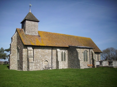
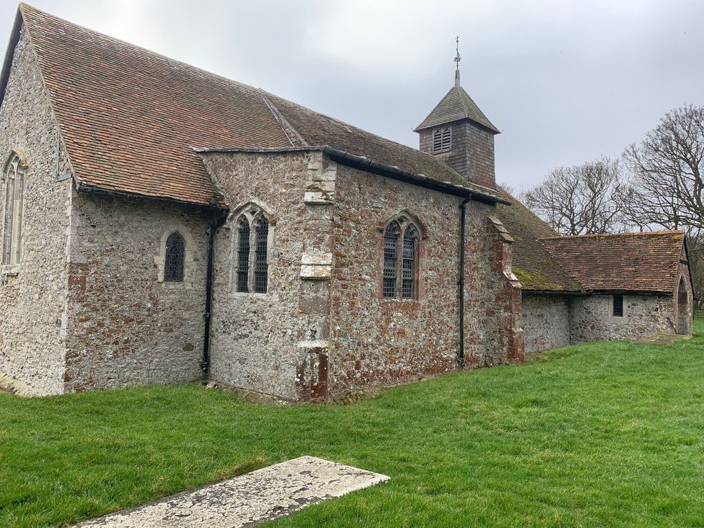
| Description | : | St Thomas the Apostle Church is located in the small hamlet of Harty, in the east of the Isle of Sheppey. The quaint church is without electricity, giving the church its period feel! Harty church is a grade II listed building dating back to around the 11th or 12th Century. |
frequently asked questions (FAQ):
-
Where is St Thomas the Apostle Churchyard?
St Thomas the Apostle Churchyard is located at Harty, Swale Borough ,Kent ,England.
-
St Thomas the Apostle Churchyard cemetery's updated grave count on graveviews.com?
1 memorials
-
Where are the coordinates of the St Thomas the Apostle Churchyard?
Latitude: 51.3598251
Longitude: 0.9045590
Nearby Cemetories:
1. St Peter's Churchyard
Oare, Swale Borough, England
Coordinate: 51.3335910, 0.8804350
2. St Clement Churchyard
Leysdown, Swale Borough, England
Coordinate: 51.3970440, 0.9066620
3. St Mary Churchyard
Luddenham, Swale Borough, England
Coordinate: 51.3324180, 0.8586720
4. All Saints Churchyard
Graveney, Swale Borough, England
Coordinate: 51.3261450, 0.9447880
5. St Mary Magdalene and St Lawrence Churchyard
Faversham, Swale Borough, England
Coordinate: 51.3193510, 0.8845170
6. St Mary of Charity Churchyard
Faversham, Swale Borough, England
Coordinate: 51.3171730, 0.8948480
7. Faversham Abbey (Defunct)
Faversham, Swale Borough, England
Coordinate: 51.3165680, 0.8958480
8. St Bartholomew Churchyard
Goodnestone, Dover District, England
Coordinate: 51.3166220, 0.9322200
9. Faversham Cemetery
Faversham, Swale Borough, England
Coordinate: 51.3110470, 0.9053170
10. St. Catherine's Churchyard
Faversham, Swale Borough, England
Coordinate: 51.3103390, 0.8926930
11. Deerton Natural Burial Ground
Teynham, Swale Borough, England
Coordinate: 51.3344460, 0.8297850
12. All Saints Churchyard
Eastchurch, Swale Borough, England
Coordinate: 51.4068909, 0.8574320
13. St Mary Churchyard
Teynham, Swale Borough, England
Coordinate: 51.3377640, 0.8213570
14. St Peter and St Paul Churchyard
Ospringe, Swale Borough, England
Coordinate: 51.3070220, 0.8690570
15. St Michael Churchyard
Hernhill, Swale Borough, England
Coordinate: 51.3077430, 0.9612050
16. St. Alphege's Churchyard
Seasalter, City of Canterbury, England
Coordinate: 51.3432041, 1.0041740
17. St Mary Churchyard
Norton, Swale Borough, England
Coordinate: 51.3149750, 0.8221900
18. Wesleyan Chapel Burial Ground
Boughton-under-Blean, Swale Borough, England
Coordinate: 51.2968700, 0.9484080
19. Saint Peter and Saint Paul Churchyard
Boughton-under-Blean, Swale Borough, England
Coordinate: 51.2892810, 0.9355410
20. St Alphege Churchyard
Whitstable, City of Canterbury, England
Coordinate: 51.3576330, 1.0251080
21. Christ Church Churchyard
Dunkirk, Swale Borough, England
Coordinate: 51.2916540, 0.9741890
22. Whitstable Cemetery
Whitstable, City of Canterbury, England
Coordinate: 51.3529870, 1.0338530
23. St Giles Churchyard
Tonge, Swale Borough, England
Coordinate: 51.3424640, 0.7757790
24. All Saints Churchyard
Whitstable, City of Canterbury, England
Coordinate: 51.3558090, 1.0396670