
| Memorials | : | 606 |
| Location | : | Fleet Street, City of London, England |
| Coordinate | : | 51.5137970, -0.1057060 |
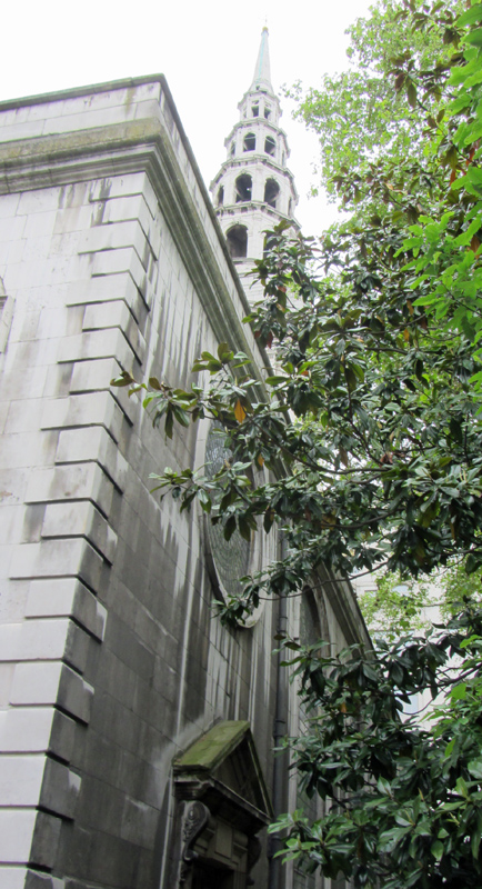
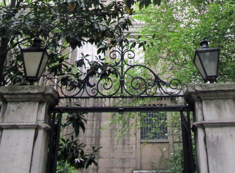
| Description | : | St. Bride's Church or Parish (also known as St. Bridget's Church or Parish) is a church on Fleet Street in the City of London, England. It is situated to the south of Fleet Street and is bounded by Fleet Street on the north; St Bride's Passage, Salisbury Square, on the west; Bride Lane on the east, and the backs of the houses of Bell's Buildings on the south. The cemetery is behind the West side of Farringdon Street and is still used for that purpose. The earliest burials in the churchyard occurred in 1574. In 1610, the Earl of Dorset... Read More |
frequently asked questions (FAQ):
-
Where is St Bride Churchyard?
St Bride Churchyard is located at Fleet Street, City of London ,Greater London ,England.
-
St Bride Churchyard cemetery's updated grave count on graveviews.com?
606 memorials
-
Where are the coordinates of the St Bride Churchyard?
Latitude: 51.5137970
Longitude: -0.1057060
Nearby Cemetories:
1. Gough Square
London, City of London, England
Coordinate: 51.5150590, -0.1077440
2. St Martin Churchyard
Ludgate, City of London, England
Coordinate: 51.5140390, -0.1020430
3. Blackfriars Priory
Blackfriars, City of London, England
Coordinate: 51.5129730, -0.1021110
4. St. Ann Blackfriars
London, City of London, England
Coordinate: 51.5129180, -0.1021170
5. St Dunstan in the West Burial Ground
Fleet Street, City of London, England
Coordinate: 51.5142540, -0.1102480
6. St Andrew-by-the-Wardrobe
London, City of London, England
Coordinate: 51.5123850, -0.1012230
7. Newgate Prison Cemetery
Newgate, City of London, England
Coordinate: 51.5158120, -0.1017230
8. St. Andrew's Churchyard
Holborn, London Borough of Camden, England
Coordinate: 51.5173050, -0.1066050
9. Holy Sepulchre London Churchyard
London, City of London, England
Coordinate: 51.5166730, -0.1023240
10. St. Faith under St. Paul Churchyard and Crypt
London, City of London, England
Coordinate: 51.5142580, -0.0990860
11. St. Benet's Churchyard
Queenhithe, City of London, England
Coordinate: 51.5117110, -0.0993280
12. Christ Church Greyfriars Churchyard
London, City of London, England
Coordinate: 51.5162000, -0.0996000
13. Saint Paul's Cathedral
London, City of London, England
Coordinate: 51.5136110, -0.0983330
14. William Wallace's Place of Execution
Smithfield, City of London, England
Coordinate: 51.5174520, -0.1001290
15. St Clement Danes Churchyard
City of Westminster, England
Coordinate: 51.5131070, -0.1138980
16. St. Bartholomew the Less Churchyard
London, City of London, England
Coordinate: 51.5179240, -0.1006630
17. Lincoln's Inn Chapel
Holborn, London Borough of Camden, England
Coordinate: 51.5164400, -0.1132400
18. Lincoln's Inn
Holborn, London Borough of Camden, England
Coordinate: 51.5161310, -0.1136610
19. St Nicholas Cole Abbey
London, City of London, England
Coordinate: 51.5121160, -0.0969270
20. Marian Martyrs' Monument
Smithfield, City of London, England
Coordinate: 51.5184100, -0.1001090
21. St. Leonard's Churchyard
Aldgate, City of London, England
Coordinate: 51.5152950, -0.0966580
22. Postman's Park
London, City of London, England
Coordinate: 51.5168320, -0.0977080
23. St Vedast Churchyard
London, City of London, England
Coordinate: 51.5149110, -0.0962350
24. St Botolph Aldersgate Churchyard
London, City of London, England
Coordinate: 51.5169440, -0.0972220