
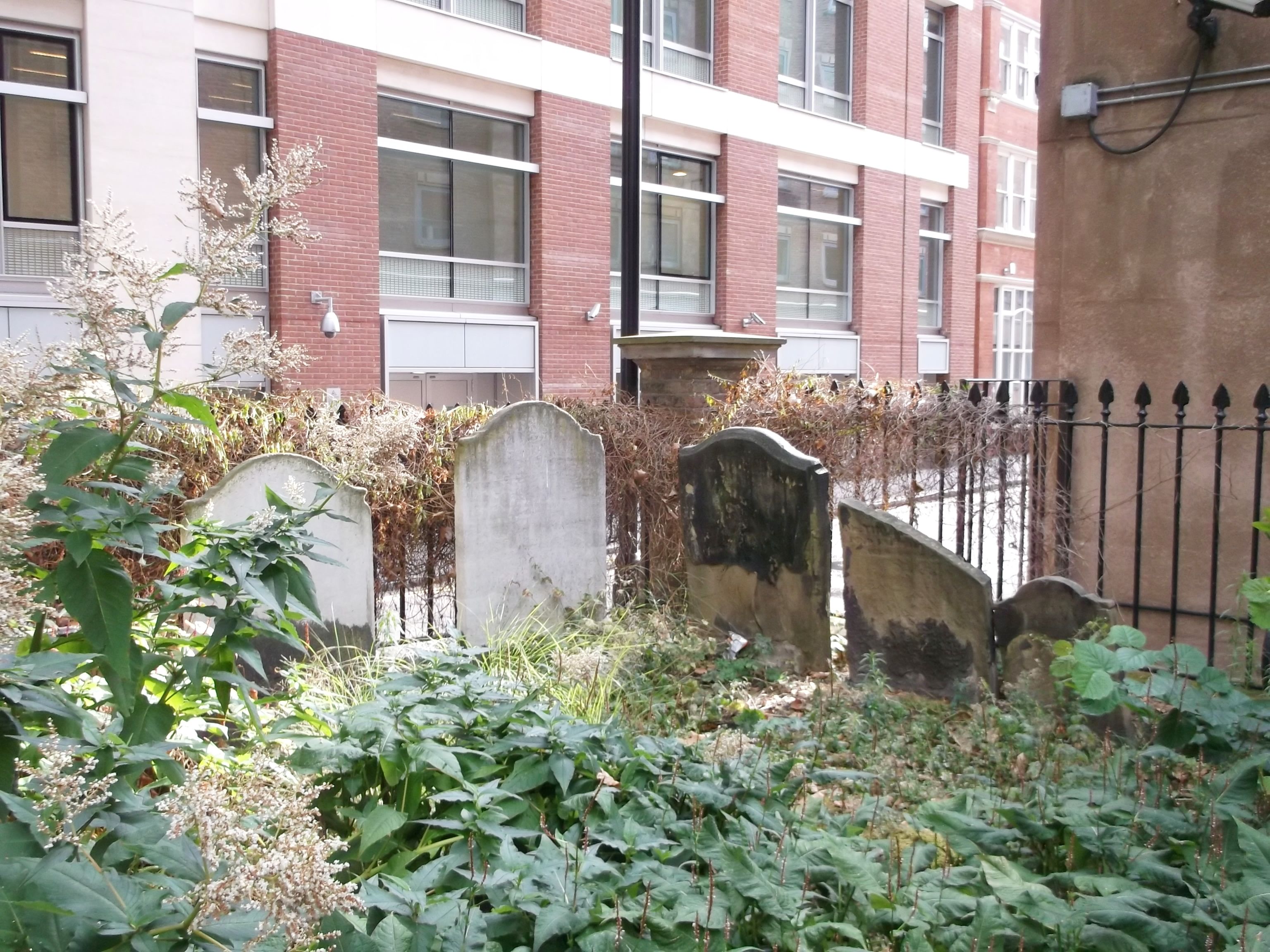
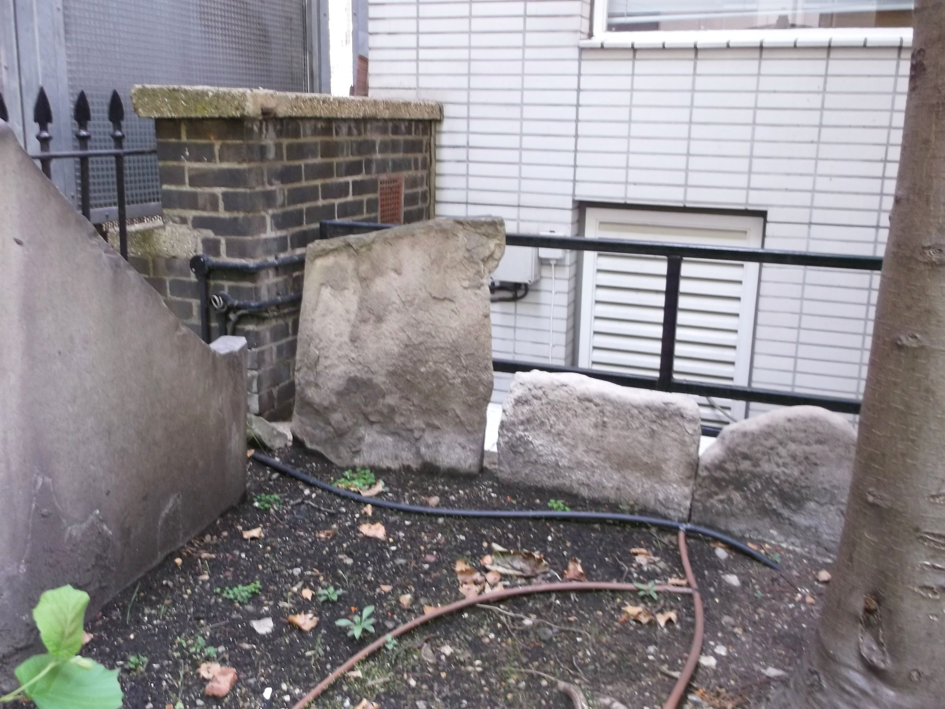
| Memorials | : | 234 |
| Location | : | Fleet Street, City of London, England |
| Coordinate | : | 51.5142540, -0.1102480 |
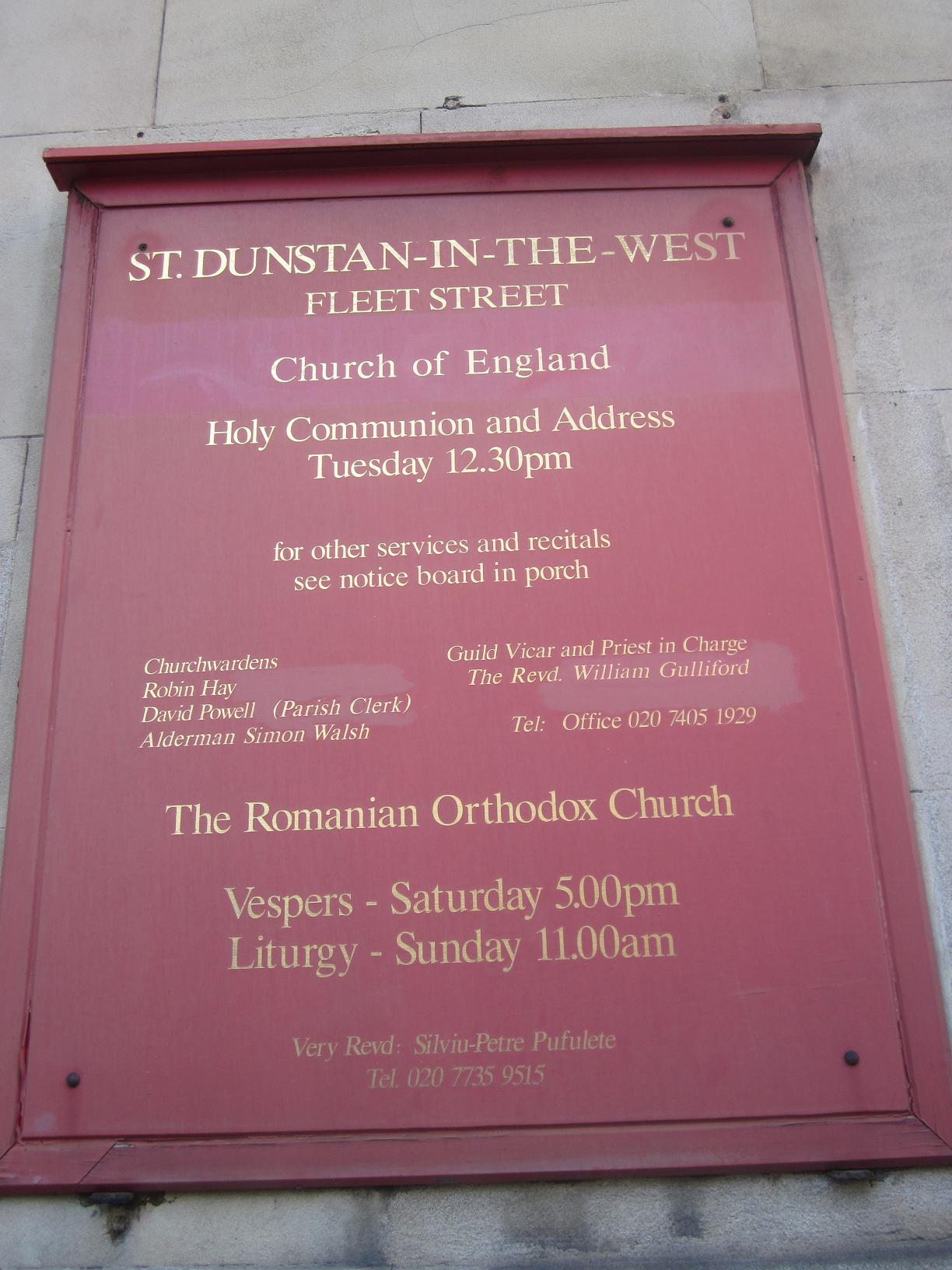
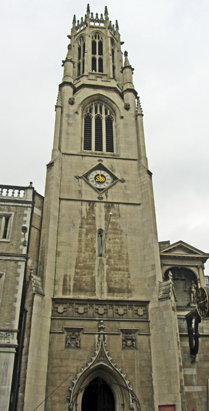
| Description | : | St Dunstan's Church was the last medieval City church to be rebuilt, and was first mentioned in c.1185, known as St Dunstan's Over Against the New Temple in 1237, later that century becoming known as St Dunstan in the West to distinguish it from St Dunstan in the East. The old church escaped the Great Fire in 1666, which halted only 3 houses to the east of the church. However by the early C19th the church was dilapidated and in 1829 an Act of Parliament was passed to enable it to be taken down and a new church built... Read More |
frequently asked questions (FAQ):
-
Where is St Dunstan in the West Burial Ground?
St Dunstan in the West Burial Ground is located at 27 Bream's Buildings Fleet Street, City of London ,Greater London ,England.
-
St Dunstan in the West Burial Ground cemetery's updated grave count on graveviews.com?
234 memorials
-
Where are the coordinates of the St Dunstan in the West Burial Ground?
Latitude: 51.5142540
Longitude: -0.1102480
Nearby Cemetories:
1. Gough Square
London, City of London, England
Coordinate: 51.5150590, -0.1077440
2. St Clement Danes Churchyard
City of Westminster, England
Coordinate: 51.5131070, -0.1138980
3. Lincoln's Inn
Holborn, London Borough of Camden, England
Coordinate: 51.5161310, -0.1136610
4. St Bride Churchyard
Fleet Street, City of London, England
Coordinate: 51.5137970, -0.1057060
5. Lincoln's Inn Chapel
Holborn, London Borough of Camden, England
Coordinate: 51.5164400, -0.1132400
6. Royal College of Surgeons of England
City of Westminster, England
Coordinate: 51.5152780, -0.1158330
7. Portugal Street Burial Ground (Defunct)
London, City of London, England
Coordinate: 51.5142280, -0.1162410
8. St. Andrew's Churchyard
Holborn, London Borough of Camden, England
Coordinate: 51.5173050, -0.1066050
9. St Mary le Strand Church
Strand, City of Westminster, England
Coordinate: 51.5121540, -0.1169360
10. St Martin Churchyard
Ludgate, City of London, England
Coordinate: 51.5140390, -0.1020430
11. Blackfriars Priory
Blackfriars, City of London, England
Coordinate: 51.5129730, -0.1021110
12. St. Ann Blackfriars
London, City of London, England
Coordinate: 51.5129180, -0.1021170
13. Sir John Soane's Museum
Holborn, London Borough of Camden, England
Coordinate: 51.5170370, -0.1174070
14. Holy Sepulchre London Churchyard
London, City of London, England
Coordinate: 51.5166730, -0.1023240
15. Newgate Prison Cemetery
Newgate, City of London, England
Coordinate: 51.5158120, -0.1017230
16. St Andrew-by-the-Wardrobe
London, City of London, England
Coordinate: 51.5123850, -0.1012230
17. Christ Church Greyfriars Churchyard
London, City of London, England
Coordinate: 51.5162000, -0.0996000
18. St. Faith under St. Paul Churchyard and Crypt
London, City of London, England
Coordinate: 51.5142580, -0.0990860
19. St. Bartholomew the Less Churchyard
London, City of London, England
Coordinate: 51.5179240, -0.1006630
20. William Wallace's Place of Execution
Smithfield, City of London, England
Coordinate: 51.5174520, -0.1001290
21. Savoy Chapel Churchyard
Strand, City of Westminster, England
Coordinate: 51.5105360, -0.1199210
22. St. Benet's Churchyard
Queenhithe, City of London, England
Coordinate: 51.5117110, -0.0993280
23. Saint Paul's Cathedral
London, City of London, England
Coordinate: 51.5136110, -0.0983330
24. Marian Martyrs' Monument
Smithfield, City of London, England
Coordinate: 51.5184100, -0.1001090