| Memorials | : | 4 |
| Location | : | Queenhithe, City of London, England |
| Website | : | www.stbenetwelshchurch.org.uk |
| Coordinate | : | 51.5117110, -0.0993280 |
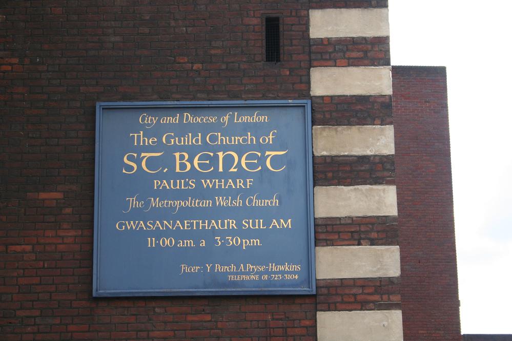
| Description | : | A Welsh church dating back to 1111, dedicated to St Benedict. Since 1555 it became the church off the College of Arms and merged with nearby St Peter's after the Great Fire of 1666 when it was destroyed along with Baynard's Castle to the east. The church was rebuilt between 1677 and 1683 by Sir Christopher Wren. |
frequently asked questions (FAQ):
-
Where is St. Benet's Churchyard?
St. Benet's Churchyard is located at Queen Victoria St Queenhithe, City of London ,Greater London , EC4V 4EREngland.
-
St. Benet's Churchyard cemetery's updated grave count on graveviews.com?
4 memorials
-
Where are the coordinates of the St. Benet's Churchyard?
Latitude: 51.5117110
Longitude: -0.0993280
Nearby Cemetories:
1. St Andrew-by-the-Wardrobe
London, City of London, England
Coordinate: 51.5123850, -0.1012230
2. St Nicholas Cole Abbey
London, City of London, England
Coordinate: 51.5121160, -0.0969270
3. Saint Paul's Cathedral
London, City of London, England
Coordinate: 51.5136110, -0.0983330
4. St. Ann Blackfriars
London, City of London, England
Coordinate: 51.5129180, -0.1021170
5. Blackfriars Priory
Blackfriars, City of London, England
Coordinate: 51.5129730, -0.1021110
6. St. John the Evangelist Churchyard
Bread Street, City of London, England
Coordinate: 51.5124910, -0.0954840
7. St. Faith under St. Paul Churchyard and Crypt
London, City of London, England
Coordinate: 51.5142580, -0.0990860
8. St Mildred Bread Street Church Demolished
London, City of London, England
Coordinate: 51.5123790, -0.0950740
9. St Martin Churchyard
Ludgate, City of London, England
Coordinate: 51.5140390, -0.1020430
10. Holy Trinity the Less Churchyard (Defunct)
London, City of London, England
Coordinate: 51.5119670, -0.0944820
11. All Hallows Churchyard
London, City of London, England
Coordinate: 51.5131130, -0.0948140
12. St James Garlickhythe Churchyard
London, City of London, England
Coordinate: 51.5111070, -0.0937560
13. St Vedast Churchyard
London, City of London, England
Coordinate: 51.5149110, -0.0962350
14. St Mary Aldermary
London, City of London, England
Coordinate: 51.5127900, -0.0933800
15. St. Leonard's Churchyard
Aldgate, City of London, England
Coordinate: 51.5152950, -0.0966580
16. St Mary-le-Bow
London, City of London, England
Coordinate: 51.5137100, -0.0935517
17. Church of Saint Mary Magdalen Milk Street
London, City of London, England
Coordinate: 51.5136110, -0.0930560
18. Newgate Prison Cemetery
Newgate, City of London, England
Coordinate: 51.5158120, -0.1017230
19. St Bride Churchyard
Fleet Street, City of London, England
Coordinate: 51.5137970, -0.1057060
20. Christ Church Greyfriars Churchyard
London, City of London, England
Coordinate: 51.5162000, -0.0996000
21. All Hallows Churchyard
City of London, England
Coordinate: 51.5143760, -0.0930270
22. Saint Pancras Soper Lane (Defunct)
London, City of London, England
Coordinate: 51.5132830, -0.0918850
23. St Antholin's Church
London, City of London, England
Coordinate: 51.5126895, -0.0915805
24. St Anne and St Agnes Churchyard
London, City of London, England
Coordinate: 51.5164490, -0.0963390


