
| Memorials | : | 0 |
| Location | : | East Tilbury, Thurrock Unitary Authority, England |
| Coordinate | : | 51.4664730, 0.4303230 |
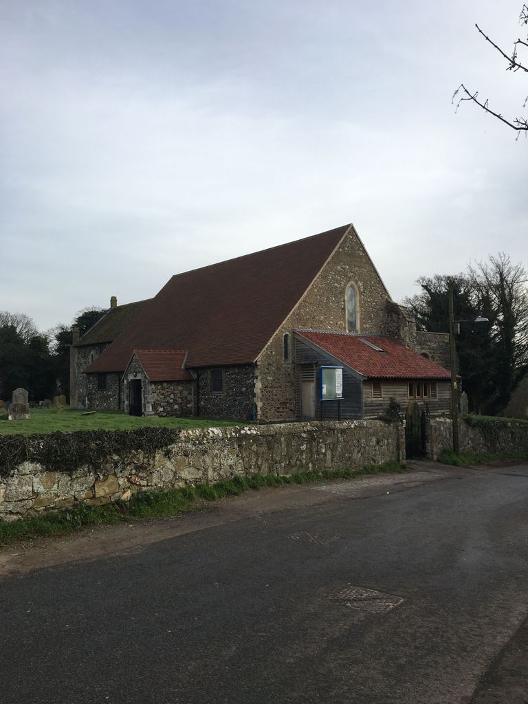
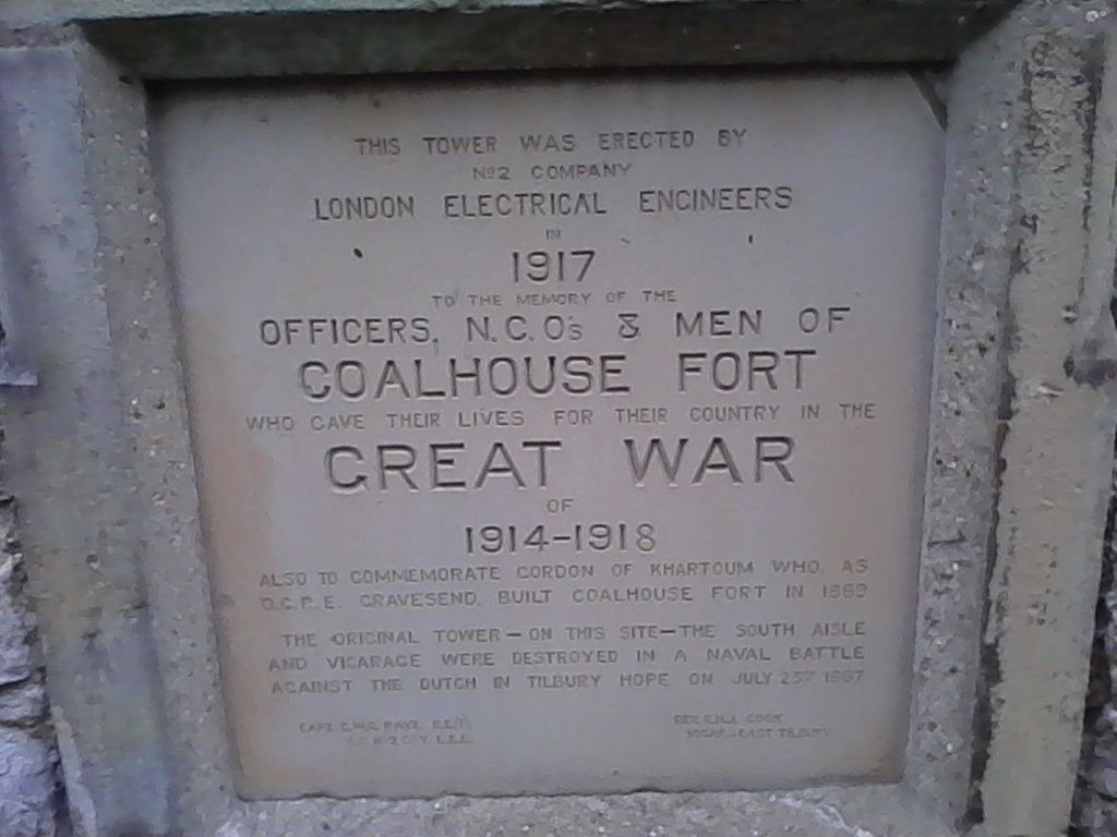
| Description | : | The church stands at the end of Princess Margaret Road on the East Tilbury Marshes, overlooking the River Thames and Coalhouse Fort. The church’s tower, along with the South Aisle and the vicarage, were destroyed by cannon fire in a naval battle against the Dutch (Holland) in Tilbury Hope on 23rd July 1667. |
frequently asked questions (FAQ):
-
Where is St. Catherine's Churchyard?
St. Catherine's Churchyard is located at East Tilbury, Thurrock Unitary Authority ,Essex ,England.
-
St. Catherine's Churchyard cemetery's updated grave count on graveviews.com?
0 memorials
-
Where are the coordinates of the St. Catherine's Churchyard?
Latitude: 51.4664730
Longitude: 0.4303230
Nearby Cemetories:
1. St James Churchyard
West Tilbury, Thurrock Unitary Authority, England
Coordinate: 51.4739320, 0.3908730
2. Linford Methodist Churchyard
Linford, Thurrock Unitary Authority, England
Coordinate: 51.4908160, 0.4087900
3. St Mary Churchyard
Higham, Gravesham Borough, England
Coordinate: 51.4408760, 0.4682570
4. Milton-next-Gravesend War Memorial
Gravesend, Gravesham Borough, England
Coordinate: 51.4389950, 0.3896110
5. Tilbury Fort
Tilbury, Thurrock Unitary Authority, England
Coordinate: 51.4526160, 0.3745650
6. St John the Baptist Churchyard
Mucking, Thurrock Unitary Authority, England
Coordinate: 51.5044510, 0.4268880
7. St. Peter and St. Paul Churchyard
Gravesend, Gravesham Borough, England
Coordinate: 51.4391441, 0.3854820
8. St Mary the Virgin Churchyard
Chalk, Gravesham Borough, England
Coordinate: 51.4265213, 0.4195510
9. St. Mary's Churchyard
Chadwell St Mary, Thurrock Unitary Authority, England
Coordinate: 51.4815470, 0.3691580
10. Saint Helen Churchyard
Cliffe, Medway Unitary Authority, England
Coordinate: 51.4619600, 0.4975900
11. Chadwell St Mary Cemetery
Chadwell St Mary, Thurrock Unitary Authority, England
Coordinate: 51.4858260, 0.3695060
12. Gravesend Methodist Churchyard
Gravesend, Gravesham Borough, England
Coordinate: 51.4418776, 0.3721993
13. Stanford-le-Hope Cemetery
Stanford-le-Hope, Thurrock Unitary Authority, England
Coordinate: 51.5104870, 0.4313190
14. St George Churchyard
Gravesend, Gravesham Borough, England
Coordinate: 51.4441060, 0.3683350
15. Gravesend War Memorial
Gravesend, Gravesham Borough, England
Coordinate: 51.4362650, 0.3720650
16. St. Margaret's Churchyard
Stanford-le-Hope, Thurrock Unitary Authority, England
Coordinate: 51.5141520, 0.4260190
17. Christ Church Milton-next-Gravesend
Gravesend, Gravesham Borough, England
Coordinate: 51.4317570, 0.3769340
18. St Peter and St Paul Churchyard
Shorne, Gravesham Borough, England
Coordinate: 51.4132347, 0.4297970
19. St John Evangelist Churchyard
Higham, Gravesham Borough, England
Coordinate: 51.4162102, 0.4616890
20. Gravesend Cemetery
Gravesend, Gravesham Borough, England
Coordinate: 51.4345220, 0.3596280
21. Grays New Cemetery
Grays, Thurrock Unitary Authority, England
Coordinate: 51.4843130, 0.3460480
22. St Mary the Virgin Churchyard
Little Thurrock, Thurrock Unitary Authority, England
Coordinate: 51.4756980, 0.3402920
23. All Saints Churchyard
Northfleet, Gravesham Borough, England
Coordinate: 51.4334679, 0.3513570
24. St Peter and St Paul Churchyard
Horndon-on-the-hill, Thurrock Unitary Authority, England
Coordinate: 51.5239220, 0.4048270