
| Memorials | : | 0 |
| Location | : | Farndon, Cheshire West and Chester Unitary Authority, England |
| Coordinate | : | 53.0840000, -2.8774000 |
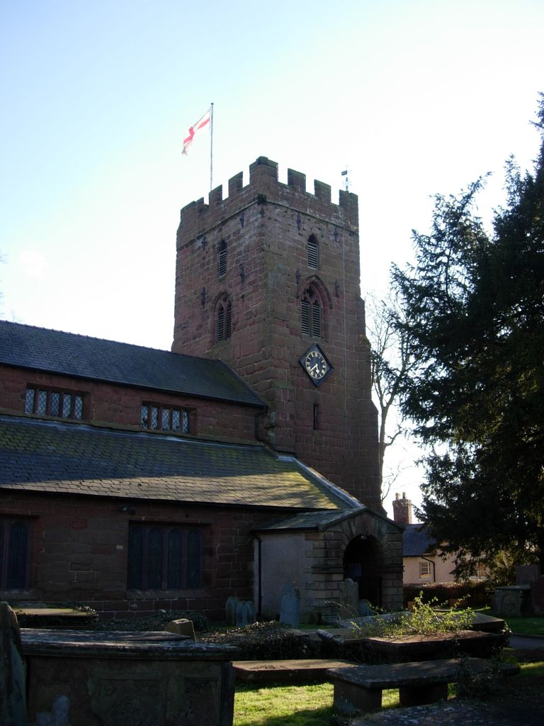
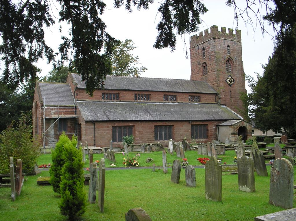
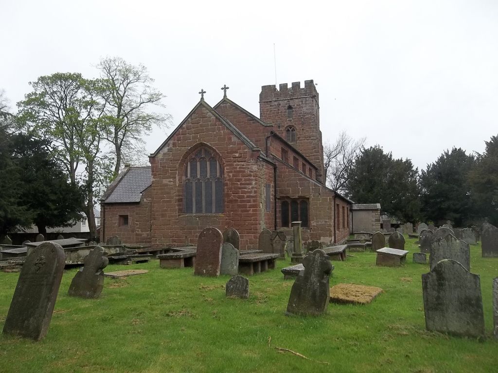
| Description | : | St Chad's Church, Farndon, is in the village of Farndon, Cheshire, England. It is designated by English Heritage as a Grade II* listed building. It is an active Anglican parish church in the diocese of Chester, the archdeaconry of Chester and the deanery of Malpas. Its benefice is combined with that of St Mary, Coddington. A church was present on the site at the time of the survey for the Domesday Book and it is likely that Saxon churches had previously been there. During the civil war the church was badly damaged. In 1643 it was being used as a barracks... Read More |
frequently asked questions (FAQ):
-
Where is St. Chad's Churchyard?
St. Chad's Churchyard is located at Farndon, Cheshire West and Chester Unitary Authority ,Cheshire ,England.
-
St. Chad's Churchyard cemetery's updated grave count on graveviews.com?
0 memorials
-
Where are the coordinates of the St. Chad's Churchyard?
Latitude: 53.0840000
Longitude: -2.8774000


Nearby Cemetories:
1. St Mary's Churchyard
Coddington, Cheshire West and Chester Unitary Authority, England
Coordinate: 53.0926800, -2.8184900
2. St Edith Churchyard
Shocklach, Cheshire West and Chester Unitary Authority, England
Coordinate: 53.0457000, -2.8487100
3. St. John The Baptist Churchyard
Aldford, Cheshire West and Chester Unitary Authority, England
Coordinate: 53.1285900, -2.8698900
4. St. Mary's Churchyard
Pulford, Cheshire West and Chester Unitary Authority, England
Coordinate: 53.1223900, -2.9351000
5. All Saints Churchyard
Handley, Cheshire West and Chester Unitary Authority, England
Coordinate: 53.1153060, -2.7990430
6. St Mary Churchyard
Bruera, Cheshire West and Chester Unitary Authority, England
Coordinate: 53.1390980, -2.8420290
7. St Mary the Virgin Churchyard
Eccleston, Cheshire West and Chester Unitary Authority, England
Coordinate: 53.1570100, -2.8792600
8. St. Mary's Churchyard
Dodleston, Cheshire West and Chester Unitary Authority, England
Coordinate: 53.1416500, -2.9553200
9. Brown Knoll Methodist Chapel
Broxton, Cheshire West and Chester Unitary Authority, England
Coordinate: 53.0766700, -2.7538600
10. St Alban's Churchyard
Tattenhall, Cheshire West and Chester Unitary Authority, England
Coordinate: 53.1217800, -2.7688900
11. Harthill Chester Churchyard
Harthill, Cheshire West and Chester Unitary Authority, England
Coordinate: 53.0924840, -2.7469490
12. St. John's Churchyard
Threapwood, Cheshire West and Chester Unitary Authority, England
Coordinate: 53.0023350, -2.8359540
13. Bickerton Municipal Cemetery
Bickerton, Cheshire East Unitary Authority, England
Coordinate: 53.0773110, -2.7329560
14. Holy Trinity Churchyard
Bickerton, Cheshire East Unitary Authority, England
Coordinate: 53.0770280, -2.7326350
15. British Cemetery
Mar del Plata, Partido de General Pueyrredón, Argentina
Coordinate: 53.0386111, -3.0052778
16. Malpas Cemetery
Malpas, Cheshire West and Chester Unitary Authority, England
Coordinate: 53.0262800, -2.7633600
17. St Peter Churchyard
Waverton, Cheshire West and Chester Unitary Authority, England
Coordinate: 53.1645900, -2.8065200
18. United Reformed Church Burial Ground
Malpas, Cheshire West and Chester Unitary Authority, England
Coordinate: 53.0198355, -2.7673954
19. St. Oswald's Churchyard
Malpas, Cheshire West and Chester Unitary Authority, England
Coordinate: 53.0194240, -2.7669350
20. St. John the Divine Churchyard
Burwardsley, Cheshire West and Chester Unitary Authority, England
Coordinate: 53.1035280, -2.7251110
21. St. Peter's Churchyard
Hargrave, Cheshire West and Chester Unitary Authority, England
Coordinate: 53.1545450, -2.7710450
22. Overleigh New Cemetery
Chester, Cheshire West and Chester Unitary Authority, England
Coordinate: 53.1801900, -2.8941500
23. Overleigh Old Cemetery
Chester, Cheshire West and Chester Unitary Authority, England
Coordinate: 53.1808930, -2.8936610
24. St. Mary Without-The-Walls Churchyard
Chester, Cheshire West and Chester Unitary Authority, England
Coordinate: 53.1828358, -2.8888967