
| Memorials | : | 0 |
| Location | : | Shocklach, Cheshire West and Chester Unitary Authority, England |
| Coordinate | : | 53.0457000, -2.8487100 |
| Description | : | Shocklach is a village in the civil parishes of Church Shocklach and Shocklach Oviatt in Cheshire, England. Shocklach Village is on the southernmost tip of Cheshire. It is approximately 1 kilometre from the border between Wales and England, the River Dee. Shocklach is set beside the tributary of the Dee between Wrexham (16 kilometres away) and Nantwich. The River Dee is a major salmon and sea trout fishery; and one in which Shocklach fishery engages in. “Salmon are most often caught in the sections lying between Shocklach up to Bala Lake". According to the Concise Oxford Dictionary of English Place... Read More |
frequently asked questions (FAQ):
-
Where is St Edith Churchyard?
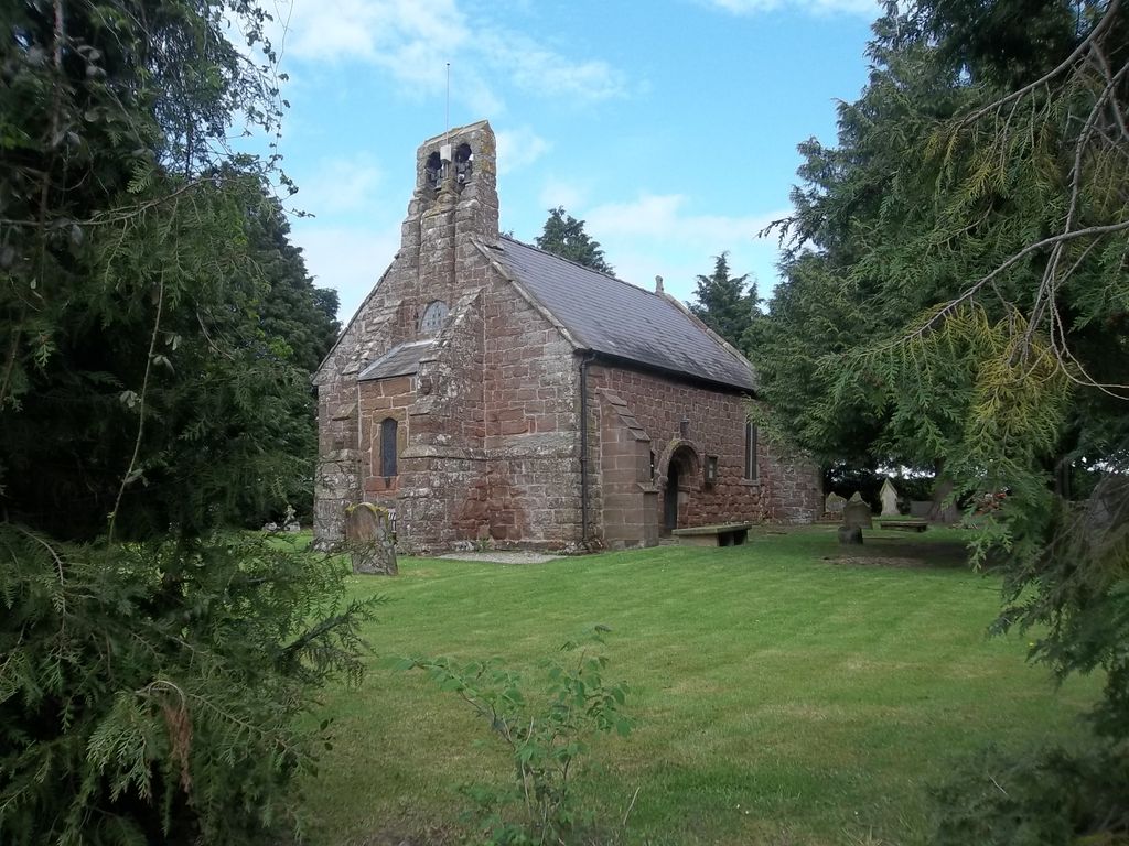
St Edith Churchyard is located at Church Road Shocklach, Cheshire West and Chester Unitary Authority ,Cheshire , SY14 7BLEngland.
-
St Edith Churchyard cemetery's updated grave count on graveviews.com?
0 memorials
-
Where are the coordinates of the St Edith Churchyard?
Latitude: 53.0457000
Longitude: -2.8487100
Nearby Cemetories:
1. St. Chad's Churchyard
Farndon, Cheshire West and Chester Unitary Authority, England
Coordinate: 53.0840000, -2.8774000
2. St. John's Churchyard
Threapwood, Cheshire West and Chester Unitary Authority, England
Coordinate: 53.0023350, -2.8359540
3. St Mary's Churchyard
Coddington, Cheshire West and Chester Unitary Authority, England
Coordinate: 53.0926800, -2.8184900
4. Malpas Cemetery
Malpas, Cheshire West and Chester Unitary Authority, England
Coordinate: 53.0262800, -2.7633600
5. United Reformed Church Burial Ground
Malpas, Cheshire West and Chester Unitary Authority, England
Coordinate: 53.0198355, -2.7673954
6. St. Oswald's Churchyard
Malpas, Cheshire West and Chester Unitary Authority, England
Coordinate: 53.0194240, -2.7669350
7. Brown Knoll Methodist Chapel
Broxton, Cheshire West and Chester Unitary Authority, England
Coordinate: 53.0766700, -2.7538600
8. All Saints Churchyard
Handley, Cheshire West and Chester Unitary Authority, England
Coordinate: 53.1153060, -2.7990430
9. Bickerton Municipal Cemetery
Bickerton, Cheshire East Unitary Authority, England
Coordinate: 53.0773110, -2.7329560
10. Holy Trinity Churchyard
Bickerton, Cheshire East Unitary Authority, England
Coordinate: 53.0770280, -2.7326350
11. Harthill Chester Churchyard
Harthill, Cheshire West and Chester Unitary Authority, England
Coordinate: 53.0924840, -2.7469490
12. St. John The Baptist Churchyard
Aldford, Cheshire West and Chester Unitary Authority, England
Coordinate: 53.1285900, -2.8698900
13. St Alban's Churchyard
Tattenhall, Cheshire West and Chester Unitary Authority, England
Coordinate: 53.1217800, -2.7688900
14. Old St. Chad's Church and Cemetery
Tushingham, Cheshire West and Chester Unitary Authority, England
Coordinate: 53.0115193, -2.7061829
15. St. Mary's Churchyard
Pulford, Cheshire West and Chester Unitary Authority, England
Coordinate: 53.1223900, -2.9351000
16. St Mary Churchyard
Bruera, Cheshire West and Chester Unitary Authority, England
Coordinate: 53.1390980, -2.8420290
17. St. John the Divine Churchyard
Burwardsley, Cheshire West and Chester Unitary Authority, England
Coordinate: 53.1035280, -2.7251110
18. British Cemetery
Mar del Plata, Partido de General Pueyrredón, Argentina
Coordinate: 53.0386111, -3.0052778
19. St. Wenefredes Churchyard
Bickley, Cheshire West and Chester Unitary Authority, England
Coordinate: 53.0365490, -2.6924400
20. St Mary the Virgin Churchyard
Eccleston, Cheshire West and Chester Unitary Authority, England
Coordinate: 53.1570100, -2.8792600
21. St. Mary's Churchyard
Dodleston, Cheshire West and Chester Unitary Authority, England
Coordinate: 53.1416500, -2.9553200
22. St. Peter's Churchyard
Hargrave, Cheshire West and Chester Unitary Authority, England
Coordinate: 53.1545450, -2.7710450
23. St Peter Churchyard
Waverton, Cheshire West and Chester Unitary Authority, England
Coordinate: 53.1645900, -2.8065200
24. St Michael Churchyard
Marbury-cum-Quoisley, Cheshire East Unitary Authority, England
Coordinate: 53.0062980, -2.6564160