
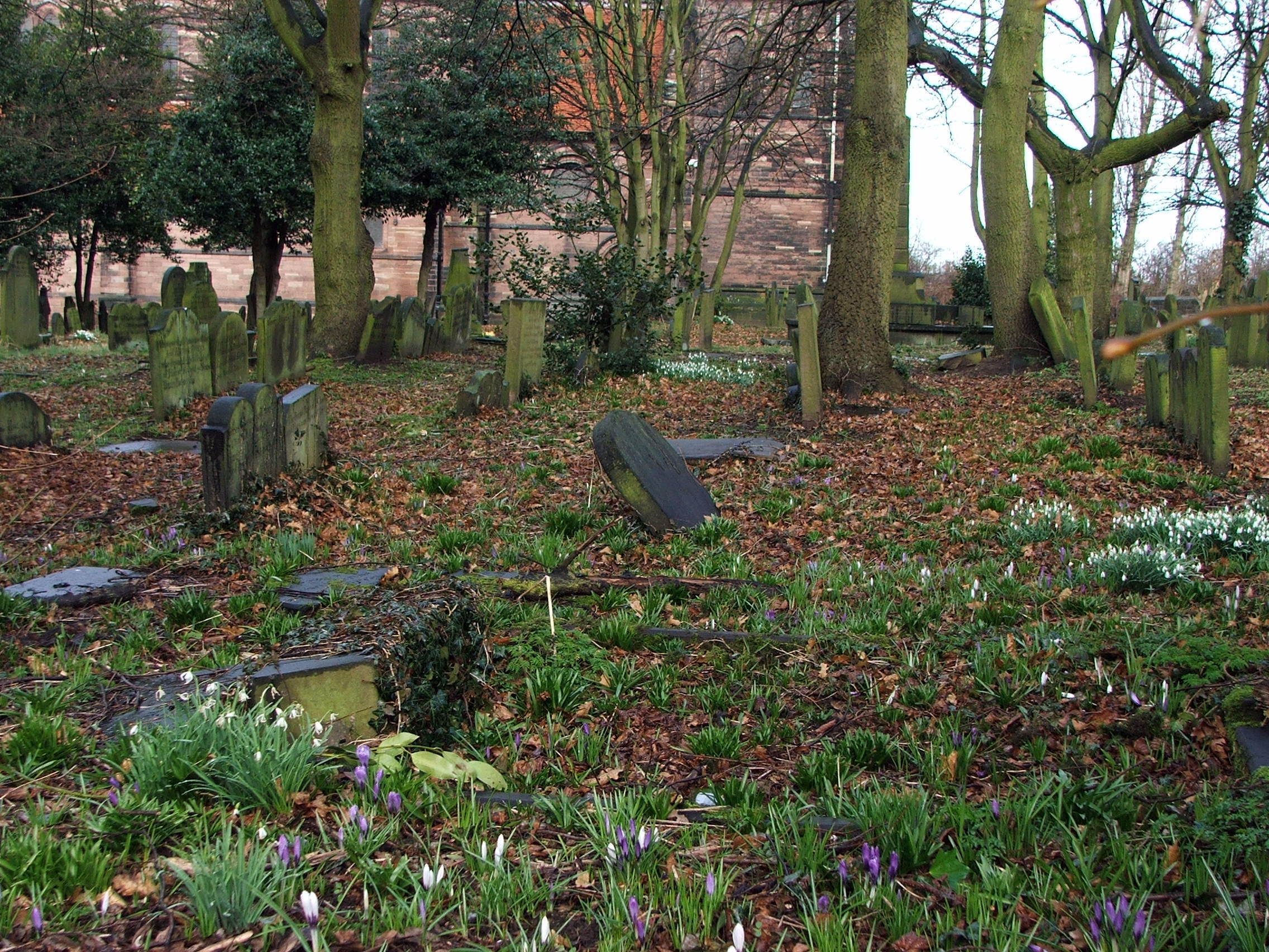
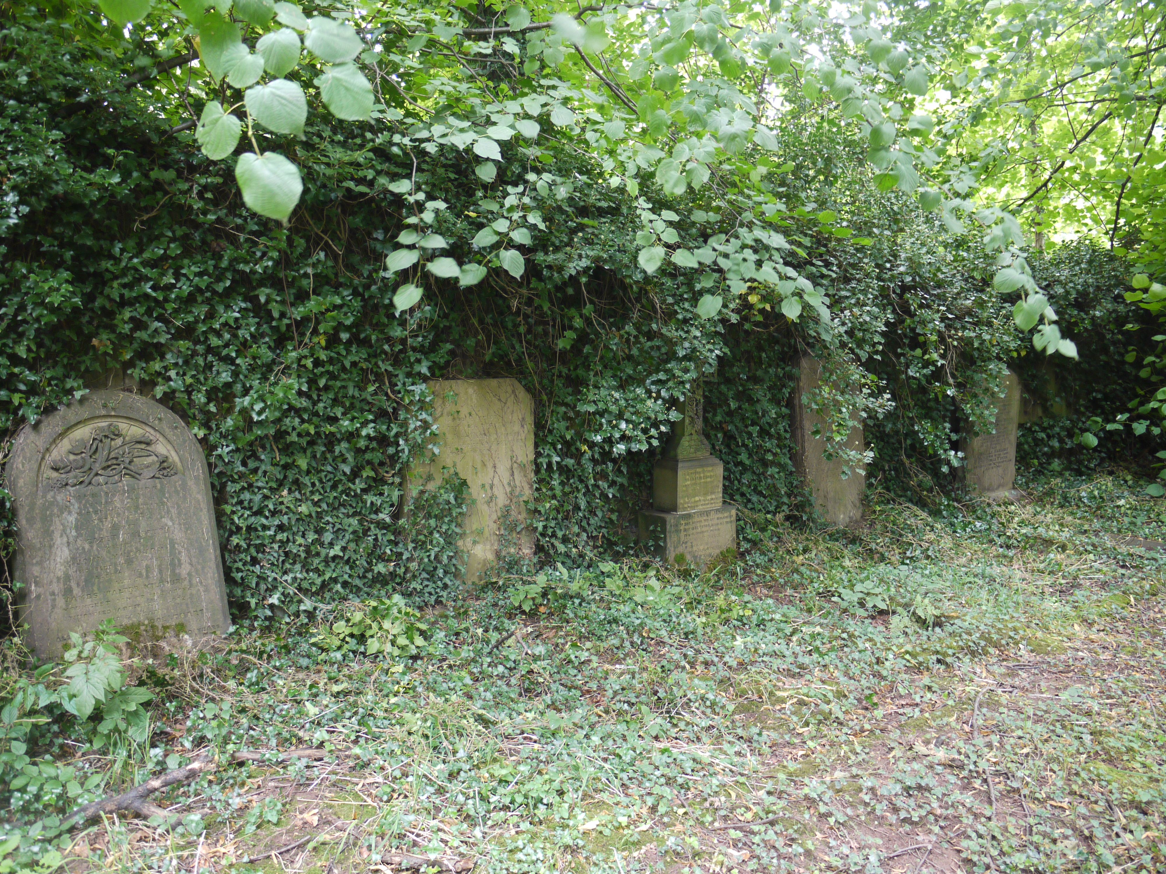
| Memorials | : | 912 |
| Location | : | Kirkby, Metropolitan Borough of Knowsley, England |
| Coordinate | : | 53.4842890, -2.8930700 |
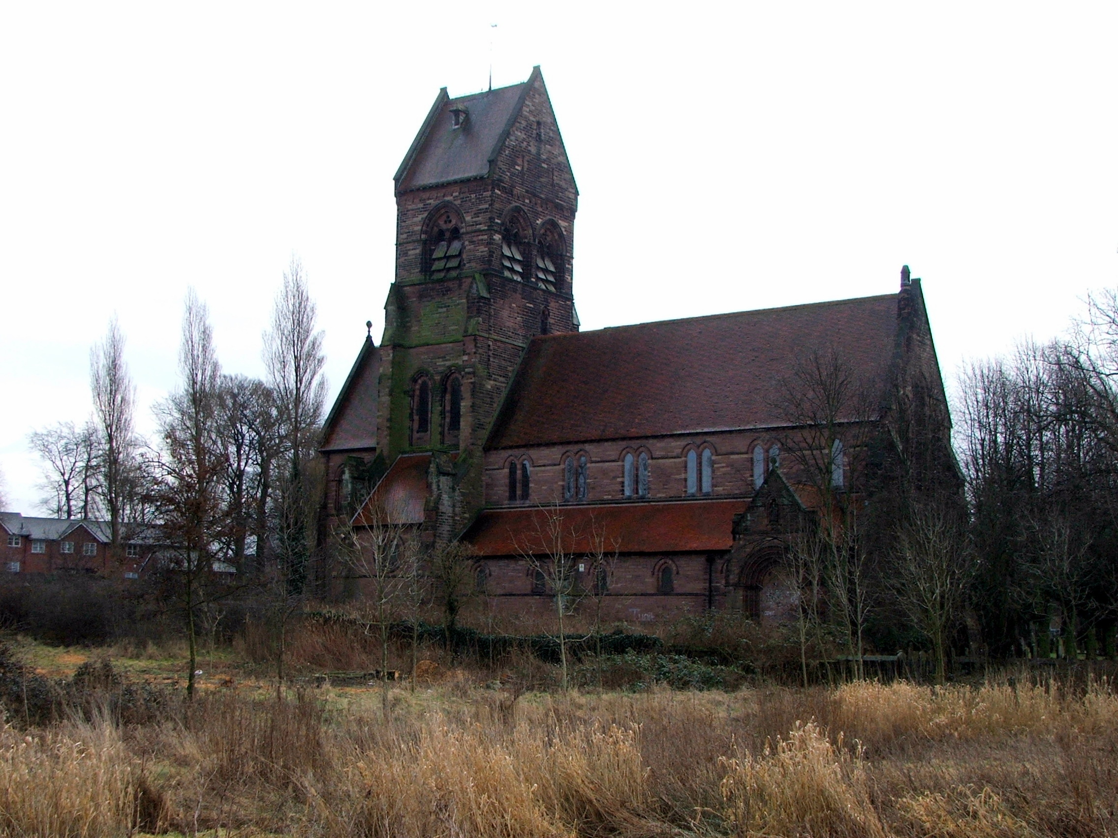
| Description | : | A place of worship has been on this site since 870. The church was documented in the “Domesday Book” in 1086. In 1766 a new red brick chapel was built on the ancient church site, which was enlarged in 1812 to hold a 600-member congregation. The foundation stone of the current church was laid in March of 1869, but a strike among the masons delayed the finishing of the building until 1871 with the last service being held in the old building on October 4, 1871. The next year, the old building was destroyed except for the altar. The church's... Read More |
frequently asked questions (FAQ):
-
Where is St. Chad Churchyard?
St. Chad Churchyard is located at Kirkby, Metropolitan Borough of Knowsley ,Merseyside ,England.
-
St. Chad Churchyard cemetery's updated grave count on graveviews.com?
895 memorials
-
Where are the coordinates of the St. Chad Churchyard?
Latitude: 53.4842890
Longitude: -2.8930700
Nearby Cemetories:
1. Melling Churchyard
Melling, Metropolitan Borough of Sefton, England
Coordinate: 53.4953370, -2.9228780
2. St Thomas and the Holy Rood Churchyard
Melling, Metropolitan Borough of Sefton, England
Coordinate: 53.4954510, -2.9227850
3. St Swithins Churchyard
Liverpool, Metropolitan Borough of Liverpool, England
Coordinate: 53.4585631, -2.9012280
4. West Derby Cemetery
West Derby, Metropolitan Borough of Liverpool, England
Coordinate: 53.4513790, -2.9154630
5. West Derby Jewish Cemetery
Liverpool, Metropolitan Borough of Liverpool, England
Coordinate: 53.4504986, -2.9137393
6. Kirkdale Cemetery
Liverpool, Metropolitan Borough of Liverpool, England
Coordinate: 53.4672530, -2.9479800
7. St. Mary's Churchyard
Knowsley, Metropolitan Borough of Knowsley, England
Coordinate: 53.4561960, -2.8528580
8. Aintree Racecourse Grounds
Aintree Village, Metropolitan Borough of Sefton, England
Coordinate: 53.4733880, -2.9549700
9. St. Andrew Churchyard
Maghull, Metropolitan Borough of Sefton, England
Coordinate: 53.5104770, -2.9428820
10. Long Lane Jewish Cemetery
Liverpool, Metropolitan Borough of Liverpool, England
Coordinate: 53.4550140, -2.9420480
11. Everton Cemetery
Everton, Metropolitan Borough of Liverpool, England
Coordinate: 53.4555430, -2.9442480
12. Sefton Parish Churchyard
Sefton, Metropolitan Borough of Sefton, England
Coordinate: 53.5044060, -2.9712190
13. Rice Lane Jewish Cemetery
Walton, Metropolitan Borough of Liverpool, England
Coordinate: 53.4521700, -2.9590600
14. Friends Burial Ground
Bickerstaffe, West Lancashire District, England
Coordinate: 53.5347720, -2.8748780
15. GreenAcres Cemetery
Rainford, Metropolitan Borough of St Helens, England
Coordinate: 53.4713530, -2.8064280
16. Walton Park Cemetery
Walton, Metropolitan Borough of Liverpool, England
Coordinate: 53.4564370, -2.9695960
17. Bootle Cemetery
Bootle, Metropolitan Borough of Sefton, England
Coordinate: 53.4627680, -2.9787450
18. Yew Tree Roman Catholic Cemetery
West Derby, Metropolitan Borough of Liverpool, England
Coordinate: 53.4285700, -2.8790700
19. Holy Trinity Church
Bickerstaffe, West Lancashire District, England
Coordinate: 53.5318400, -2.8383400
20. St Mary the Virgin Churchyard
Walton, Metropolitan Borough of Liverpool, England
Coordinate: 53.4464930, -2.9673330
21. Ford Cemetery
Ford, Metropolitan Borough of Sefton, England
Coordinate: 53.4824040, -2.9925980
22. Saint Michael's Churchyard
Aughton, West Lancashire District, England
Coordinate: 53.5419170, -2.9197240
23. Anfield Cemetery and Crematorium
Anfield, Metropolitan Borough of Liverpool, England
Coordinate: 53.4354680, -2.9578100
24. St Luke Churchyard
Walton, Metropolitan Borough of Liverpool, England
Coordinate: 53.4396910, -2.9671400