| Memorials | : | 0 |
| Location | : | Worcester, City of Worcester, England |
| Phone | : | 01905 423911 |
| Website | : | www.achurchnearyou.com/church/18632/ |
| Coordinate | : | 52.1906579, -2.2341371 |
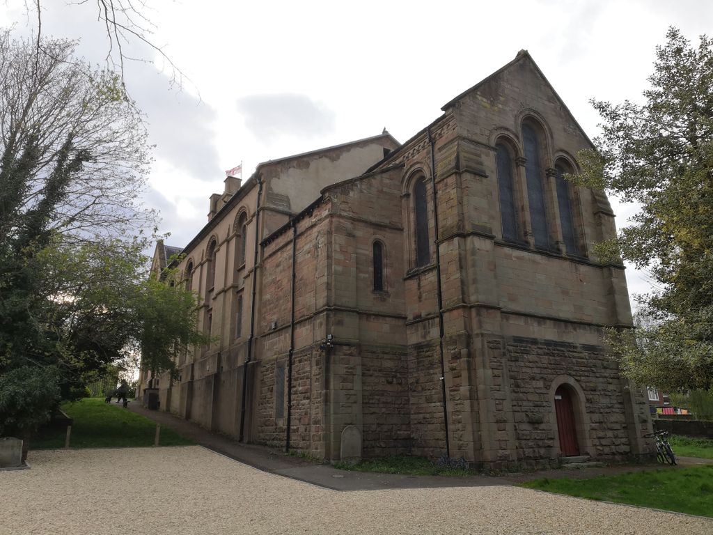
| Description | : | The Church is dedicated to Clement, Bishop of Rome. St Clement's Church, Worcester, one of the three oldest parishes in the city of Worcester established circa 10th Century and moved to it's present site in 1823 by Order of King George IV. It seems impossible now to date exactly the foundation of St Clement's Church, but the parish is nearly 1000 years old. It 's origin was in pre Conquest days when times were difficult, largely because of the Danish Raids The original church was built of timber and stone in part of Worcester which had been important for centuries, for it... Read More |
frequently asked questions (FAQ):
-
Where is St. Clement's Churchyard?
St. Clement's Churchyard is located at Henwick Road Worcester, City of Worcester ,Worcestershire , WR2 5NPEngland.
-
St. Clement's Churchyard cemetery's updated grave count on graveviews.com?
0 memorials
-
Where are the coordinates of the St. Clement's Churchyard?
Latitude: 52.1906579
Longitude: -2.2341371
Nearby Cemetories:
1. St Johns Bedwardine
Worcester, City of Worcester, England
Coordinate: 52.1882200, -2.2352000
2. Saint John's Cemetery
Worcester, City of Worcester, England
Coordinate: 52.1894670, -2.2436270
3. All Saints Churchyard
Worcester, City of Worcester, England
Coordinate: 52.1919400, -2.2240200
4. Saint Andrew Churchyard
Worcester, City of Worcester, England
Coordinate: 52.1911300, -2.2224300
5. Saint Alban Church
Worcester, City of Worcester, England
Coordinate: 52.1904262, -2.2218995
6. St Helen's Church
Worcester, City of Worcester, England
Coordinate: 52.1903000, -2.2209900
7. Black Friars of Worcester
Worcester, City of Worcester, England
Coordinate: 52.1962970, -2.2244990
8. Worcester Cathedral
Worcester, City of Worcester, England
Coordinate: 52.1887270, -2.2208070
9. Saint Swithun Churchyard
Worcester, City of Worcester, England
Coordinate: 52.1925300, -2.2204000
10. Greyfriars
Worcester, City of Worcester, England
Coordinate: 52.1905400, -2.2187800
11. St Martin In The Cornmarket
Worcester, City of Worcester, England
Coordinate: 52.1930500, -2.2189300
12. St. Peter the Great Churchyard
Worcester, City of Worcester, England
Coordinate: 52.1878260, -2.2185430
13. St Oswald's Hospital Churchyard
Worcester, City of Worcester, England
Coordinate: 52.1989700, -2.2232400
14. St Paul Churchyard
Worcester, City of Worcester, England
Coordinate: 52.1917400, -2.2156500
15. St. George's Churchyard
Worcester, City of Worcester, England
Coordinate: 52.2038940, -2.2246274
16. St. Stephens Churchyard
Worcester, City of Worcester, England
Coordinate: 52.2098500, -2.2254300
17. Astwood Cemetery
Worcester, City of Worcester, England
Coordinate: 52.2078630, -2.2050980
18. St Thomas Churchyard
Rushwick, Malvern Hills District, England
Coordinate: 52.1903870, -2.2751750
19. St Peter's Church Burial Ground
Powick, Malvern Hills District, England
Coordinate: 52.1613890, -2.2432490
20. St Philip and St James Churchyard
Hallow, Malvern Hills District, England
Coordinate: 52.2192900, -2.2524500
21. Elgar Birthplace Museum
Lower Broadheath, Malvern Hills District, England
Coordinate: 52.1989600, -2.2827000
22. Christ Church Churchyard
Lower Broadheath, Malvern Hills District, England
Coordinate: 52.2131500, -2.2786300
23. St. Philip and James Churchyard
Whittington, Wychavon District, England
Coordinate: 52.1741600, -2.1821800
24. St. John the Baptist Churchyard
Claines, Wychavon District, England
Coordinate: 52.2273145, -2.2184514


