
| Memorials | : | 0 |
| Location | : | York, York Unitary Authority, England |
| Coordinate | : | 53.9593540, -1.0774470 |
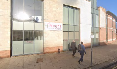
| Description | : | The burial ground was originally on Hungate Street that ran past St Savior Church to join St Saviourgate. This plot of land was purchased by the St Crux Church trustees for use as a parish burial ground in 1770. A new burial ground was needed as the church trustees had sold most of the original St Crux Churchyard for road work associated with the widening of Pavement. The burial ground is clearly presented on the 1852 ordnance map of York. This was well before the modern Stongbow was constructed and Hungate Street was cut off from St Saviourgate.... Read More |
frequently asked questions (FAQ):
-
Where is St Crux Hungate Burial Ground?
St Crux Hungate Burial Ground is located at Behind The Stonebow at the intersection with Hungate Street York, York Unitary Authority ,North Yorkshire , YO1 7NPEngland.
-
St Crux Hungate Burial Ground cemetery's updated grave count on graveviews.com?
0 memorials
-
Where are the coordinates of the St Crux Hungate Burial Ground?
Latitude: 53.9593540
Longitude: -1.0774470
Nearby Cemetories:
1. St Saviour Churchyard
York, York Unitary Authority, England
Coordinate: 53.9596100, -1.0780000
2. St John Churchyard
York, York Unitary Authority, England
Coordinate: 53.9591850, -1.0761680
3. Central Methodist Hall
York, York Unitary Authority, England
Coordinate: 53.9594090, -1.0788330
4. York Unitarian Chapelyard
York, York Unitary Authority, England
Coordinate: 53.9602950, -1.0775710
5. All Saints Peasholme (Defunct)
York, York Unitary Authority, England
Coordinate: 53.9597200, -1.0759220
6. St Crux Churchyard
York, York Unitary Authority, England
Coordinate: 53.9589890, -1.0795460
7. Holy Trinity Kings Court Churchyard
York, York Unitary Authority, England
Coordinate: 53.9599760, -1.0800800
8. St Andrew Churchyard
York, York Unitary Authority, England
Coordinate: 53.9609180, -1.0784710
9. St Cuthbert Churchyard
York, York Unitary Authority, England
Coordinate: 53.9609180, -1.0752310
10. St Sampson Churchyard
York, York Unitary Authority, England
Coordinate: 53.9597440, -1.0813060
11. All Saints Pavement Churchyard
York, York Unitary Authority, England
Coordinate: 53.9581090, -1.0808820
12. Holy Trinity Goodramgate Churchyard
York, York Unitary Authority, England
Coordinate: 53.9609810, -1.0804640
13. St Denys Churchyard
York, York Unitary Authority, England
Coordinate: 53.9567080, -1.0762240
14. St Peter the Little (Defunct)
York, York Unitary Authority, England
Coordinate: 53.9585310, -1.0821170
15. St. Mary Castlegate Churchyard
York, York Unitary Authority, England
Coordinate: 53.9570800, -1.0804370
16. Saint Peter's
York, York Unitary Authority, England
Coordinate: 53.9577400, -1.0822600
17. Carmelite Friary of York (Defunct)
York, York Unitary Authority, England
Coordinate: 53.9577020, -1.0822860
18. St Helen Davygate Church Cemetery
York, York Unitary Authority, England
Coordinate: 53.9596460, -1.0830390
19. St Michael Churchyard
York, York Unitary Authority, England
Coordinate: 53.9577900, -1.0825600
20. York Minster
York, York Unitary Authority, England
Coordinate: 53.9619440, -1.0819440
21. St Margaret Churchyard
York, York Unitary Authority, England
Coordinate: 53.9565370, -1.0729530
22. St Maurice Churchyard
York, York Unitary Authority, England
Coordinate: 53.9633340, -1.0782010
23. St Martin le Grand Churchyard
York, York Unitary Authority, England
Coordinate: 53.9593870, -1.0843800
24. St Helen Churchyard
York, York Unitary Authority, England
Coordinate: 53.9603030, -1.0841970