| Memorials | : | 0 |
| Location | : | Hemet, Riverside County, USA |
| Coordinate | : | 33.7362940, -116.9698520 |
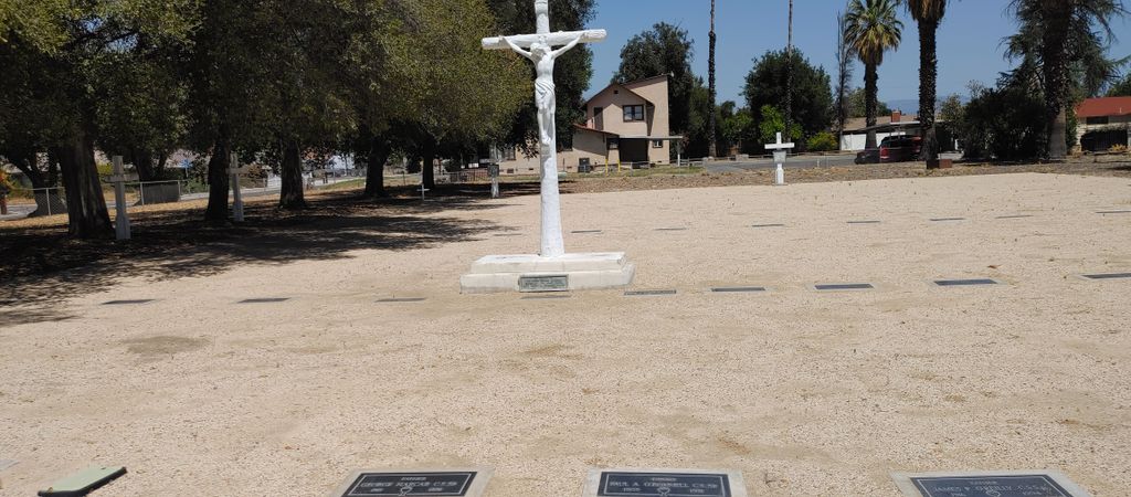
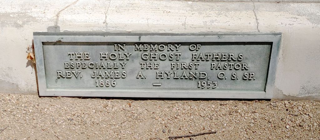
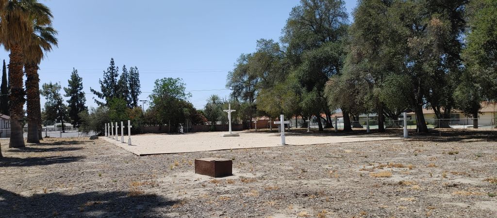
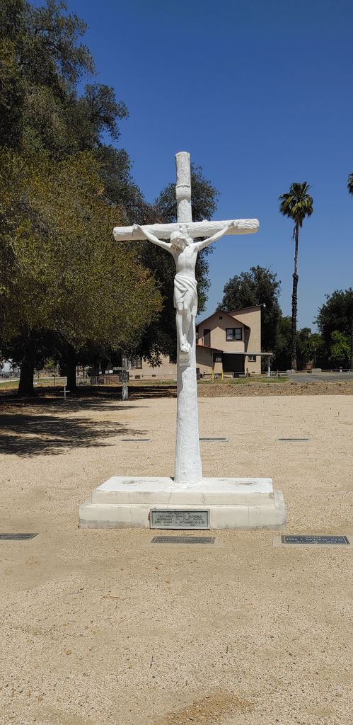
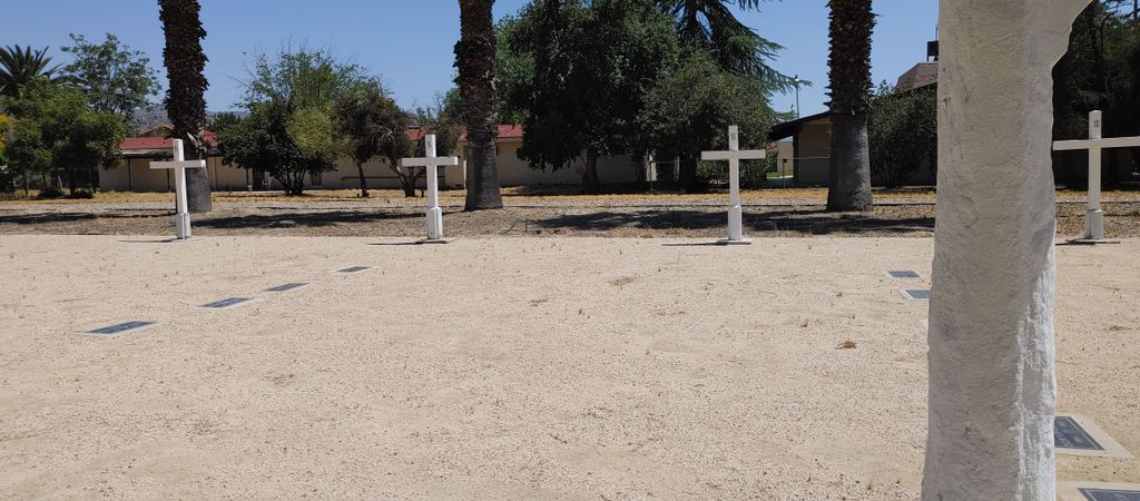
| Description | : | This is a Roman Catholic cemetery devoted to the burial of Catholic priests. This private cemetery is the burial spot for priests who have died while residing at the retirement home for priests of the Congregation of the Holy Spirit , also known as Holy Ghost Fathers. The cemetery is located next to the retirement home, which is at 309 E. Whittier Avenue in Hemet, Riverside County, California, USA. As of May 2022, only two priests remain at this retirement home. The new location for retired priests from this order is located in Pittsburgh, Pennsylvania, USA. The order... Read More |
frequently asked questions (FAQ):
-
Where is Holy Ghost Fathers Cemetery?
Holy Ghost Fathers Cemetery is located at 309 E. Whittier Avenue Hemet, Riverside County ,California , 92543USA.
-
Holy Ghost Fathers Cemetery cemetery's updated grave count on graveviews.com?
0 memorials
-
Where are the coordinates of the Holy Ghost Fathers Cemetery?
Latitude: 33.7362940
Longitude: -116.9698520
Nearby Cemetories:
1. Episcopal Church of the Good Shepherd Columbarium
Hemet, Riverside County, USA
Coordinate: 33.7440620, -116.9691790
2. San Jacinto Valley Cemetery
San Jacinto, Riverside County, USA
Coordinate: 33.7599983, -116.9599991
3. Soboba Indian Reservation Cemetery
San Jacinto, Riverside County, USA
Coordinate: 33.7796000, -116.9136000
4. Stewart Sunnyslope Cemetery
Beaumont, Riverside County, USA
Coordinate: 33.9196570, -116.9651700
5. Saint Stephen’s Episcopal Church Columbarium
Sun City, Riverside County, USA
Coordinate: 33.7330990, -117.2042950
6. Saint Stephens Episcopal Church Memorial Garden
Beaumont, Riverside County, USA
Coordinate: 33.9322860, -116.9795610
7. Menifee Valley Cemetery
Sun City, Riverside County, USA
Coordinate: 33.7290420, -117.2059910
8. Mountain View Cemetery
Beaumont, Riverside County, USA
Coordinate: 33.9435997, -116.9800034
9. McCanna Cemetery
Perris, Riverside County, USA
Coordinate: 33.7802300, -117.2159300
10. Saint Boniface Indian School Cemetery
Banning, Riverside County, USA
Coordinate: 33.9383488, -116.8886330
11. Idyllwild Community Church Columbarium
Idyllwild, Riverside County, USA
Coordinate: 33.7467926, -116.7116256
12. Perris Valley Cemetery
Perris, Riverside County, USA
Coordinate: 33.7947006, -117.2228012
13. St. Hugh's Episcopal Church Memorial Garden
Idyllwild, Riverside County, USA
Coordinate: 33.7518934, -116.7055594
14. Desert Lawn Memorial Park
Calimesa, Riverside County, USA
Coordinate: 33.9566994, -117.0203018
15. San Gorgonio Memorial Park
Banning, Riverside County, USA
Coordinate: 33.9483900, -116.8812400
16. Manker Family Cemetery
Lake Elsinore, Riverside County, USA
Coordinate: 33.6689800, -117.2451200
17. Moravian Cemetery
Banning, Riverside County, USA
Coordinate: 33.9542670, -116.8193780
18. Morongo Tribal Cemetery
Banning, Riverside County, USA
Coordinate: 33.9543340, -116.8193220
19. Saint Mary's Catholic Cemetery
Banning, Riverside County, USA
Coordinate: 33.9604830, -116.8257330
20. Park Family Cemetery
Aguanga, Riverside County, USA
Coordinate: 33.5158430, -116.7879560
21. Cahuilla Indian Reservation Cemetery
Anza, Riverside County, USA
Coordinate: 33.5393400, -116.7453800
22. Pechanga Tribal Cemetery
Temecula, Riverside County, USA
Coordinate: 33.4816840, -117.0908380
23. Radec Cemetery
Radec, Riverside County, USA
Coordinate: 33.4648000, -116.9134000
24. Wildomar Cemetery
Wildomar, Riverside County, USA
Coordinate: 33.6100006, -117.2699966

