
| Memorials | : | 0 |
| Location | : | Kaikōura, Kaikoura District, New Zealand |
| Coordinate | : | -42.3791350, 173.6321660 |
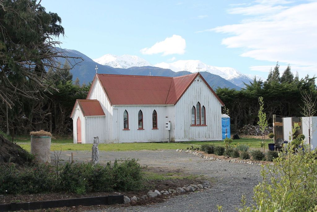
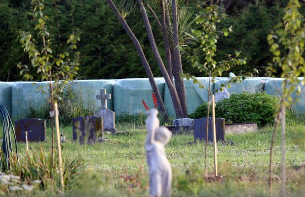
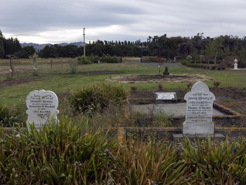
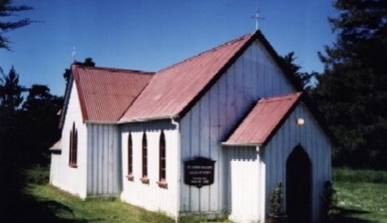
| Description | : | Anglican Vicar Thomas Porritt convened a meeting of parishioners in 1872, in which he proposed the construction of an Anglican church building in Kowhai. With land offered by Hugh Trimble on Red Swamp Road and tender offered by Dodimead and Westerby's an unlined and unpainted St. James church opened for worship on 24 August, 1873. There is a small churchyard at the rear of St. James which serves as a resting place for several of Kowhai pioneering families. The earliest legible stone dates from 1882 and although there have not been any burials since 1994 the churchyard remains open.... Read More |
frequently asked questions (FAQ):
-
Where is St. James Anglican Churchyard?
St. James Anglican Churchyard is located at 252 Red Swamp Road Kaikōura, Kaikoura District ,Canterbury , 7371New Zealand.
-
St. James Anglican Churchyard cemetery's updated grave count on graveviews.com?
0 memorials
-
Where are the coordinates of the St. James Anglican Churchyard?
Latitude: -42.3791350
Longitude: 173.6321660
Nearby Cemetories:
1. Kaikoura Public Cemetery
Kaikōura, Kaikoura District, New Zealand
Coordinate: -42.4105400, 173.6797300
2. Hapuku Urupā
Hapuku, Kaikoura District, New Zealand
Coordinate: -42.3124300, 173.7506600
3. Whalers Grave
Oaro, Kaikoura District, New Zealand
Coordinate: -42.5340691, 173.5026990
4. Rangi Gill's Gravesite
Molesworth, Marlborough District, New Zealand
Coordinate: -42.1379353, 173.1600656
5. St. George Church Churchyard
Kekerengu, Kaikoura District, New Zealand
Coordinate: -42.0000264, 174.0013961
6. Homeview Cemetery
Cheviot, Hurunui District, New Zealand
Coordinate: -42.7939600, 173.2701100
7. Red Gate Hut Graves
Molesworth, Marlborough District, New Zealand
Coordinate: -42.1325380, 173.0534620
8. Waiau Cemetery
Waiau, Hurunui District, New Zealand
Coordinate: -42.6547350, 173.0465200
9. Jed River Cemetery
Hurunui District, New Zealand
Coordinate: -42.8480000, 173.3133270
10. Sammy Palmer's Grave
Wharanui, Marlborough District, New Zealand
Coordinate: -41.9065258, 174.0104896
11. Saint Oswald's Churchyard
Wharanui, Marlborough District, New Zealand
Coordinate: -41.9287622, 174.0855260
12. Hanmer Springs Cemetery
Hanmer Springs, Hurunui District, New Zealand
Coordinate: -42.5175400, 172.8632300
13. Rotherham Cemetery
Rotherham, Hurunui District, New Zealand
Coordinate: -42.6948170, 172.9572170
14. Altimarlock Station
Altimarlock, Marlborough District, New Zealand
Coordinate: -41.7387595, 173.8579141
15. Ward Flaxbourne Cemetery
Ward, Marlborough District, New Zealand
Coordinate: -41.8164648, 174.1400507
16. Old Flaxbourne Graveyard
Ward, Marlborough District, New Zealand
Coordinate: -41.8335228, 174.1781740
17. Culverden Cemetery
Culverden, Hurunui District, New Zealand
Coordinate: -42.7704060, 172.8366990
18. Fidèle Crew Graves
Ward, Marlborough District, New Zealand
Coordinate: -41.7834471, 174.2287789
19. Taylor Pass Cemetery
Seddon, Marlborough District, New Zealand
Coordinate: -41.6706624, 173.9871644
20. Seddon Cemetery
Seddon, Marlborough District, New Zealand
Coordinate: -41.6831810, 174.0582210
21. Cape Campbell Lighthouse Burial Site
Marlborough District, New Zealand
Coordinate: -41.7316008, 174.2731993
22. Lansdowne Cemetery
Hillersden, Marlborough District, New Zealand
Coordinate: -41.5709846, 173.5434728
23. Wairau Valley Catholic Cemetery
Wairau Valley, Marlborough District, New Zealand
Coordinate: -41.5617282, 173.5383700
24. Wairau Valley Community Churchyard
Wairau Valley, Marlborough District, New Zealand
Coordinate: -41.5604349, 173.5424065