
| Memorials | : | 0 |
| Location | : | Bristol, Bristol Unitary Authority, England |
| Coordinate | : | 51.4585220, -2.5936690 |
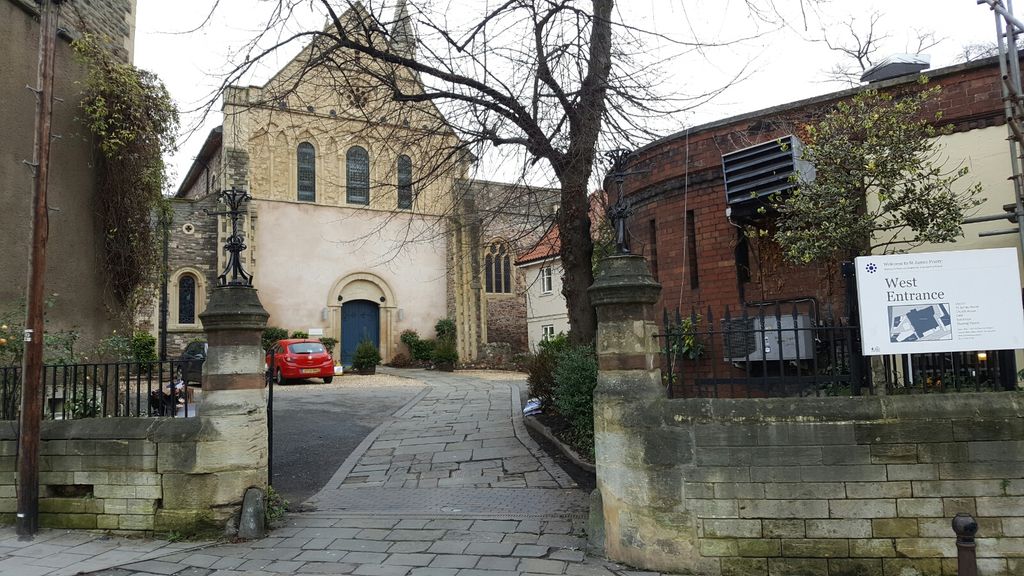
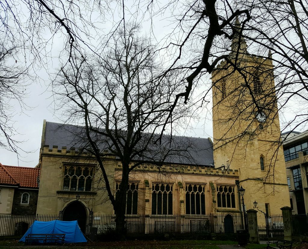
| Description | : | The Priory Church of St James, Bristol is a Grade I listed building. The Priory was founded by Robert de Caen (Robert of Gloucester) in 1129 as a Benedictine priory. Legend has it that every 10th stone brought from Normandy to build the Castle was set aside to build the Priory, and now that the castle has vanished these stones are like an echo from 800 years ago. |
frequently asked questions (FAQ):
-
Where is St. James Priory?
St. James Priory is located at Horsefair, Whitson Street Bristol, Bristol Unitary Authority ,Bristol ,England.
-
St. James Priory cemetery's updated grave count on graveviews.com?
0 memorials
-
Where are the coordinates of the St. James Priory?
Latitude: 51.4585220
Longitude: -2.5936690
Nearby Cemetories:
1. St. James Churchyard
Bristol, Bristol Unitary Authority, England
Coordinate: 51.4585510, -2.5932310
2. Broadmead Baptist Church
Bristol, Bristol Unitary Authority, England
Coordinate: 51.4575500, -2.5915500
3. Church of St John the Baptist
Bristol, Bristol Unitary Authority, England
Coordinate: 51.4559460, -2.5950320
4. Holy Trinity Church
Bristol, Bristol Unitary Authority, England
Coordinate: 51.4559548, -2.5915587
5. St. Michael on the Mount Without Churchyard
Bristol, Bristol Unitary Authority, England
Coordinate: 51.4571510, -2.5984070
6. All Saints Church
Bristol, Bristol Unitary Authority, England
Coordinate: 51.4546990, -2.5932550
7. Black Friars Priory
Bristol, Bristol Unitary Authority, England
Coordinate: 51.4572220, -2.5877780
8. Quakers Friars Burial Ground
Bristol, Bristol Unitary Authority, England
Coordinate: 51.4572220, -2.5877780
9. St. Peter's Churchyard
Bristol, Bristol Unitary Authority, England
Coordinate: 51.4553560, -2.5896930
10. Brunswick Square Unitarian Burying Ground
Bristol, Bristol Unitary Authority, England
Coordinate: 51.4605400, -2.5877800
11. St Nicholas Churchyard
Bristol, Bristol Unitary Authority, England
Coordinate: 51.4539170, -2.5923050
12. Whitfield's Tabernacle
St Pauls, Bristol Unitary Authority, England
Coordinate: 51.4579500, -2.5860800
13. St Stephen's Churchyard
Bristol, Bristol Unitary Authority, England
Coordinate: 51.4535380, -2.5937270
14. St Pauls Churchyard
Bristol, Bristol Unitary Authority, England
Coordinate: 51.4611550, -2.5847190
15. Redcross Street Burial Ground (Defunct)
Bristol Unitary Authority, England
Coordinate: 51.4563073, -2.5833100
16. St. Mark's Church
Bristol, Bristol Unitary Authority, England
Coordinate: 51.4528770, -2.5999610
17. St Philip and St Jacob Churchyard
Bristol, Bristol Unitary Authority, England
Coordinate: 51.4545420, -2.5844690
18. Temple Church Churchyard
Redcliffe, Bristol Unitary Authority, England
Coordinate: 51.4521160, -2.5867630
19. Temple Churchyard
Bristol, Bristol Unitary Authority, England
Coordinate: 51.4520010, -2.5868870
20. Bristol Cathedral
Bristol, Bristol Unitary Authority, England
Coordinate: 51.4517059, -2.6007321
21. Quaker Burial Ground
Redcliffe, Bristol Unitary Authority, England
Coordinate: 51.4486700, -2.5905900
22. St Mary the Virgin Churchyard
Redcliffe, Bristol Unitary Authority, England
Coordinate: 51.4482800, -2.5895460
23. Holy Trinity Church
St Phillips, Bristol Unitary Authority, England
Coordinate: 51.4580335, -2.5760701
24. Barton Road Jewish Cemetery
St Phillips, Bristol Unitary Authority, England
Coordinate: 51.4531400, -2.5779800