
| Memorials | : | 164 |
| Location | : | Litchfield, Basingstoke and Deane Borough, England |
| Coordinate | : | 51.2832730, -1.3396450 |
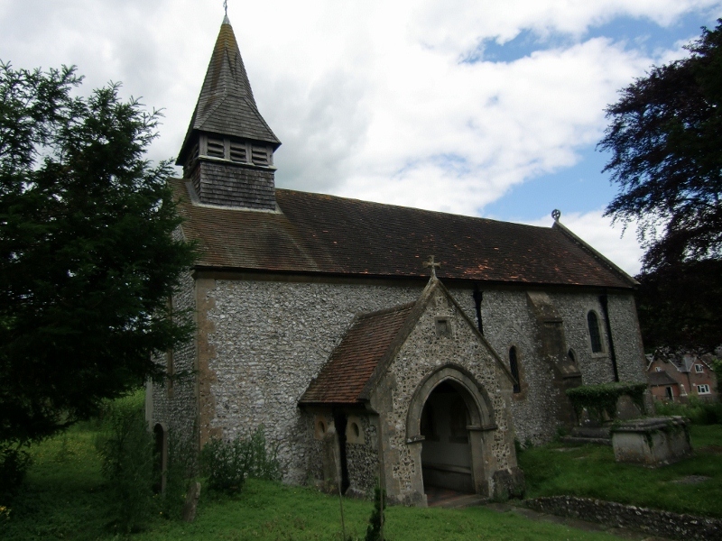
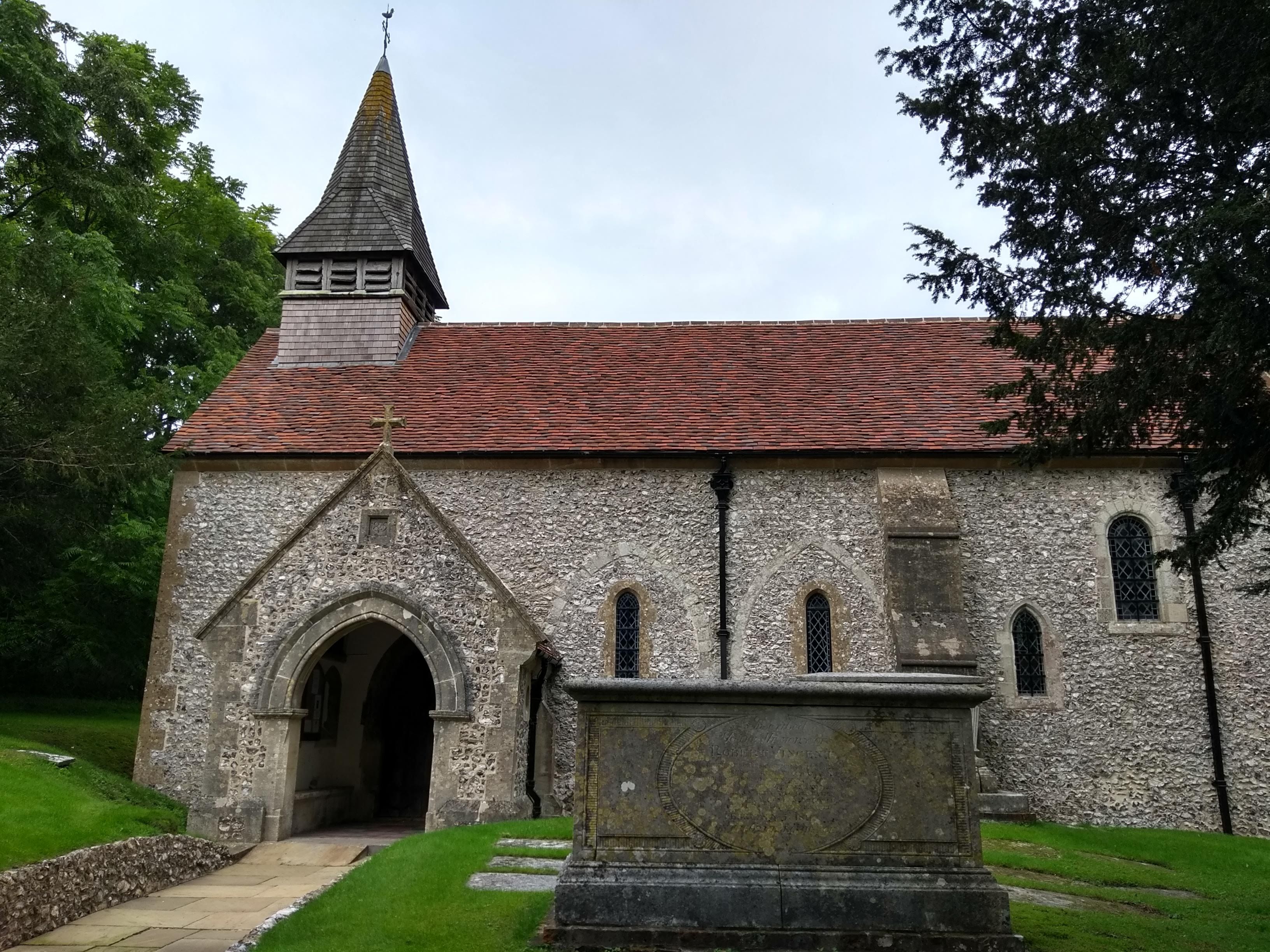
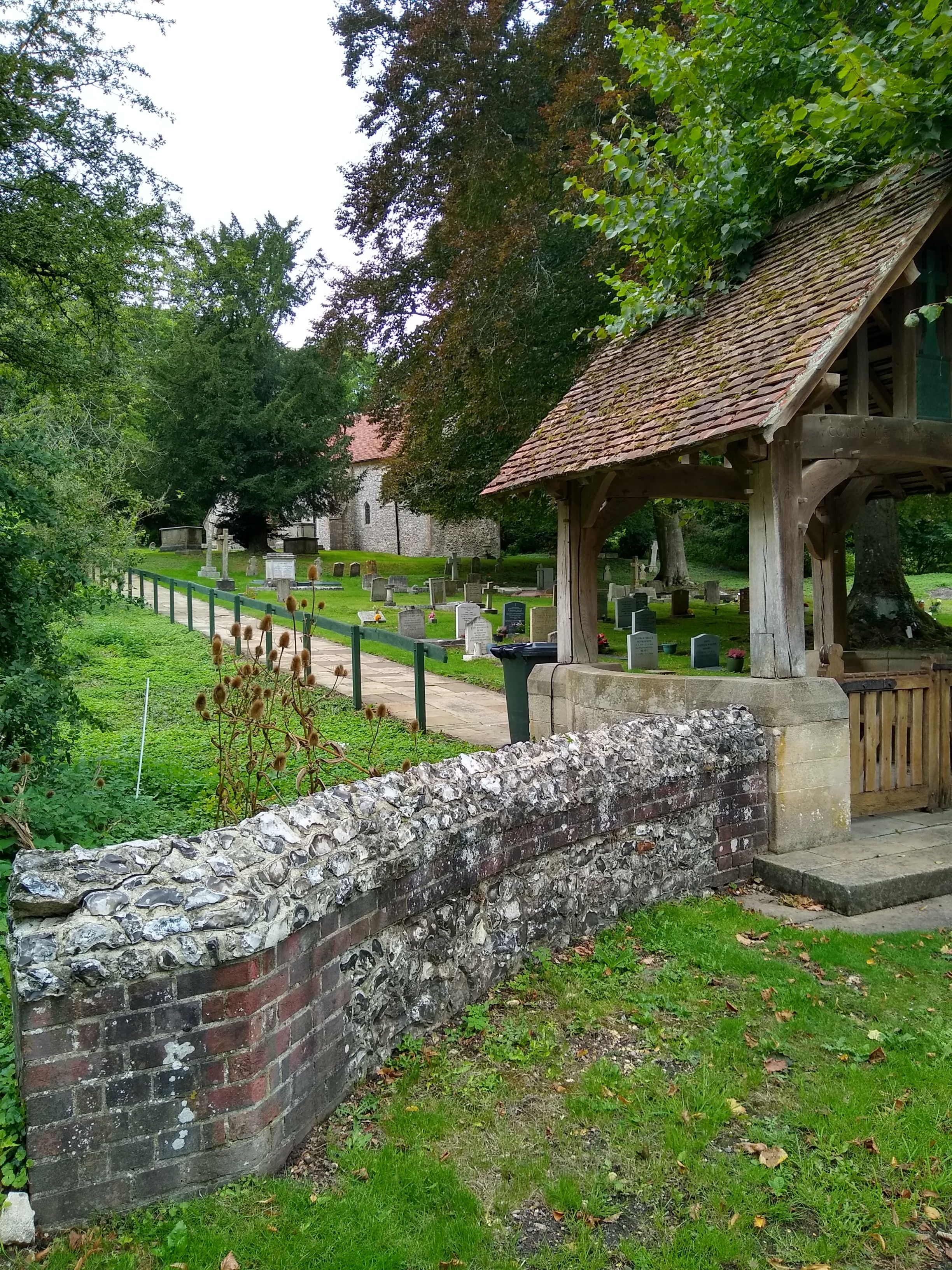
| Description | : | St. James the Less, Litchfield, Hampshire has a belfry and a small spire. The church is of Victorian build with some parts dating back to 1200. The quiet village of Litchfield is located near the A34 trunk road between Winchester to the south and Newbury to the north. |
frequently asked questions (FAQ):
-
Where is St. James the Less Churchyard?
St. James the Less Churchyard is located at Main Road Litchfield, Basingstoke and Deane Borough ,Hampshire , RG28 7PTEngland.
-
St. James the Less Churchyard cemetery's updated grave count on graveviews.com?
164 memorials
-
Where are the coordinates of the St. James the Less Churchyard?
Latitude: 51.2832730
Longitude: -1.3396450
Nearby Cemetories:
1. St James Churchyard
Lower Woodcott, Basingstoke and Deane Borough, England
Coordinate: 51.2915300, -1.3813600
2. Beacon Hill
Highclere, Basingstoke and Deane Borough, England
Coordinate: 51.3126090, -1.3467130
3. Highclere Stud Equine Cemetery
Burghclere, Basingstoke and Deane Borough, England
Coordinate: 51.3125000, -1.3588400
4. All Saints Churchyard
Old Burghclere, Basingstoke and Deane Borough, England
Coordinate: 51.3181600, -1.3290300
5. St Michael and All Angels Churchyard
Crux Easton, Basingstoke and Deane Borough, England
Coordinate: 51.3037600, -1.3918900
6. Breach Farm Woodland Burial Ground
Andover, Test Valley Borough, England
Coordinate: 51.2535050, -1.3952130
7. St Peter Churchyard
St Mary Bourne, Basingstoke and Deane Borough, England
Coordinate: 51.2501700, -1.3961300
8. Highclere Cemetery
Highclere, Basingstoke and Deane Borough, England
Coordinate: 51.3319240, -1.3625700
9. St James Churchyard
Ashmansworth, Basingstoke and Deane Borough, England
Coordinate: 51.3071600, -1.4122600
10. St. Mary's Churchyard
Laverstoke, Basingstoke and Deane Borough, England
Coordinate: 51.2367500, -1.3033800
11. St. Nicholas' Churchyard
Freefolk, Basingstoke and Deane Borough, England
Coordinate: 51.2348000, -1.3039100
12. All Hallows Churchyard
Whitchurch, Basingstoke and Deane Borough, England
Coordinate: 51.2270580, -1.3427600
13. Whitchurch Cemetery
Whitchurch, Basingstoke and Deane Borough, England
Coordinate: 51.2270150, -1.3456120
14. Overton Cemetery
Overton, Basingstoke and Deane Borough, England
Coordinate: 51.2479600, -1.2638100
15. St. Mary's Churchyard
Overton, Basingstoke and Deane Borough, England
Coordinate: 51.2465600, -1.2639000
16. St Lawrence Churchyard
Ecchinswell, Basingstoke and Deane Borough, England
Coordinate: 51.3356400, -1.2821600
17. Church of the Ascension Churchyard
Burghclere, Basingstoke and Deane Borough, England
Coordinate: 51.3466000, -1.3269200
18. St Mary Churchyard
Tufton, Basingstoke and Deane Borough, England
Coordinate: 51.2185300, -1.3463600
19. St. Andrew's Churchyard
Hurstbourne Priors, Basingstoke and Deane Borough, England
Coordinate: 51.2174800, -1.3729100
20. St Peter Churchyard
Hurstbourne Tarrant, Test Valley Borough, England
Coordinate: 51.2746300, -1.4492700
21. All Saints Churchyard
Hannington, Basingstoke and Deane Borough, England
Coordinate: 51.2956100, -1.2285200
22. St Mary Churchyard
Kingsclere, Basingstoke and Deane Borough, England
Coordinate: 51.3244900, -1.2474000
23. Holy Trinity and St. Andrew's Churchyard
Ashe, Basingstoke and Deane Borough, England
Coordinate: 51.2472000, -1.2375000
24. St Barnabas Churchyard
Faccombe, Test Valley Borough, England
Coordinate: 51.3204100, -1.4415400