
| Memorials | : | 21 |
| Location | : | Faccombe, Test Valley Borough, England |
| Coordinate | : | 51.3204100, -1.4415400 |
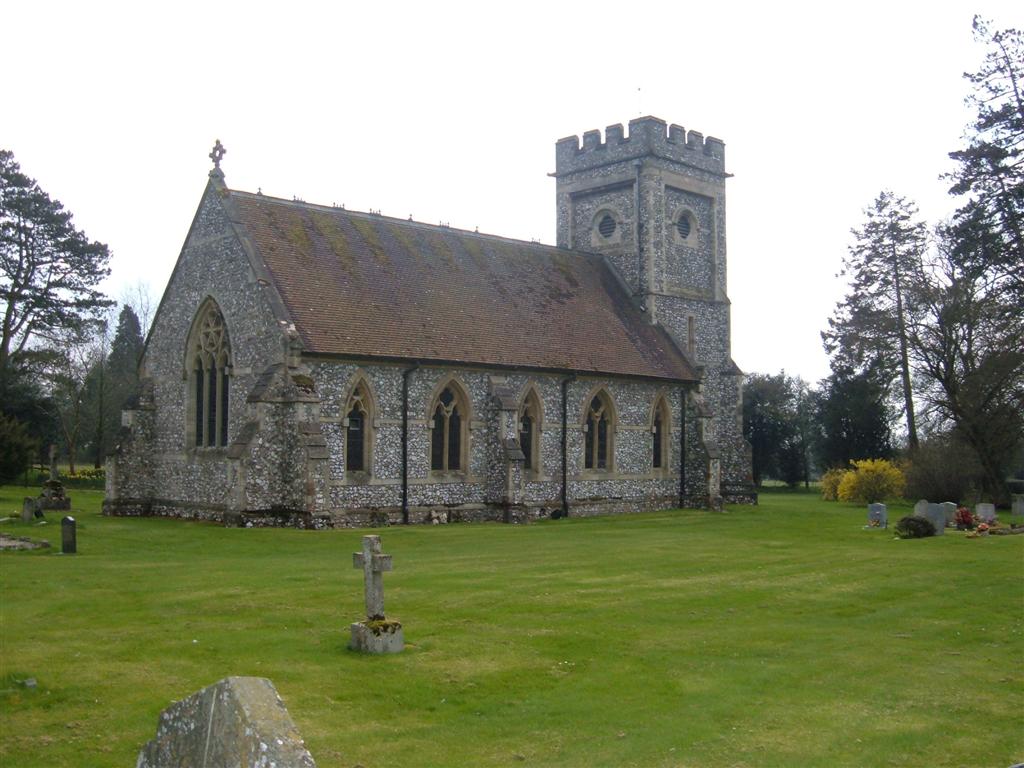
| Description | : | This is the site of the second church and churchyard built for the Netherton-Faccombe parish. The original parish church and churchyard, dedicated to St Michael, were located in the nearby hamlet of Netherton. St Barnabas was opened in 1866 and parish registers for St Michael were transferred to the St Barnabas parish at that time. The burial register dates from 1586 and is held at the Hampshire Archives. Entries in the register prior to 1866 will generally represent burials that took place in the St Michael Churchyard with subsequent burials occurring in the St Barnabas Churchyard. A number of original... Read More |
frequently asked questions (FAQ):
-
Where is St Barnabas Churchyard?
St Barnabas Churchyard is located at Faccombe, Test Valley Borough ,Hampshire , SP11 0DSEngland.
-
St Barnabas Churchyard cemetery's updated grave count on graveviews.com?
21 memorials
-
Where are the coordinates of the St Barnabas Churchyard?
Latitude: 51.3204100
Longitude: -1.4415400
Nearby Cemetories:
1. St Michael Cemetery
Netherton, Test Valley Borough, England
Coordinate: 51.3175780, -1.4622810
2. St James Churchyard
Ashmansworth, Basingstoke and Deane Borough, England
Coordinate: 51.3071600, -1.4122600
3. St Peter Churchyard
Linkenholt, Test Valley Borough, England
Coordinate: 51.3205900, -1.4798200
4. Saint Swithun Churchyard
Combe, West Berkshire Unitary Authority, England
Coordinate: 51.3445800, -1.4728000
5. St. Martin's Churchyard
East Woodhay, Basingstoke and Deane Borough, England
Coordinate: 51.3511800, -1.4188700
6. St Michael and All Angels Churchyard
Crux Easton, Basingstoke and Deane Borough, England
Coordinate: 51.3037600, -1.3918900
7. St Mary the Virgin Churchyard
Vernham Dean, Test Valley Borough, England
Coordinate: 51.3105630, -1.4994880
8. West Woodhay Churchyard
West Woodhay, West Berkshire Unitary Authority, England
Coordinate: 51.3637960, -1.4385220
9. St Peter Churchyard
Hurstbourne Tarrant, Test Valley Borough, England
Coordinate: 51.2746300, -1.4492700
10. St James Churchyard
Lower Woodcott, Basingstoke and Deane Borough, England
Coordinate: 51.2915300, -1.3813600
11. St. Thomas Churchyard
Woolton Hill, Basingstoke and Deane Borough, England
Coordinate: 51.3517900, -1.3841060
12. St. James the Great
Buttermere, Wiltshire Unitary Authority, England
Coordinate: 51.3475000, -1.5090000
13. Highclere Cemetery
Highclere, Basingstoke and Deane Borough, England
Coordinate: 51.3319240, -1.3625700
14. Highclere Stud Equine Cemetery
Burghclere, Basingstoke and Deane Borough, England
Coordinate: 51.3125000, -1.3588400
15. Cerdicesbeorg
Hurstbourne Tarrant, Test Valley Borough, England
Coordinate: 51.2735869, -1.4813578
16. St. Michael's Churchyard
Inkpen, West Berkshire Unitary Authority, England
Coordinate: 51.3722999, -1.4877492
17. Beacon Hill
Highclere, Basingstoke and Deane Borough, England
Coordinate: 51.3126090, -1.3467130
18. All Saints Churchyard
Old Burghclere, Basingstoke and Deane Borough, England
Coordinate: 51.3181600, -1.3290300
19. St. Thomas of Canterbury Churchyard
Tangley, Test Valley Borough, England
Coordinate: 51.2701840, -1.5224740
20. Breach Farm Woodland Burial Ground
Andover, Test Valley Borough, England
Coordinate: 51.2535050, -1.3952130
21. St. James the Less Churchyard
Litchfield, Basingstoke and Deane Borough, England
Coordinate: 51.2832730, -1.3396450
22. St Peter Churchyard
St Mary Bourne, Basingstoke and Deane Borough, England
Coordinate: 51.2501700, -1.3961300
23. Church of the Ascension Churchyard
Burghclere, Basingstoke and Deane Borough, England
Coordinate: 51.3466000, -1.3269200
24. St. Michael and All Angels Churchyard
Enborne, West Berkshire Unitary Authority, England
Coordinate: 51.3893860, -1.3751660