
| Memorials | : | 35 |
| Location | : | Burghclere, Basingstoke and Deane Borough, England |
| Coordinate | : | 51.3466000, -1.3269200 |
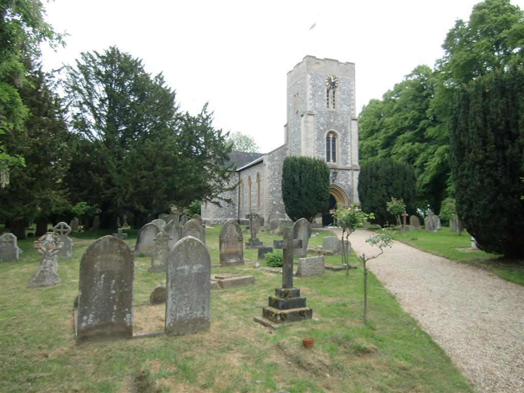
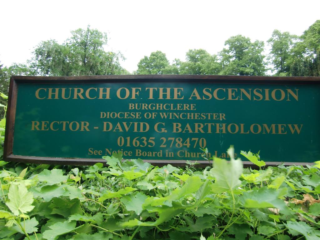
| Description | : | Church of the Ascension : Harts Lane, Burghclere, Hampshire, RG20 9LN |
frequently asked questions (FAQ):
-
Where is Church of the Ascension Churchyard?
Church of the Ascension Churchyard is located at Harts Lane Burghclere, Basingstoke and Deane Borough ,Hampshire , RG20 9LNEngland.
-
Church of the Ascension Churchyard cemetery's updated grave count on graveviews.com?
35 memorials
-
Where are the coordinates of the Church of the Ascension Churchyard?
Latitude: 51.3466000
Longitude: -1.3269200
Nearby Cemetories:
1. St Mary and St John the Baptist Churchyard
Newtown, Basingstoke and Deane Borough, England
Coordinate: 51.3702000, -1.3169200
2. Highclere Cemetery
Highclere, Basingstoke and Deane Borough, England
Coordinate: 51.3319240, -1.3625700
3. All Saints Churchyard
Old Burghclere, Basingstoke and Deane Borough, England
Coordinate: 51.3181600, -1.3290300
4. St Lawrence Churchyard
Ecchinswell, Basingstoke and Deane Borough, England
Coordinate: 51.3356400, -1.2821600
5. St. Thomas Churchyard
Woolton Hill, Basingstoke and Deane Borough, England
Coordinate: 51.3517900, -1.3841060
6. Beacon Hill
Highclere, Basingstoke and Deane Borough, England
Coordinate: 51.3126090, -1.3467130
7. Highclere Stud Equine Cemetery
Burghclere, Basingstoke and Deane Borough, England
Coordinate: 51.3125000, -1.3588400
8. St Peter Churchyard
Headley, Basingstoke and Deane Borough, England
Coordinate: 51.3601370, -1.2620360
9. St Mary the Virgin Churchyard
Greenham, West Berkshire Unitary Authority, England
Coordinate: 51.3883350, -1.3030280
10. Newtown Road Cemetery
Newbury, West Berkshire Unitary Authority, England
Coordinate: 51.3924300, -1.3252900
11. Newbury Friends Burial Ground (Defunct)
Reading Borough, England
Coordinate: 51.3987240, -1.3228830
12. St. Michael and All Angels Churchyard
Enborne, West Berkshire Unitary Authority, England
Coordinate: 51.3893860, -1.3751660
13. St Mary Churchyard
Kingsclere, Basingstoke and Deane Borough, England
Coordinate: 51.3244900, -1.2474000
14. St Nicolas Churchyard
Newbury, West Berkshire Unitary Authority, England
Coordinate: 51.4009920, -1.3248370
15. St. Martin's Churchyard
East Woodhay, Basingstoke and Deane Borough, England
Coordinate: 51.3511800, -1.4188700
16. St Michael and All Angels Churchyard
Crux Easton, Basingstoke and Deane Borough, England
Coordinate: 51.3037600, -1.3918900
17. St. Mary the Virgin Churchyard
Speen, West Berkshire Unitary Authority, England
Coordinate: 51.4076540, -1.3469800
18. St. James the Less Churchyard
Litchfield, Basingstoke and Deane Borough, England
Coordinate: 51.2832730, -1.3396450
19. St James Churchyard
Lower Woodcott, Basingstoke and Deane Borough, England
Coordinate: 51.2915300, -1.3813600
20. Shaw St Marys Churchyard
Newbury, West Berkshire Unitary Authority, England
Coordinate: 51.4116940, -1.3186810
21. St James Churchyard
Ashmansworth, Basingstoke and Deane Borough, England
Coordinate: 51.3071600, -1.4122600
22. St Mary Churchyard
Hamstead Marshall, West Berkshire Unitary Authority, England
Coordinate: 51.3981940, -1.3977010
23. Shaw Cemetery
Newbury, West Berkshire Unitary Authority, England
Coordinate: 51.4138160, -1.3106410
24. St Mary's
Thatcham, West Berkshire Unitary Authority, England
Coordinate: 51.4017420, -1.2591060