
| Memorials | : | 189 |
| Location | : | Padiham, Burnley Borough, England |
| Website | : | www.burnley.gov.uk/residents/bereavement-services/location-cemeteries-and-crematorium |
| Coordinate | : | 53.7948720, -2.3145290 |
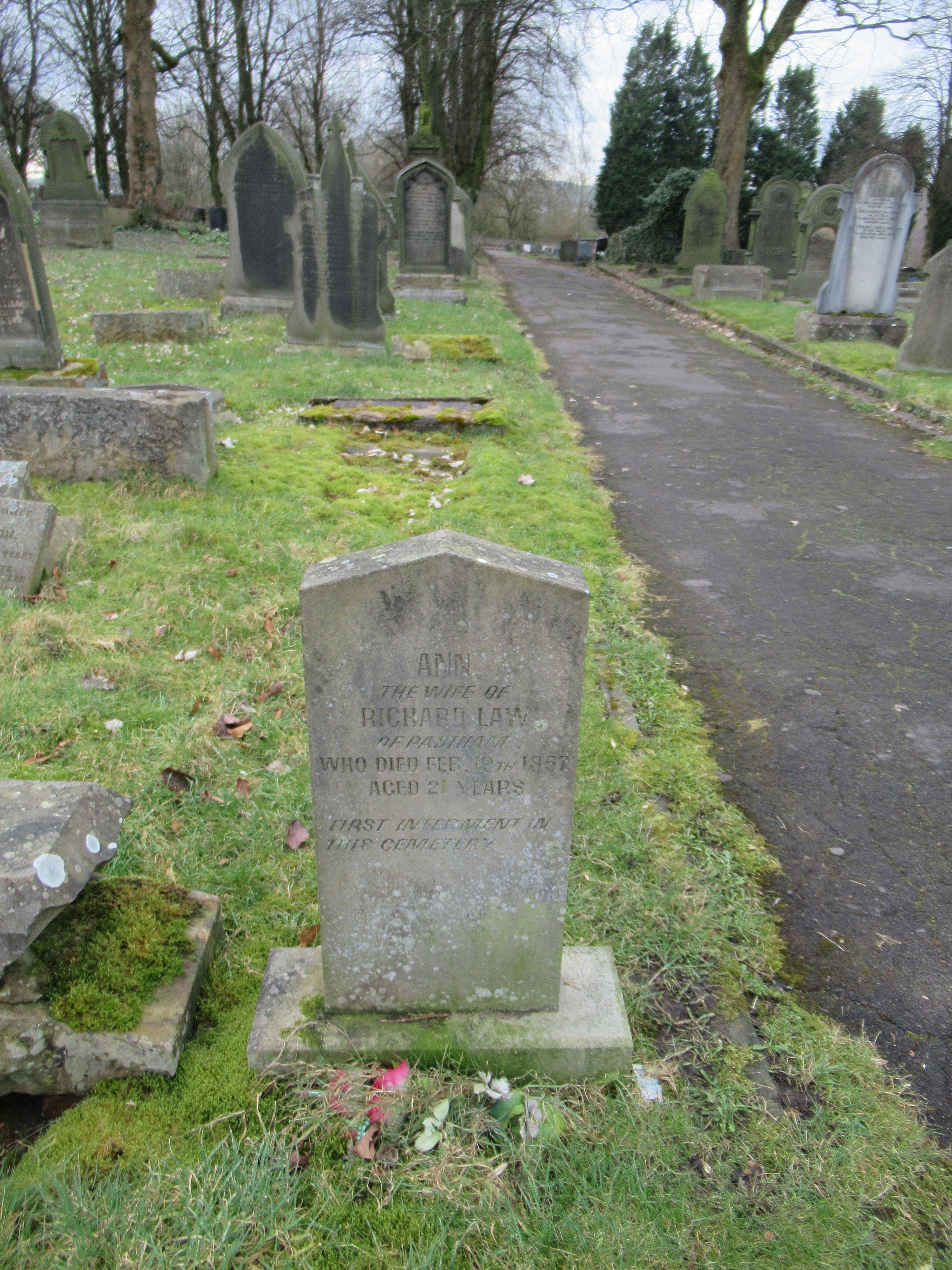
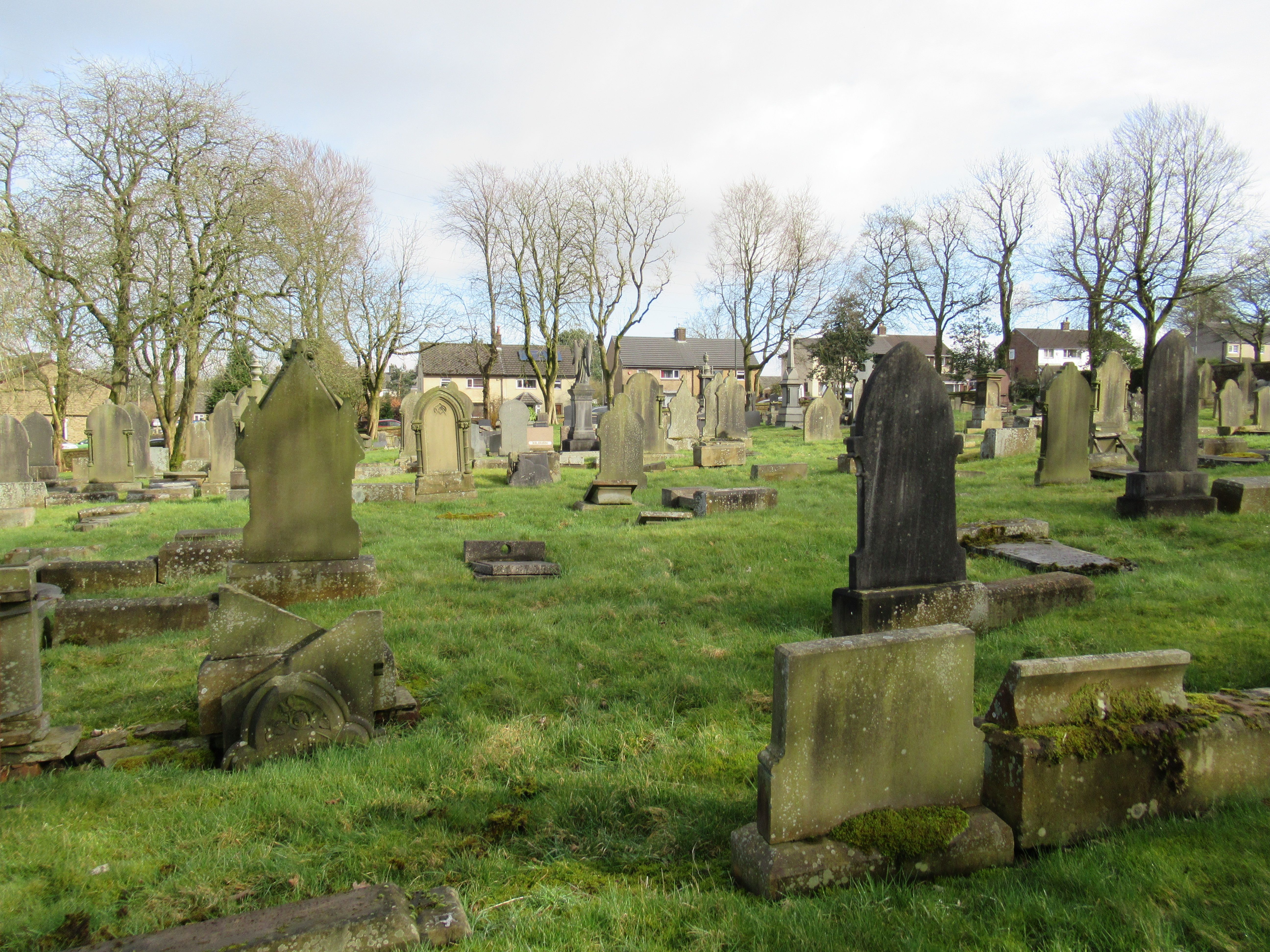
| Description | : | Padiham Public Cemetery, St John's Road, Padiham is located at OS Grid Reference - SD 793332. It was opened on 23 Feb 1857. New graves are still available to purchase. The entries for 1857-1872 are on loose sheets and do not have a Burial number. In March 1872 a preprinted book was introduced with the Burial number starting at 887. |
frequently asked questions (FAQ):
-
Where is St. John's Cemetery?
St. John's Cemetery is located at St. John’s Road Padiham, Burnley Borough ,Lancashire , BB12 7BNEngland.
-
St. John's Cemetery cemetery's updated grave count on graveviews.com?
189 memorials
-
Where are the coordinates of the St. John's Cemetery?
Latitude: 53.7948720
Longitude: -2.3145290
Nearby Cemetories:
1. St Leonard Churchyard Extension
Padiham, Burnley Borough, England
Coordinate: 53.7991800, -2.3222000
2. Wesleyan Methodist Chapel Chapelyard
Padiham, Burnley Borough, England
Coordinate: 53.8018980, -2.3181730
3. St. Leonard's Churchyard
Padiham, Burnley Borough, England
Coordinate: 53.8022600, -2.3164300
4. All Saints Churchyard
Habergham Eaves, Burnley Borough, England
Coordinate: 53.7971060, -2.2913770
5. St Margaret Churchyard
Hapton, Burnley Borough, England
Coordinate: 53.7802400, -2.3169230
6. St James Church
Altham, Hyndburn Borough, England
Coordinate: 53.7928940, -2.3465250
7. Burnley Cemetery
Burnley, Burnley Borough, England
Coordinate: 53.7821730, -2.2795070
8. Burnley Crematorium
Burnley, Burnley Borough, England
Coordinate: 53.7821730, -2.2795070
9. St. John's Churchyard
Read, Ribble Valley Borough, England
Coordinate: 53.8088800, -2.3585600
10. St John Churchyard
Higham, Pendle Borough, England
Coordinate: 53.8251420, -2.2898120
11. Holy Trinity Churchyard
Burnley, Burnley Borough, England
Coordinate: 53.7898290, -2.2574200
12. St Marys Burial Ground
Clayton-le-Moors, Hyndburn Borough, England
Coordinate: 53.7792778, -2.3705871
13. Accrington Cemetery and Crematorium
Accrington, Hyndburn Borough, England
Coordinate: 53.7623787, -2.3508649
14. St. James' Churchyard
Burnley, Burnley Borough, England
Coordinate: 53.7905590, -2.2458280
15. Saint Nicholas Parish Churchyard
Sabden, Ribble Valley Borough, England
Coordinate: 53.8346503, -2.3332764
16. Ebenezer Baptist Chapel Chapelyard
Burnley, Burnley Borough, England
Coordinate: 53.7975120, -2.2397260
17. St. Peter's Churchyard
Burnley, Burnley Borough, England
Coordinate: 53.7924450, -2.2394890
18. St. Anne Churchyard
Fence, Pendle Borough, England
Coordinate: 53.8304372, -2.2679552
19. Barnes Square Weslyan Methodist Churchyard
Clayton-le-Moors, Hyndburn Borough, England
Coordinate: 53.7744350, -2.3853800
20. All Saints Churchyard
Clayton-le-Moors, Hyndburn Borough, England
Coordinate: 53.7738520, -2.3881690
21. Church and Clayton-le-Moors Cemetery
Accrington, Hyndburn Borough, England
Coordinate: 53.7630200, -2.3804820
22. Wheatley Lane Methodist Churchyard
Fence, Pendle Borough, England
Coordinate: 53.8341457, -2.2596202
23. Our Lady and Saint Hubert
Great Harwood, Hyndburn Borough, England
Coordinate: 53.7851070, -2.4009760
24. St. James' Parish Church
Accrington, Hyndburn Borough, England
Coordinate: 53.7519900, -2.3652600