
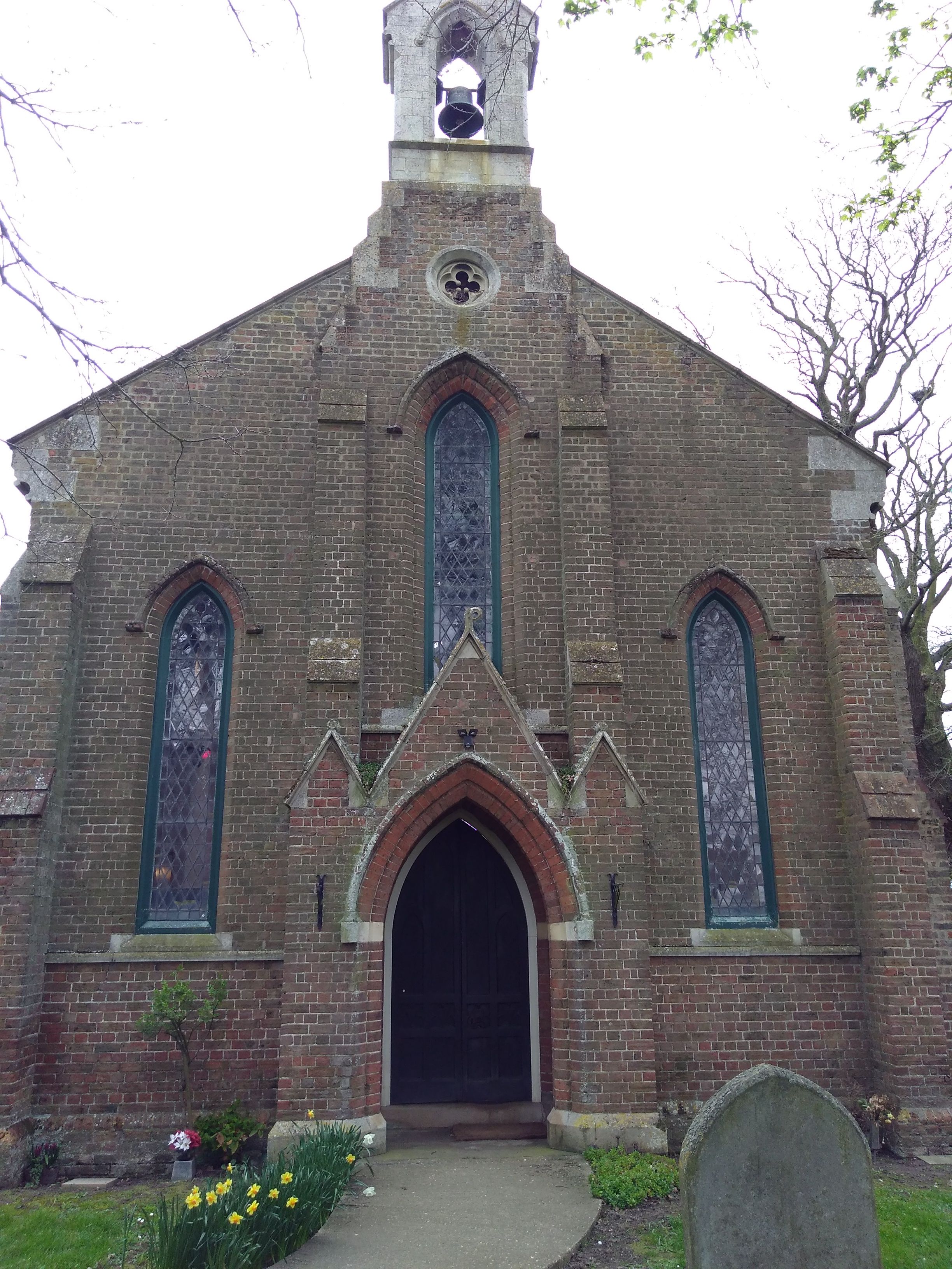
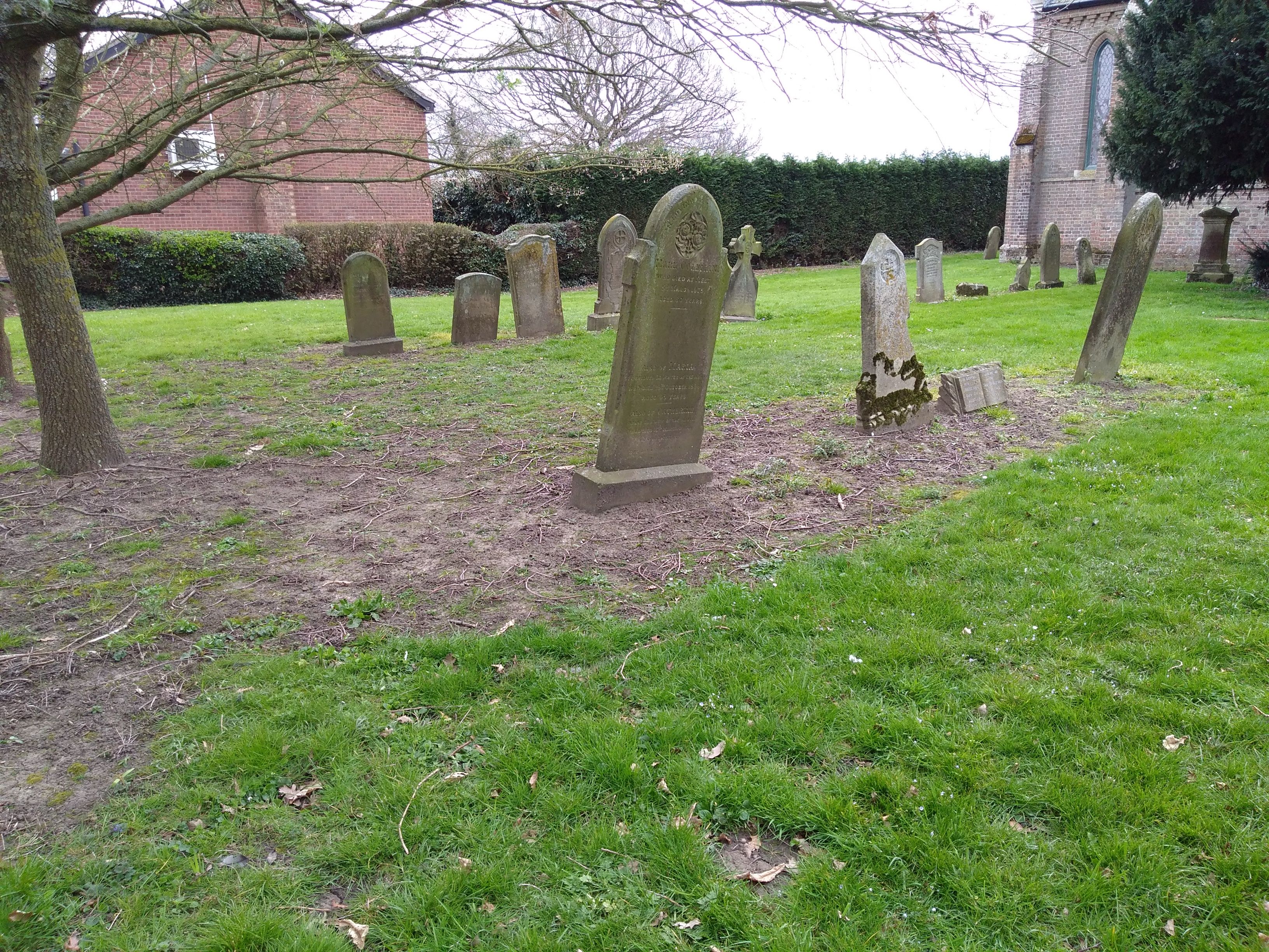
| Memorials | : | 43 |
| Location | : | Holbeach, South Holland District, England |
| Coordinate | : | 52.7457510, -0.0024000 |
frequently asked questions (FAQ):
-
Where is St. John's Churchyard?
St. John's Churchyard is located at Holbeach, South Holland District ,Lincolnshire ,England.
-
St. John's Churchyard cemetery's updated grave count on graveviews.com?
43 memorials
-
Where are the coordinates of the St. John's Churchyard?
Latitude: 52.7457510
Longitude: -0.0024000


Nearby Cemetories:
1. St. John the Baptist Churchyard
Whaplode Drove, South Holland District, England
Coordinate: 52.7034435, -0.0476688
2. St. Mary's Churchyard
Whaplode, South Holland District, England
Coordinate: 52.7974840, -0.0385520
3. Whaplode Cemetery
Whaplode, South Holland District, England
Coordinate: 52.8016190, -0.0281347
4. All Saints Churchyard
Holbeach, South Holland District, England
Coordinate: 52.8036140, 0.0142530
5. St. Mary Magdalene Churchyard
Fleet, South Holland District, England
Coordinate: 52.7928490, 0.0582900
6. Holbeach Cemetery
Holbeach, South Holland District, England
Coordinate: 52.8062100, 0.0171500
7. Holy Trinity Churchyard
Gedney Hill, South Holland District, England
Coordinate: 52.6826080, -0.0211840
8. All Saints Churchyard
Moulton, South Holland District, England
Coordinate: 52.7990056, -0.0629691
9. Moulton Cemetery
Moulton, South Holland District, England
Coordinate: 52.8017000, -0.0632400
10. St. Giles' Churchyard
Tydd St Giles, Fenland District, England
Coordinate: 52.7269470, 0.1118120
11. St Mary Magdalene Churchyard
Gedney, South Holland District, England
Coordinate: 52.7984900, 0.0791600
12. St. Mary's Cemetery
Weston, South Holland District, England
Coordinate: 52.8078662, -0.0809039
13. St Paul Churchyard
Gorefield, Fenland District, England
Coordinate: 52.6873400, 0.0944700
14. Long Sutton Baptist Churchyard
Long Sutton, South Holland District, England
Coordinate: 52.7837460, 0.1204960
15. Gorefield Congregational Churchyard
Gorefield, Fenland District, England
Coordinate: 52.6865500, 0.0968700
16. St. Mary's Churchyard
Long Sutton, South Holland District, England
Coordinate: 52.7844700, 0.1221800
17. St. Mary Churchyard
Tydd St Mary, South Holland District, England
Coordinate: 52.7456600, 0.1404600
18. St. Luke's Churchyard
Holbeach Hurn, South Holland District, England
Coordinate: 52.8231700, 0.0653600
19. Long Sutton Cemetery
Long Sutton, South Holland District, England
Coordinate: 52.7848300, 0.1272300
20. Emmanual Anglican Cemetery
Parson Drove, Fenland District, England
Coordinate: 52.6574955, 0.0285929
21. St Paul's Churchyard
Spalding, South Holland District, England
Coordinate: 52.7969559, -0.1305557
22. St Nicholas Churchyard
Lutton, South Holland District, England
Coordinate: 52.8085300, 0.1246500
23. Spalding Cemetery
Spalding, South Holland District, England
Coordinate: 52.7954960, -0.1519390
24. St Mary Churchyard
Wisbech St Mary, Fenland District, England
Coordinate: 52.6523950, 0.0983170