
| Memorials | : | 0 |
| Location | : | Littlehempston, South Hams District, England |
| Coordinate | : | 50.4515000, -3.6741000 |
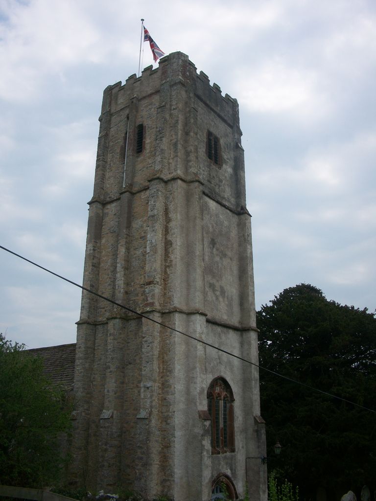
| Description | : | St. John the Baptist. The church was rebuilt in 1439 and consists of chancel, nave, north and south aisles, south porch with parvise over it, and embattled west tower with four bells, the first dated 1847, the second and fifth 1700, the remaining two are early bells with legends in Old English characters. The chancel retains a piscina with shelf, and also the ancient priest's doorway. |
frequently asked questions (FAQ):
-
Where is St John the Baptist Church?
St John the Baptist Church is located at Grattons Lane Littlehempston, South Hams District ,Devon , TQ9 6LYEngland.
-
St John the Baptist Church cemetery's updated grave count on graveviews.com?
0 memorials
-
Where are the coordinates of the St John the Baptist Church?
Latitude: 50.4515000
Longitude: -3.6741000
Nearby Cemetories:
1. St. Mary the Virgin Churchyard
Berry Pomeroy, South Hams District, England
Coordinate: 50.4368790, -3.6505430
2. Totnes Priory
Totnes, South Hams District, England
Coordinate: 50.4318610, -3.6878700
3. St. Mary's Churchyard
Totnes, South Hams District, England
Coordinate: 50.4318190, -3.6877720
4. St. John the Evangelist
Bridgetown, South Hams District, England
Coordinate: 50.4295400, -3.6789000
5. St. Mary's Churchyard
Dartington, South Hams District, England
Coordinate: 50.4511400, -3.7123700
6. St. Andrew Churchyard
Ipplepen, Teignbridge District, England
Coordinate: 50.4872610, -3.6443980
7. St Andrew Churchyard
Harberton, South Hams District, England
Coordinate: 50.4149440, -3.7209660
8. St Matthew's Churchyard
Landscove, South Hams District, England
Coordinate: 50.4842200, -3.7284000
9. St. John the Baptist Churchyard
Marldon, South Hams District, England
Coordinate: 50.4608700, -3.5984100
10. St David's Churchyard
Ashprington, South Hams District, England
Coordinate: 50.4023200, -3.6637600
11. St Mary the Virgin Churchyard
Collaton St Mary, Torbay Unitary Authority, England
Coordinate: 50.4304300, -3.6005090
12. St Mary the Virgin Churchyard
Denbury, Teignbridge District, England
Coordinate: 50.5075930, -3.6602590
13. St Mary & St Gabriel Churchyard
Stoke Gabriel, South Hams District, England
Coordinate: 50.4027900, -3.6207100
14. Paignton Cemetery
Paignton, Torbay Unitary Authority, England
Coordinate: 50.4360560, -3.5821130
15. St Peter Churchyard
Harbertonford, South Hams District, England
Coordinate: 50.3931400, -3.7127600
16. Cornworthy Parish Chapel Church
Cornworthy, South Hams District, England
Coordinate: 50.3880000, -3.6583000
17. St Mary the Virgin Churchyard
Abbotskerswell, Teignbridge District, England
Coordinate: 50.5073360, -3.6147140
18. Bidwell Woodland Natural Burial Ground
Rattery, South Hams District, England
Coordinate: 50.4418160, -3.7799990
19. St. John The Baptist Churchyard
Paignton, Torbay Unitary Authority, England
Coordinate: 50.4368000, -3.5693300
20. St Bartholomew Parish Churchyard
Ogwell, Teignbridge District, England
Coordinate: 50.5188100, -3.6401400
21. Holy Trinity Churchyard
Buckfastleigh, Teignbridge District, England
Coordinate: 50.4852300, -3.7755900
22. St. Mary's Churchyard
Kingskerswell, Torbay Unitary Authority, England
Coordinate: 50.4992800, -3.5862190
23. St George the Martyr Churchyard
Dean Prior, South Hams District, England
Coordinate: 50.4578890, -3.7902140
24. Newton Abbot Cemetery
Newton Abbot, Teignbridge District, England
Coordinate: 50.5201180, -3.6200730