
| Memorials | : | 0 |
| Location | : | Totnes, South Hams District, England |
| Coordinate | : | 50.4318610, -3.6878700 |
frequently asked questions (FAQ):
-
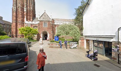
Where is Totnes Priory?
Totnes Priory is located at Totnes, South Hams District ,Devon ,England.
-
Totnes Priory cemetery's updated grave count on graveviews.com?
0 memorials
-
Where are the coordinates of the Totnes Priory?
Latitude: 50.4318610
Longitude: -3.6878700
Nearby Cemetories:
1. St. Mary's Churchyard
Totnes, South Hams District, England
Coordinate: 50.4318190, -3.6877720
2. St. John the Evangelist
Bridgetown, South Hams District, England
Coordinate: 50.4295400, -3.6789000
3. St John the Baptist Church
Littlehempston, South Hams District, England
Coordinate: 50.4515000, -3.6741000
4. St. Mary the Virgin Churchyard
Berry Pomeroy, South Hams District, England
Coordinate: 50.4368790, -3.6505430
5. St. Mary's Churchyard
Dartington, South Hams District, England
Coordinate: 50.4511400, -3.7123700
6. St Andrew Churchyard
Harberton, South Hams District, England
Coordinate: 50.4149440, -3.7209660
7. St David's Churchyard
Ashprington, South Hams District, England
Coordinate: 50.4023200, -3.6637600
8. St Peter Churchyard
Harbertonford, South Hams District, England
Coordinate: 50.3931400, -3.7127600
9. Cornworthy Parish Chapel Church
Cornworthy, South Hams District, England
Coordinate: 50.3880000, -3.6583000
10. St Mary & St Gabriel Churchyard
Stoke Gabriel, South Hams District, England
Coordinate: 50.4027900, -3.6207100
11. St Mary the Virgin Churchyard
Collaton St Mary, Torbay Unitary Authority, England
Coordinate: 50.4304300, -3.6005090
12. St Matthew's Churchyard
Landscove, South Hams District, England
Coordinate: 50.4842200, -3.7284000
13. Bidwell Woodland Natural Burial Ground
Rattery, South Hams District, England
Coordinate: 50.4418160, -3.7799990
14. St. Andrew Churchyard
Ipplepen, Teignbridge District, England
Coordinate: 50.4872610, -3.6443980
15. St. John the Baptist Churchyard
Marldon, South Hams District, England
Coordinate: 50.4608700, -3.5984100
16. Paignton Cemetery
Paignton, Torbay Unitary Authority, England
Coordinate: 50.4360560, -3.5821130
17. St George the Martyr Churchyard
Dean Prior, South Hams District, England
Coordinate: 50.4578890, -3.7902140
18. St Mary's Churchyard
Diptford, South Hams District, England
Coordinate: 50.3966500, -3.7917300
19. St. John The Baptist Churchyard
Paignton, Torbay Unitary Authority, England
Coordinate: 50.4368000, -3.5693300
20. Holy Trinity Churchyard
Buckfastleigh, Teignbridge District, England
Coordinate: 50.4852300, -3.7755900
21. St Mary the Virgin Churchyard
Denbury, Teignbridge District, England
Coordinate: 50.5075930, -3.6602590
22. St. James's Churchyard
South Brent, South Hams District, England
Coordinate: 50.4112991, -3.8121303
23. Buckfast Abbey
Buckfastleigh, Teignbridge District, England
Coordinate: 50.4917800, -3.7767600
24. St Mary the Virgin Churchyard
Abbotskerswell, Teignbridge District, England
Coordinate: 50.5073360, -3.6147140