
| Memorials | : | 23 |
| Location | : | Clacton-on-Sea, Tendring District, England |
| Coordinate | : | 51.8049495, 1.1564588 |
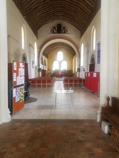
| Description | : | The parish church of St. John the Baptist in the village of Great Clacton dates from the middle of the 12th century. Additional building work took place in the 14th & 15th centuries. The church was restored in the 19th century. The well-maintained churchyard lies to the south & east of the church. |
frequently asked questions (FAQ):
-
Where is St John the Baptist Churchyard?
St John the Baptist Churchyard is located at Clacton-on-Sea, Tendring District ,Essex ,England.
-
St John the Baptist Churchyard cemetery's updated grave count on graveviews.com?
23 memorials
-
Where are the coordinates of the St John the Baptist Churchyard?
Latitude: 51.8049495
Longitude: 1.1564588
Nearby Cemetories:
1. Clacton Cemetery
Clacton-on-Sea, Tendring District, England
Coordinate: 51.8080410, 1.1650260
2. St Osyth Cemetery
St Osyth, Tendring District, England
Coordinate: 51.8051920, 1.0832480
3. All Saints Churchyard
Frinton-on-Sea, Tendring District, England
Coordinate: 51.8287263, 1.2192621
4. St Andrew Churchyard
Weeley, Tendring District, England
Coordinate: 51.8507210, 1.1264710
5. Ss Peter and Paul churchyard
St Osyth, Tendring District, England
Coordinate: 51.7985550, 1.0771640
6. St Osyths Priory
St Osyth, Tendring District, England
Coordinate: 51.7991400, 1.0749050
7. St Michael Churchyard
Thorpe-le-Soken, Tendring District, England
Coordinate: 51.8566770, 1.1631870
8. Kirby Cross Cemetery
Kirby Cross, Tendring District, England
Coordinate: 51.8401820, 1.2181840
9. St Mary Churchyard
Frinton-on-Sea, Tendring District, England
Coordinate: 51.8291690, 1.2453870
10. Weeley Crematorium
Weeley, Tendring District, England
Coordinate: 51.8596020, 1.1097050
11. St Michael Churchyard
Kirby-le-Soken, Tendring District, England
Coordinate: 51.8527210, 1.2214760
12. St. Leonard's Churchyard
Beaumont, Tendring District, England
Coordinate: 51.8778500, 1.1656000
13. St. Edmund King and Martyr Churchyard
Tendring, Tendring District, England
Coordinate: 51.8749900, 1.1123400
14. St Mary Magdalene Churchyard
Thorrington, Tendring District, England
Coordinate: 51.8357310, 1.0446130
15. Walton-on-the-Naze Cemetery
Walton-on-the-Naze, Tendring District, England
Coordinate: 51.8475300, 1.2661800
16. All Saints Churchyard
Walton-on-the-Naze, Tendring District, England
Coordinate: 51.8480900, 1.2663300
17. St. Mary's Churchyard
Little Bentley, Tendring District, England
Coordinate: 51.8824400, 1.0823100
18. All Saints with St. James Churchyard
Brightlingsea, Tendring District, England
Coordinate: 51.8285070, 1.0130530
19. All Saints Churchyard
Great Oakley, Tendring District, England
Coordinate: 51.9013700, 1.1781500
20. Great Oakley Cemetery
Great Oakley, Tendring District, England
Coordinate: 51.9021500, 1.1788900
21. Frating Churchyard
Frating, Tendring District, England
Coordinate: 51.8607700, 1.0225800
22. St. Mary's Churchyard
Wix, Tendring District, England
Coordinate: 51.9180038, 1.1444474
23. St Edmund Churchyard
East Mersea, Colchester Borough, England
Coordinate: 51.7886840, 0.9723200
24. St Mary the Virgin Churchyard
Little Bromley, Tendring District, England
Coordinate: 51.9095300, 1.0401700