
| Memorials | : | 3 |
| Location | : | West Challow, Vale of White Horse District, England |
| Coordinate | : | 51.5920920, -1.4708930 |
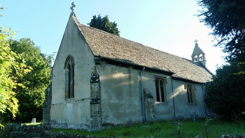
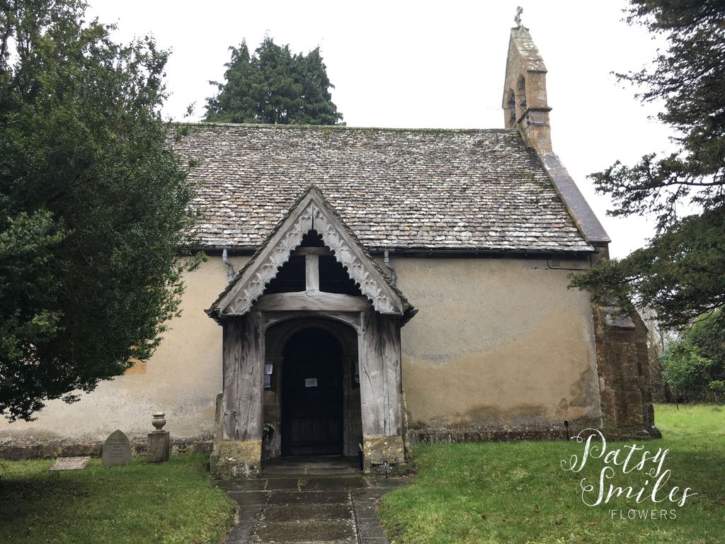
| Description | : | 12th century church with two historic bells. Near to the abandoned Wilts & Berks Canal. It has a nave and chancel, which are structurally undivided, and a North Porch. The walls are of rubble with freestone dressings and are rough-cast externally and plastered within. The roof is of stone shingles. The historical development of the church ranges from the nave in the 12th century to the North Porch in the 15th century. The church has two historical bells - one by Ellis Knight of Reading, 1629, the other by Paul the Potter, circa 1283. It has a relief inscription in... Read More |
frequently asked questions (FAQ):
-
Where is St. Laurence Churchyard?
St. Laurence Churchyard is located at The Glebe, West Challow, Wantage, Oxon West Challow, Vale of White Horse District ,Oxfordshire , OX12 9TJEngland.
-
St. Laurence Churchyard cemetery's updated grave count on graveviews.com?
3 memorials
-
Where are the coordinates of the St. Laurence Churchyard?
Latitude: 51.5920920
Longitude: -1.4708930
Nearby Cemetories:
1. St. Mary's Churchyard
Childrey, Vale of White Horse District, England
Coordinate: 51.5876500, -1.4818600
2. St. Nicholas Churchyard
East Challow, Vale of White Horse District, England
Coordinate: 51.5919480, -1.4518960
3. Vicarage Hill Cemetery
East Challow, Vale of White Horse District, England
Coordinate: 51.5877810, -1.4512553
4. Holy Cross Churchyard
Sparsholt, Vale of White Horse District, England
Coordinate: 51.5857220, -1.5008460
5. St. Andrew Churchyard
Letcombe Regis, Vale of White Horse District, England
Coordinate: 51.5758900, -1.4527800
6. St. Peter and Paul Churchyard
Wantage, Vale of White Horse District, England
Coordinate: 51.5886860, -1.4284970
7. Wantage Baptist Church
Wantage, Vale of White Horse District, England
Coordinate: 51.5892190, -1.4270540
8. St Michael & All Angels Churchyard
Letcombe Bassett, Vale of White Horse District, England
Coordinate: 51.5620598, -1.4620905
9. Chain Hill Cemetery
Wantage, Vale of White Horse District, England
Coordinate: 51.5843868, -1.4217107
10. All Saints Churchyard
Goosey, Vale of White Horse District, England
Coordinate: 51.6225320, -1.4865200
11. Strict Baptist Chapel
Grove, Vale of White Horse District, England
Coordinate: 51.6051668, -1.4219236
12. St. James The Great Churchyard
Denchworth, Vale of White Horse District, England
Coordinate: 51.6229400, -1.4507800
13. Grove Cemetery
Grove, Vale of White Horse District, England
Coordinate: 51.6160002, -1.4299708
14. Kingston Lisle Cemetery
Kingston Lisle, Vale of White Horse District, England
Coordinate: 51.5931324, -1.5284142
15. St. John the Baptist Churchyard
Grove, Vale of White Horse District, England
Coordinate: 51.6112858, -1.4204966
16. St Nicholas Churchyard
Baulking, Vale of White Horse District, England
Coordinate: 51.6142910, -1.5431850
17. East Lockinge All Souls Church Cemetery
Lockinge, Vale of White Horse District, England
Coordinate: 51.5846900, -1.3899900
18. East Lockinge War Memorial
Wantage, Vale of White Horse District, England
Coordinate: 51.5844426, -1.3883416
19. St Deny's Churchyard
Stanford-in-the-Vale, Vale of White Horse District, England
Coordinate: 51.6399960, -1.5062800
20. St. James The Great Churchyard
West Hanney, Vale of White Horse District, England
Coordinate: 51.6325030, -1.4144360
21. All Saints Churchyard
Wantage, Vale of White Horse District, England
Coordinate: 51.5827496, -1.3822236
22. St. Peter Churchyard
Charney Bassett, Vale of White Horse District, England
Coordinate: 51.6472944, -1.4501905
23. Holy Trinity Churchyard
Ardington, Vale of White Horse District, England
Coordinate: 51.5920530, -1.3784550
24. St Mary's Churchyard
Lyford, Vale of White Horse District, England
Coordinate: 51.6456433, -1.4371256