
| Memorials | : | 28 |
| Location | : | Wantage, Vale of White Horse District, England |
| Coordinate | : | 51.5886860, -1.4284970 |
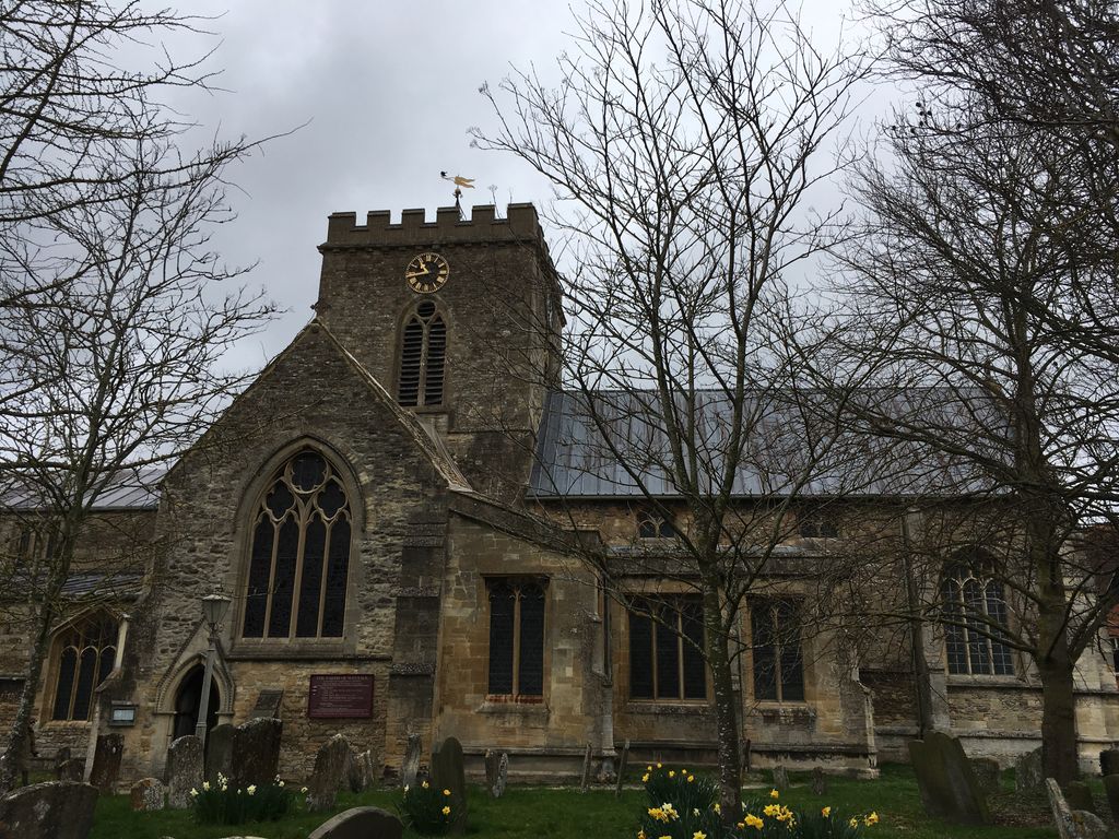
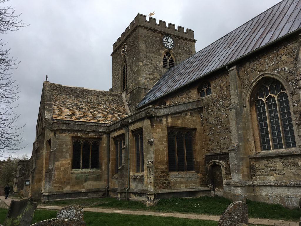
| Description | : | There was a church in Wantage at least as early as 950 A.D., when it is mentioned in the will of a Saxon noblewoman. The extremely large and imposing church we see today dates to the 13th century, with much remodelling over the following two centuries, and heavy remodelling in the Victorian period, when a large east window was added. The sheer size of the church is testament to the importance of Wantage as a market town and focal point for the Vale of White Horse. The church is cruciform in design, with a large central tower and large transepts... Read More |
frequently asked questions (FAQ):
-
Where is St. Peter and Paul Churchyard?
St. Peter and Paul Churchyard is located at Wantage, Vale of White Horse District ,Oxfordshire ,England.
-
St. Peter and Paul Churchyard cemetery's updated grave count on graveviews.com?
28 memorials
-
Where are the coordinates of the St. Peter and Paul Churchyard?
Latitude: 51.5886860
Longitude: -1.4284970
Nearby Cemetories:
1. Wantage Baptist Church
Wantage, Vale of White Horse District, England
Coordinate: 51.5892190, -1.4270540
2. Chain Hill Cemetery
Wantage, Vale of White Horse District, England
Coordinate: 51.5843868, -1.4217107
3. Vicarage Hill Cemetery
East Challow, Vale of White Horse District, England
Coordinate: 51.5877810, -1.4512553
4. St. Nicholas Churchyard
East Challow, Vale of White Horse District, England
Coordinate: 51.5919480, -1.4518960
5. Strict Baptist Chapel
Grove, Vale of White Horse District, England
Coordinate: 51.6051668, -1.4219236
6. St. Andrew Churchyard
Letcombe Regis, Vale of White Horse District, England
Coordinate: 51.5758900, -1.4527800
7. St. John the Baptist Churchyard
Grove, Vale of White Horse District, England
Coordinate: 51.6112858, -1.4204966
8. East Lockinge All Souls Church Cemetery
Lockinge, Vale of White Horse District, England
Coordinate: 51.5846900, -1.3899900
9. East Lockinge War Memorial
Wantage, Vale of White Horse District, England
Coordinate: 51.5844426, -1.3883416
10. St. Laurence Churchyard
West Challow, Vale of White Horse District, England
Coordinate: 51.5920920, -1.4708930
11. Grove Cemetery
Grove, Vale of White Horse District, England
Coordinate: 51.6160002, -1.4299708
12. All Saints Churchyard
Wantage, Vale of White Horse District, England
Coordinate: 51.5827496, -1.3822236
13. Holy Trinity Churchyard
Ardington, Vale of White Horse District, England
Coordinate: 51.5920530, -1.3784550
14. St. Mary's Churchyard
Childrey, Vale of White Horse District, England
Coordinate: 51.5876500, -1.4818600
15. St Michael & All Angels Churchyard
Letcombe Bassett, Vale of White Horse District, England
Coordinate: 51.5620598, -1.4620905
16. St. James The Great Churchyard
Denchworth, Vale of White Horse District, England
Coordinate: 51.6229400, -1.4507800
17. St. James The Great Churchyard
West Hanney, Vale of White Horse District, England
Coordinate: 51.6325030, -1.4144360
18. Holy Cross Churchyard
Sparsholt, Vale of White Horse District, England
Coordinate: 51.5857220, -1.5008460
19. Holy Trinity Churchyard
West Hendred, Vale of White Horse District, England
Coordinate: 51.5916030, -1.3556760
20. All Saints Churchyard
Goosey, Vale of White Horse District, England
Coordinate: 51.6225320, -1.4865200
21. Cat Street Cemetery
East Hendred, Vale of White Horse District, England
Coordinate: 51.5964877, -1.3397450
22. St. Augustine of Canterbury Churchyard
East Hendred, Vale of White Horse District, England
Coordinate: 51.5944074, -1.3382489
23. St Mary's Churchyard
Lyford, Vale of White Horse District, England
Coordinate: 51.6456433, -1.4371256
24. St Mary Roman Catholic Churchyard
East Hendred, Vale of White Horse District, England
Coordinate: 51.5937960, -1.3363240